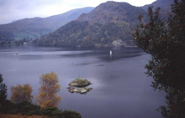
Glenridding and Patterdale, a mile apart at the head of Ullswater, share twelve Wainwrights you can start on foot: Glenridding Dodd, Sheffield Pike, Birkhouse Moor, Helvellyn, Catstycam, White Side, Raise, Arnison Crag, Birks, Saint Sunday Crag, Place Fell and Angletarn Pikes. Treat the two villages as one base. A short bus ride south to Hartsop and Brothers Water adds Brock Crags, Rest Dodd, The Nab, Hartsop above How, Hartsop Dodd and Gray Crag, and Aira Force to the north gives you Gowbarrow Fell. The west side of the valley is Eastern Fells country and the east side is the Far Eastern Fells.
Parking and buses
Glenridding has a large Lake District National Park pay and display car park in the middle of the village, with toilets next to it. Patterdale is harder. The WalkLakes route to St Sunday Crag says parking there is very limited and mostly means the Patterdale Hotel overflow car park, which charges and fills early at weekends. If you are coming for Helvellyn on a summer Saturday, arrive early or come by bus.
The Stagecoach summer 2026 timetable (23 March to 1 November) lists two routes:
- 508 from Penrith railway station via Pooley Bridge and Aira Force to Glenridding and Patterdale, roughly hourly, with every other bus continuing over Kirkstone Pass to Windermere
- 509 from Keswick via Threlkeld and Aira Force to Glenridding, Patterdale and Hartsop road end, four times a day
Kirkstone Pass was closed by a landslip in November 2025 and reopened on 17 July 2026, so the Windermere link is running again. The Ullswater Steamers from Glenridding pier are another way in, and a way out to Howtown for Hallin Fell and Steel Knotts on the far shore.
Short walks from the villages
Glenridding Dodd is the quick one: 5 km with 330 m of ascent on the WalkLakes route, about 1 hour 30 minutes of walking. Add Sheffield Pike above it and the loop becomes 9.2 km and 611 m. From Patterdale, Arnison Crag and Birks go together on a 7.9 km round with 526 m of climbing. Place Fell, across the valley, is 7.4 km and 546 m by Boredale Hause. Angletarn Pikes is the next top south from the same col. The WalkLakes times here are minimum moving times, so add your stops.
Short walks from Glenridding and Patterdale
| Rank | Fell | Height | Area | Difficulty |
|---|---|---|---|---|
| 193 | Glenridding DoddEastern Fells | 442 m | Eastern Fells | Moderate |
| 194 | Arnison CragEastern Fells | 433 m | Eastern Fells | Easy |
| 108 | Place FellFar Eastern Fells | 657 m | Far Eastern Fells | Moderate |
| 143 | Angletarn PikesFar Eastern Fells | 567 m | Far Eastern Fells | Moderate |
| 124 | BirksEastern Fells | 622 m | Eastern Fells | Easy |
| 99 | Sheffield PikeEastern Fells | 676 m | Eastern Fells | Moderate |
Full days from the villages
Helvellyn and the fells round Red Tarn are the main draw. The round by Striding Edge and Swirral Edge is 14.1 km with 900 m of ascent. A quieter line to Catstycam and Birkhouse Moor via Lanty's Tarn is 13.4 km and 756 m. White Side and Raise from Glenridding, by the old Greenside mine road, is 13.7 km and 776 m. Saint Sunday Crag from Patterdale, returning by Grisedale Tarn, is 14.6 km and 748 m.
Full days from Glenridding and Patterdale
| Rank | Fell | Height | Area | Difficulty |
|---|---|---|---|---|
| 78 | Birkhouse MoorEastern Fells | 718 m | Eastern Fells | Moderate |
| 10 | CatstycamEastern Fells | 890 m | Eastern Fells | Moderate |
| 16 | White SideEastern Fells | 863 m | Eastern Fells | Moderate |
| 12 | RaiseEastern Fells | 883 m | Eastern Fells | Moderate |
| =22 | Saint Sunday CragEastern Fells | 841 m | Eastern Fells | Moderate |
| 3 | HelvellynEastern Fells | 950 m | Eastern Fells | Difficult |
A short bus ride away
The 509 stops at Hartsop road end and the 508 at Brothers Water, two miles south of Patterdale. From Hartsop, WalkLakes has a 12.2 km round over Brock Crags and Angletarn Pikes, a 14.4 km day to Rest Dodd and The Nab, and the Pasture Beck round over Gray Crag and Hartsop Dodd (10.4 km, 836 m). The Dovedale round from Cow Bridge takes in Hartsop above How. North of Glenridding, the 508 stop at Aira Force starts a 5.9 km walk up Gowbarrow Fell. Gowbarrow is a popular last fell: 18 people on the LDWA register of completions finished there.
By bus from Glenridding and Patterdale
| Rank | Fell | Height | Area | Difficulty |
|---|---|---|---|---|
| 181 | Gowbarrow FellEastern Fells | 481 m | Eastern Fells | Easy |
| 125 | Hartsop DoddFar Eastern Fells | 618 m | Far Eastern Fells | Moderate |
| 90 | Gray CragFar Eastern Fells | 699 m | Far Eastern Fells | Moderate |
| 144 | Brock CragsFar Eastern Fells | 561 m | Far Eastern Fells | Moderate |
| 93 | Rest DoddFar Eastern Fells | 696 m | Far Eastern Fells | Easy |
| 138 | The NabFar Eastern Fells | 576 m | Far Eastern Fells | Easy |
| =136 | Hartsop above HowEastern Fells | 581 m | Eastern Fells | Easy |
Classic rounds from Glenridding and Patterdale
Helvellyn by Striding Edge and Swirral Edge
The WalkLakes route climbs beside Mires Beck and over Birkhouse Moor to the Hole-in-the-Wall, crosses Striding Edge to the summit, and comes down Swirral Edge with a detour to Catstycam. WalkLakes points out that people still fall from it and are seriously or fatally hurt. In winter the edges and the summit rim are a different proposition, so read the winter Wainwrights guide first, and see Wainwright scrambles if you are unsure about the edge.
Place Fell and the lakeshore
Climb Place Fell from Patterdale and return along the Ullswater shore path. The WalkLakes version is 12.1 km with 738 m of ascent. For a longer day, walk on to Howtown and take the steamer back to Glenridding.
Saint Sunday Crag and Grisedale
From Patterdale, go through Glenamara Park and up the steep ridge past Thornhow End to the saddle below Saint Sunday Crag, with Birks a short detour. Over the top, drop to Grisedale Tarn and walk back down the length of Grisedale.
Take a map and compass on all of these, and check the Mountain Weather Information Service (MWIS) forecast before you go.