Eastern Fells · Book 1
Catstycam
Catstycam is a Wainwright, one of the 214 Lake District fells in Alfred Wainwright’s Pictorial Guides. At 890 m (2,920 ft) it is the 10th highest of the 214 and the 3rd highest in the Eastern Fells.
- Height
- 890 m
- 2,920 ft
- Rank
- 10
- of 214
- In area
- 3
- of 35
- Difficulty
- Moderate
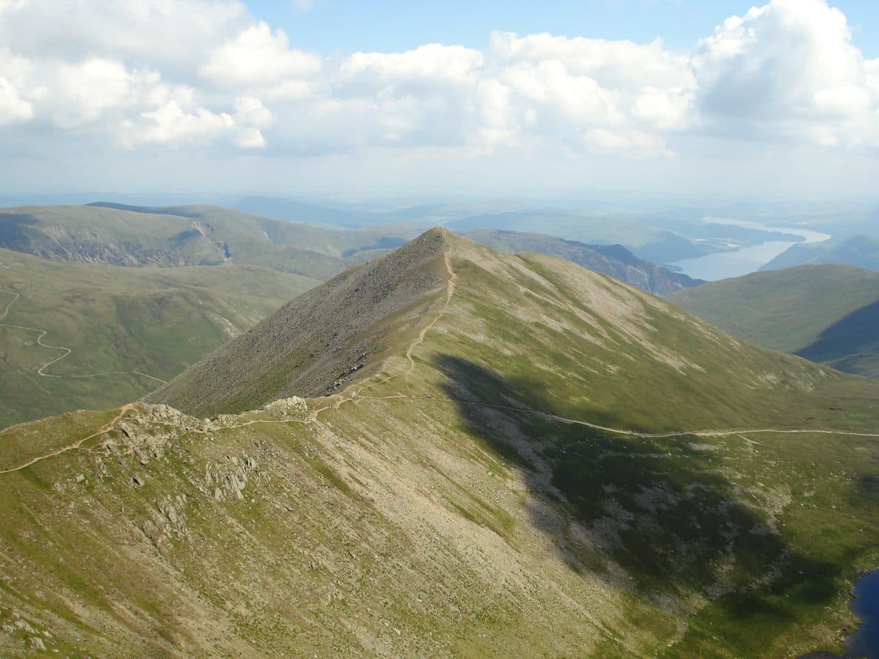
Photo: Peer Lawther via Flickr
About Catstycam
A near-perfect cone above Red Tarn that feels like a miniature independent peak. Often paired with Helvellyn via Swirral Edge, it offers steep, pleasing slopes and a compact summit with wide views. Shorter than its neighbours but full of mountain feel, especially in evening light. Ideal as an add-on or a focused, punchy outing.
Glenridding, on Ullswater, is the place to start. The main car park is the large National Park pay and display in the village, and the Ullswater Steamers car park nearby is cheaper in winter. There are only a handful of spaces further up Greenside Road near the old lead mine, so do not count on driving that far.
Most people take Catstycam in with Helvellyn. The classic day goes up Striding Edge, over Helvellyn and down Swirral Edge. Where Swirral Edge levels out, turn off along the short ridge to Catstycam's top instead of dropping to Red Tarn. The start of Swirral Edge is a loose drop onto jumbled boulders and often needs a bit of down scrambling.
On its own, Catstycam needs no edge at all. From Glenridding, walk up past Lanty's Tarn and over Birkhouse Moor to Red Tarn, then take the path up to the middle of Swirral Edge and along to the summit. It is steep and rough in places, but you will not need your hands. Come back down the steep east shoulder or the gravel path beside Red Tarn Beck, then follow Glenridding Beck past the Greenside mine workings. The north west ridge is very steep and a poor way down.
The summit is small and neat, with a tiny cairn where three paths meet. From here you get the best side view of Striding Edge across Red Tarn and a close look at Helvellyn's east face.
Red Tarn is named after the screes around it, not the water. The Greenside mine dammed it in the 19th century to store water, which is partly why it is now so deep. Ordnance Survey maps spell the fell Catstye Cam.
In winter
Cornices can build along Helvellyn's rim where Swirral Edge meets the summit plateau, so anyone coming over from Helvellyn needs a safe way off the top before the edge even starts. Catstycam's own east ridge is steep enough that a frozen path on it calls for crampons, and the north west ridge is no place to be in ice.
- Great Views
- Popular
- Potentially Dangerous
Sources: Wikipedia: Catstye Cam, Walk Lakes: Lanty's Tarn, Birkhouse Moor, Red Tarn, Catstycam, Walk Lakes: Helvellyn, the classic ridges of Striding and Swirral Edge. Updated .
Summit
- OS grid ref
- NY 348 158
- Latitude
- 54.53346° N
- Longitude
- 3.00892° W
- Area
- Eastern Fells
Walking up Catstycam
The nearest car park on foot is Bury Jubilee Hut, 3.2 km (2.0 miles) from the summit along mapped paths. Directions to the car park
Route from Bury Jubilee Hut
- Distance
- 3.2 km
- 2.0 miles, one way
- Ascent
- 585 m
- Total climb to the summit
- Time up
- 1 h 33 min
- Allow 1 to 2 hours
Times use Naismith’s rule, 5 km/h on the flat plus extra time for the climb, with Langmuir’s corrections. It’s a rule of thumb for the way up only, so add stops, weather and the walk back down.
The route follows paths mapped by OpenStreetMap contributors and isn’t a guided line. Check the mountain forecast before you go and carry a map and compass.
Catstycam questions
Is Catstycam a Wainwright?
How high is Catstycam?
Where do you park for Catstycam?
How long does it take to climb Catstycam?
How hard is Catstycam?
Which Wainwrights are near Catstycam?
What is the grid reference for the summit of Catstycam?
Often walked with Catstycam
Fells people usually take in on the same day.
Catstycam in our guides
Wainwrights near Catstycam
Straight-line distance and direction from the summit.
 Helvellyn950 m0.9 km SW
 White Side863 m1.3 km NW
 Birkhouse Moor718 m1.5 km E
 Nethermost Pike891 m1.7 km S
 Raise883 m1.7 km N
 Dollywaggon Pike859 m2.8 km S
More in the Eastern Fells
- Helvellyn950 m
- Nethermost Pike891 m
- Raise883 m
- Fairfield873 m
- White Side863 m
- Dollywaggon Pike859 m
- Great Dodd857 m
- Stybarrow Dodd844 m
- Saint Sunday Crag841 m
- Hart Crag822 m
- Dove Crag792 m
- Watson's Dodd789 m
- Red Screes776 m
- Great Rigg766 m
- Hart Side756 m
- Seat Sandal737 m
- Clough Head726 m
- Birkhouse Moor718 m
- Sheffield Pike676 m
- High Pike [Scandale]656 m
- Middle Dodd654 m
- Little Hart Crag637 m
- Birks622 m
- Heron Pike612 m
- Hartsop above How581 m
- Great Mell Fell537 m
- High Hartsop Dodd519 m
- Low Pike508 m
- Little Mell Fell505 m
- Stone Arthur504 m
- Gowbarrow Fell481 m
- Nab Scar450 m
- Glenridding Dodd442 m
- Arnison Crag433 m
Bag Catstycam with Upfell
Reach the summit and capture Catstycam, even with no signal. It goes on your round of the 214 with its own patch.
Coming soon to theApp Store