Southern Fells · Book 4
Esk Pike
Esk Pike is a Wainwright, one of the 214 Lake District fells in Alfred Wainwright’s Pictorial Guides. At 885 m (2,904 ft) it is the 11th highest of the 214 and the 5th highest in the Southern Fells.
- Height
- 885 m
- 2,904 ft
- Rank
- 11
- of 214
- In area
- 5
- of 30
- Difficulty
- Difficult
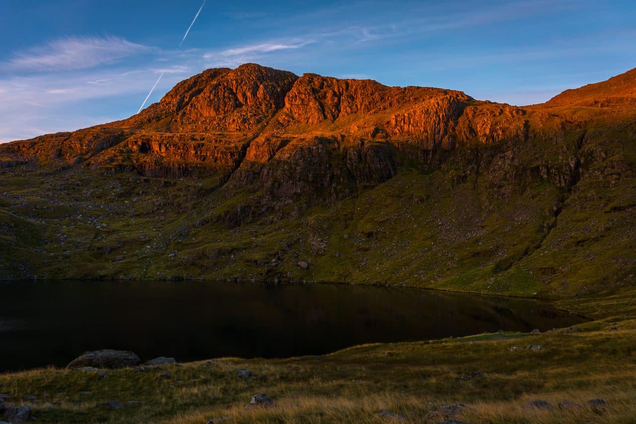
Photo: mhx via Flickr
About Esk Pike
A rocky, shapely summit anchoring the heart of the Scafell range. Approaches from Borrowdale, Langdale or Eskdale give a real mountain day with bouldery ridges and wide views to Bowfell and Great End. The summit area is rough underfoot and navigation matters in mist. Often linked with Bowfell or the Corridor Route for a classic traverse.
Every way onto Esk Pike is a long one. It stands between Bowfell and the Scafells with no road near it, and walkers come from Borrowdale, Great Langdale or Eskdale, or pick it up on a longer round.
From Great Langdale, start at the Old Dungeon Ghyll car park, walk up Mickleden and take the stone-pitched climb up Rossett Gill, then go past Angle Tarn to Esk Hause. From Seathwaite in Borrowdale, walk to Stockley Bridge and climb Grains Gill and Ruddy Gill to the same col, past cascades and a footbridge over a deep gorge. From Esk Hause the north-west ridge goes up over grass and a rocky shelf and finishes in a narrow gully or on open rock, where you need your hands for a moment. That route is about 3.5 miles with 2,590 feet of climbing. From Brotherilkeld in Eskdale, the lines by Ore Gap, Esk Hause and the south ridge are all about 9 km. Many people arrive from Bowfell instead, dropping to Ore Gap and climbing the steps on the far side.
The path up from Esk Hause is rough and eroded. The top is very stony, with pale rock everywhere and a small cairn on the highest outcrop.
The Scafells fill the view, with the Eastern and Northern Fells beyond and glimpses of Derwentwater and Windermere. The south ridge runs down for over 2 miles to the packhorse bridge at Lingcove, past Pike de Bield, which looks straight into the upper Esk. Ore Gap is named after the red haematite in its ground, and compasses can give false readings nearby.
In winter
Esk Hause and Ore Gap are both high, broad cols where the paths are hard to follow under snow, and the haematite in the ground at Ore Gap can upset a compass. Every approach is long, so a short winter day leaves little margin.
- Great Views
- Potentially Dangerous
- Dog Friendly
Sources: Wikipedia: Esk Pike, Wainwright Routes: Esk Pike Route One. Updated .
Summit
- OS grid ref
- NY 236 075
- Latitude
- 54.45716° N
- Longitude
- 3.17919° W
- Area
- Southern Fells
Walking up Esk Pike
The nearest car park on foot is Old Dungeon Ghyll, 6.3 km (3.9 miles) from the summit along mapped paths. Directions to the car park
Route from Old Dungeon Ghyll
- Distance
- 6.3 km
- 3.9 miles, one way
- Ascent
- 895 m
- Total climb to the summit
- Time up
- 2 h 39 min
- Allow 1 to 4 hours
Times use Naismith’s rule, 5 km/h on the flat plus extra time for the climb, with Langmuir’s corrections. It’s a rule of thumb for the way up only, so add stops, weather and the walk back down.
The route follows paths mapped by OpenStreetMap contributors and isn’t a guided line. Check the mountain forecast before you go and carry a map and compass.
Esk Pike questions
Is Esk Pike a Wainwright?
How high is Esk Pike?
Where do you park for Esk Pike?
How long does it take to climb Esk Pike?
How hard is Esk Pike?
Which Wainwrights are near Esk Pike?
What is the grid reference for the summit of Esk Pike?
Often walked with Esk Pike
Fells people usually take in on the same day.
Wainwrights near Esk Pike
Straight-line distance and direction from the summit.
 Allen Crags785 m1.0 km N
 Rossett Pike651 m1.3 km E
 Great End910 m1.3 km NW
 Bowfell903 m1.3 km SE
 Scafell Pike978 m2.1 km W
 Seathwaite Fell601 m2.8 km N
More in the Southern Fells
- Scafell Pike978 m
- Scafell964 m
- Great End910 m
- Bowfell903 m
- Crinkle Crags (Long Top)859 m
- Lingmell807 m
- Coniston Old Man802 m
- Swirl How802 m
- Brim Fell796 m
- Allen Crags785 m
- Great Carrs785 m
- Glaramara783 m
- Dow Crag778 m
- Grey Friar773 m
- Wetherlam763 m
- Slight Side762 m
- Pike o'Blisco705 m
- Cold Pike701 m
- Harter Fell [Eskdale]654 m
- Rossett Pike651 m
- Illgill Head609 m
- Seathwaite Fell601 m
- Rosthwaite Fell (Bessyboot)551 m
- Hard Knott549 m
- Whin Rigg537 m
- Green Crag489 m
- Lingmoor Fell470 m
- Black Fell323 m
- Holme Fell317 m
Bag Esk Pike with Upfell
Reach the summit and capture Esk Pike, even with no signal. It goes on your round of the 214 with its own patch.
Coming soon to theApp Store