Southern Fells · Book 4
Allen Crags
Allen Crags is a Wainwright, one of the 214 Lake District fells in Alfred Wainwright’s Pictorial Guides. At 785 m (2,575 ft) it is the joint 42nd highest of the 214 and the joint 11th highest in the Southern Fells.
- Height
- 785 m
- 2,575 ft
- Rank
- =42
- of 214
- In area
- =11
- of 30
- Difficulty
- Difficult
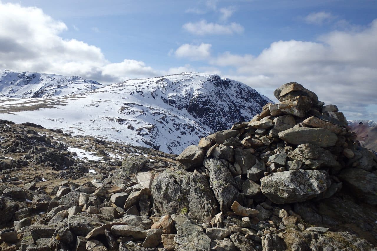
Photo: Michael Graham via Geograph, CC BY-SA 2.0
About Allen Crags
A knobbly ridge‑top above Esk Hause with intricate lines between boulders and shelves. Brilliant as part of a long Scafells day, with big views into upper Eskdale.
Walk north from Esk Hause and Allen Crags is the first high ground you reach. It closes the southern end of the long ridge that climbs out of Borrowdale over Glaramara, and many walkers collect it on a Borrowdale round rather than for its own sake.
Seathwaite, at the end of the Borrowdale road, is the base. Boulders now stop verge parking by the farm, so use the field beside it. A bridleway runs to Stockley Bridge and up Grains Gill and Ruddy Gill to Esk Hause, and from there Allen Crags is a short climb north. For a quieter line, leave Grains Gill at a footbridge and follow Allen Gill up through broken crags, keeping to grass, to meet the ridge at Lincomb Tarns. That way has pathless stretches. Neither needs any scrambling.
The ridge from Glaramara is about 3 km long, rocky and up and down, with tarns, boulders and three smaller tops along the way. A 15 km loop from Seathwaite takes in Seathwaite Fell, Glaramara and Allen Crags together.
Of the three summit cairns, the middle one, set on rock, is the highest. The east side drops steeply into Langstrath and the west falls in grey slabs to Grains Gill. Higher fells block much of the view south, but Great Gable looks good from here, and to the north you can see down to Derwentwater and Skiddaw.
In winter
Esk Hause, just below the summit, is a broad col where several paths meet, so take a compass bearing before you leave it in mist or snow. The ridge from Glaramara is 3 km of knolls and tarns, and a full Seathwaite round needs an early start to finish in winter daylight.
- Ridge Walk
- Great Views
- Potentially Dangerous
- Dog Friendly
Sources: Wikipedia: Allen Crags, Wainwright Routes: Allen Crags Route One. Updated .
Summit
- OS grid ref
- NY 236 085
- Latitude
- 54.46635° N
- Longitude
- 3.17915° W
- Area
- Southern Fells
Walking up Allen Crags
The nearest car park on foot is Lake Head Car Park, 7.0 km (4.3 miles) from the summit along mapped paths. Directions to the car park
Route from Lake Head Car Park
- Distance
- 7.0 km
- 4.3 miles, one way
- Ascent
- 982 m
- Total climb to the summit
- Time up
- 2 h 54 min
- Allow 2 to 4 hours
Times use Naismith’s rule, 5 km/h on the flat plus extra time for the climb, with Langmuir’s corrections. It’s a rule of thumb for the way up only, so add stops, weather and the walk back down.
The route follows paths mapped by OpenStreetMap contributors and isn’t a guided line. This car park was picked automatically and hasn’t been checked by hand yet, so compare it with a map. Check the mountain forecast before you go and carry a map and compass.
Allen Crags questions
Is Allen Crags a Wainwright?
How high is Allen Crags?
Where do you park for Allen Crags?
How long does it take to climb Allen Crags?
How hard is Allen Crags?
Which Wainwrights are near Allen Crags?
What is the grid reference for the summit of Allen Crags?
Often walked with Allen Crags
Fells people usually take in on the same day.
Allen Crags in our guides
Wainwrights near Allen Crags
Straight-line distance and direction from the summit.
 Great End910 m1.0 km W
 Esk Pike885 m1.0 km S
 Rossett Pike651 m1.6 km SE
 Seathwaite Fell601 m1.8 km NW
 Bowfell903 m2.2 km S
 Glaramara783 m2.3 km NE
More in the Southern Fells
- Scafell Pike978 m
- Scafell964 m
- Great End910 m
- Bowfell903 m
- Esk Pike885 m
- Crinkle Crags (Long Top)859 m
- Lingmell807 m
- Coniston Old Man802 m
- Swirl How802 m
- Brim Fell796 m
- Great Carrs785 m
- Glaramara783 m
- Dow Crag778 m
- Grey Friar773 m
- Wetherlam763 m
- Slight Side762 m
- Pike o'Blisco705 m
- Cold Pike701 m
- Harter Fell [Eskdale]654 m
- Rossett Pike651 m
- Illgill Head609 m
- Seathwaite Fell601 m
- Rosthwaite Fell (Bessyboot)551 m
- Hard Knott549 m
- Whin Rigg537 m
- Green Crag489 m
- Lingmoor Fell470 m
- Black Fell323 m
- Holme Fell317 m
Bag Allen Crags with Upfell
Reach the summit and capture Allen Crags, even with no signal. It goes on your round of the 214 with its own patch.
Coming soon to theApp Store