Southern Fells · Book 4
Green Crag
Green Crag is a Wainwright, one of the 214 Lake District fells in Alfred Wainwright’s Pictorial Guides. At 489 m (1,604 ft) it is the 176th highest of the 214 and the 27th highest in the Southern Fells.
- Height
- 489 m
- 1,604 ft
- Rank
- 176
- of 214
- In area
- 27
- of 30
- Difficulty
- Moderate
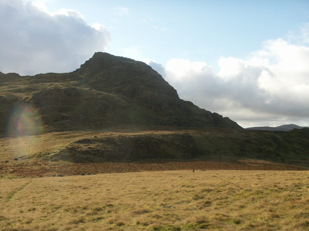
Photo: Bobble Hat via Wikimedia Commons
About Green Crag
A rugged little Southern Fells height above Eskdale’s patchwork of crags and tarns. The approach wanders through heather and rock with short scrambly steps, rewarding with a wild, intimate view of Harter Fell and the Scafells. Feels delightfully off the beaten track.
A row of rocky knotts sticks up out of Birker Fell moor between Eskdale and the Duddon, and from Eskdale they make a jagged skyline. Green Crag is the highest of them. For a fell of only 489 metres it feels remote.
The shortest way up starts on the unenclosed Birker Fell road between Ulpha and Eskdale Green, where there are a few rough gravel pull-ins rather than proper laybys. After that it is pathless moor. Head north-east, cross Highford Beck twice, climb a steep grass ramp to Great Crag, then go east past Broad Crag to Green Crag. Walk Lakes puts the round at 6.6 km with 316 metres of ascent. From Eskdale, the better line follows the old sled gate, a graded track once used to drag peat down on sleds, which climbs near Birker Force. On the Duddon side, waymarked paths run through the plantations from the Forestry car parks.
The moor is wet all year. Tussocky grass makes for tiring walking, and there is a deep peat hollow with undercut banks to watch for, especially with dogs or children. The summit rock is only easy to reach from the north or west, and even that way needs a little mild scrambling.
A small cairn stands on the bare rock at the top. North, the Scafell massif fills the view, with Harter Fell to the north-east and the sea to the south. Devoke Water lies south-west beyond Seat How. The slopes still carry traces of the Gate Gill iron mine, worked for haematite in the 1880s, along with the old peat roads and huts.
In winter
Birker Fell is boggy all year and the moor has no cairns, fences or built paths to follow, so in mist or snow you navigate entirely by map and compass. Take care near the deep peat hollow with undercut banks, which snow can hide.
- Scramble
- Great Views
- Quiet & Remote
- Waterfall Route
- Potentially Dangerous
Sources: Wikipedia: Green Crag, Walk Lakes: Green Crag from the Birker Fell road. Updated .
Summit
- OS grid ref
- SD 200 982
- Latitude
- 54.37368° N
- Longitude
- 3.23277° W
- Area
- Southern Fells
Walking up Green Crag
The nearest car park on foot is Wha House Car Park, 3.8 km (2.4 miles) from the summit along mapped paths. Directions to the car park
Route from Wha House Car Park
- Distance
- 3.8 km
- 2.4 miles, one way
- Ascent
- 450 m
- Total climb to the summit
- Time up
- 1 h 27 min
- Allow 1 to 2 hours
Times use Naismith’s rule, 5 km/h on the flat plus extra time for the climb, with Langmuir’s corrections. It’s a rule of thumb for the way up only, so add stops, weather and the walk back down.
The route follows paths mapped by OpenStreetMap contributors and isn’t a guided line. Check the mountain forecast before you go and carry a map and compass.
Green Crag questions
Is Green Crag a Wainwright?
How high is Green Crag?
Where do you park for Green Crag?
How long does it take to climb Green Crag?
How hard is Green Crag?
Which Wainwrights are near Green Crag?
What is the grid reference for the summit of Green Crag?
Often walked with Green Crag
Fells people usually take in on the same day.
Wainwrights near Green Crag
Straight-line distance and direction from the summit.
 Harter Fell [Eskdale]654 m2.3 km NE
 Hard Knott549 m5.2 km NE
 Dow Crag778 m6.2 km E
 Grey Friar773 m6.3 km E
 Slight Side762 m6.8 km N
 Brim Fell796 m7.0 km E
More in the Southern Fells
- Scafell Pike978 m
- Scafell964 m
- Great End910 m
- Bowfell903 m
- Esk Pike885 m
- Crinkle Crags (Long Top)859 m
- Lingmell807 m
- Coniston Old Man802 m
- Swirl How802 m
- Brim Fell796 m
- Allen Crags785 m
- Great Carrs785 m
- Glaramara783 m
- Dow Crag778 m
- Grey Friar773 m
- Wetherlam763 m
- Slight Side762 m
- Pike o'Blisco705 m
- Cold Pike701 m
- Harter Fell [Eskdale]654 m
- Rossett Pike651 m
- Illgill Head609 m
- Seathwaite Fell601 m
- Rosthwaite Fell (Bessyboot)551 m
- Hard Knott549 m
- Whin Rigg537 m
- Lingmoor Fell470 m
- Black Fell323 m
- Holme Fell317 m
Bag Green Crag with Upfell
Reach the summit and capture Green Crag, even with no signal. It goes on your round of the 214 with its own patch.
Coming soon to theApp Store