Southern Fells · Book 4
Wetherlam
Wetherlam is a Wainwright, one of the 214 Lake District fells in Alfred Wainwright’s Pictorial Guides. At 763 m (2,503 ft) it is the joint 55th highest of the 214 and the 16th highest in the Southern Fells.
- Height
- 763 m
- 2,503 ft
- Rank
- =55
- of 214
- In area
- 16
- of 30
- Difficulty
- Moderate
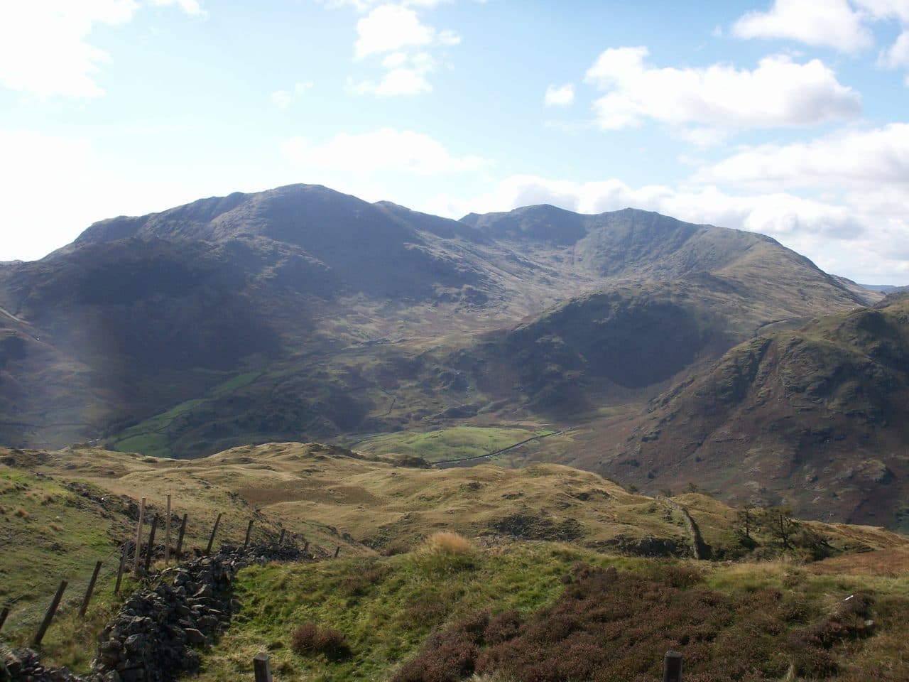
Photo: Bobble Hat via Wikimedia Commons
About Wetherlam
Craggy and characterful above Tilberthwaite and Coppermines, with weaving lines over knolls and slabs. Best linked with Swirl How for a classic day packed with texture.
Wetherlam has been called the most industrialised fell in the Lake District. Copper and slate were both worked on its slopes. Copper mining peaked in the 1850s, and the main Coniston mines closed in 1915. Tilberthwaite Mine on the east side kept going until 1942, and the Greenburn mine on the north sank shafts 700 feet deep between 1845 and 1865.
Coniston, Tilberthwaite and Little Langdale are the three main starts. In Coniston, use the free roadside parking just past the Ruskin Museum and take the track up Coppermines Valley. From there you can climb the south ridge over Lad Stones, or go up Red Dell and onto Black Sails. The Red Dell line passes waterwheel pits, levels and shafts on its way to the ridge, about 3.3 miles and 2,485 feet to the top. From Tilberthwaite and from Little Langdale, paths lead to Birk Fell Hawse, the col north-east of the summit. Wetherlam Edge then rises very steeply, about 200 metres in half a kilometre, to the top.
Most of the ground is paths and old quarry tracks. Black Sails has rock outcrops, and Wetherlam Edge is a steep, rocky climb. Near the workings, keep to the paths, as the old shafts are fenced off.
The summit is a gentle dome with a cairn. The Southern, Central and Eastern Fells are all in view, from the Old Man and the Scafells round to the Langdale Pikes, Helvellyn and Fairfield, with Coniston Water below. Little Langdale is perhaps the finest sight. Levers Water, under the west slopes, was raised to about 125 feet deep to serve the mines.
In winter
Wetherlam Edge from Birk Fell Hawse climbs about 200 metres in half a kilometre and is slippery and serious when iced. The mine workings on the Coniston side have shafts, most of them fenced, which snow can hide.
- Great Views
- Dog Friendly
Sources: Wikipedia: Wetherlam, Wainwright Routes: Wetherlam Route One. Updated .
Summit
- OS grid ref
- NY 288 011
- Latitude
- 54.40048° N
- Longitude
- 3.09796° W
- Area
- Southern Fells
Walking up Wetherlam
The nearest car park on foot is Low Tilberthwaite, 3.1 km (1.9 miles) from the summit along mapped paths. Directions to the car park
Route from Low Tilberthwaite
- Distance
- 3.1 km
- 1.9 miles, one way
- Ascent
- 609 m
- Total climb to the summit
- Time up
- 1 h 33 min
- Allow 1 to 2 hours
Times use Naismith’s rule, 5 km/h on the flat plus extra time for the climb, with Langmuir’s corrections. It’s a rule of thumb for the way up only, so add stops, weather and the walk back down.
The route follows paths mapped by OpenStreetMap contributors and isn’t a guided line. Check the mountain forecast before you go and carry a map and compass.
Wetherlam questions
Is Wetherlam a Wainwright?
How high is Wetherlam?
Where do you park for Wetherlam?
How long does it take to climb Wetherlam?
How hard is Wetherlam?
Which Wainwrights are near Wetherlam?
What is the grid reference for the summit of Wetherlam?
Often walked with Wetherlam
Fells people usually take in on the same day.
Wetherlam in our guides
Wainwrights near Wetherlam
Straight-line distance and direction from the summit.
 Swirl How802 m1.6 km W
 Great Carrs785 m1.7 km W
 Holme Fell317 m2.7 km E
 Grey Friar773 m2.9 km W
 Brim Fell796 m3.1 km SW
 Pike o'Blisco705 m3.5 km NW
More in the Southern Fells
- Scafell Pike978 m
- Scafell964 m
- Great End910 m
- Bowfell903 m
- Esk Pike885 m
- Crinkle Crags (Long Top)859 m
- Lingmell807 m
- Coniston Old Man802 m
- Swirl How802 m
- Brim Fell796 m
- Allen Crags785 m
- Great Carrs785 m
- Glaramara783 m
- Dow Crag778 m
- Grey Friar773 m
- Slight Side762 m
- Pike o'Blisco705 m
- Cold Pike701 m
- Harter Fell [Eskdale]654 m
- Rossett Pike651 m
- Illgill Head609 m
- Seathwaite Fell601 m
- Rosthwaite Fell (Bessyboot)551 m
- Hard Knott549 m
- Whin Rigg537 m
- Green Crag489 m
- Lingmoor Fell470 m
- Black Fell323 m
- Holme Fell317 m
Bag Wetherlam with Upfell
Reach the summit and capture Wetherlam, even with no signal. It goes on your round of the 214 with its own patch.
Coming soon to theApp Store