Southern Fells · Book 4
Scafell Pike
Scafell Pike is a Wainwright, one of the 214 Lake District fells in Alfred Wainwright’s Pictorial Guides. At 978 m (3,209 ft) it is the highest of the 214 and the highest in the Southern Fells.
- Height
- 978 m
- 3,209 ft
- Rank
- 1
- of 214
- In area
- 1
- of 30
- Difficulty
- Difficult
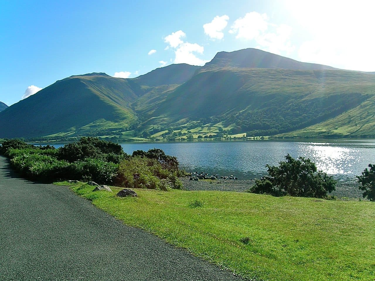
Photo: Thorneh via Wikimedia Commons
About Scafell Pike
England's highest point, Scafell Pike towers over the Southern Fells with plenty of drama. It stands on a rugged plateau of old volcanic rock, shaped by glaciers, with sweeping views across the Lake District. The summit itself is a vast boulder field where cairns mark the highest point, and the ground demands respect, particularly in poor weather. Popular routes from Wasdale, Great Langdale or Seathwaite lead to views that reach into Wales and beyond.
Wasdale gives the shortest climb, and on a summer weekend you will not have it to yourself. Park at the National Trust pay and display car park at Brackenclose, next to the campsite at the head of Wastwater, or on Wasdale Head green. The path follows Lingmell Gill, crosses it, then goes up the stone-pitched staircase of Brown Tongue into Hollow Stones. From there you can go right to Lingmell Col or straight up the scree towards Mickledore. Both lines end on the same bouldery plateau. Up and down is about 9 km, and most people take five or six hours.
The longer approaches are finer walks. From Seathwaite in Borrowdale you go up to Styhead and along the Corridor Route under Great End. From Great Langdale you climb Rossett Gill to Esk Hause and follow the ridge over Broad Crag. The Eskdale approach follows the River Esk up into wild, remote country.
Every route has rough ground. The top of the mountain is shattered rock, the highest boulder field in England, and the paths across it are marked mostly by cairns. Nothing needs hands, but it is slow and hard on ankles, and in cloud one stretch of boulders looks much like another.
The summit and its memorial
The summit has an Ordnance Survey trig point and a large stepped cairn platform. A Buttermere slate tablet set into the cairn records that Lord Leconfield gave the summit to the National Trust in 1919 in memory of the Lake District men killed in the First World War. On a clear day you can see Snowdonia, the Isle of Man and the Mourne Mountains in Northern Ireland, more than 100 miles away.
In winter
Snow buries the paths across the summit boulder field and the cairns vanish in cloud. Most winter accidents here come from walkers leaving the summit on the wrong bearing and ending up above Piers Gill. Midwinter daylight is well under eight hours, so the round trip from Wasdale needs a dawn start, crampons and an axe.
- Great Views
- Popular
- Potentially Dangerous
- Dog Friendly
Sources: Wikipedia: Scafell Pike, Walk Lakes: Scafell Pike and Scafell via Foxes Tarn, Climb Scafell Pike: From Wasdale via Brown Tongue, IWM War Memorials Register: Men of the Lake District. Updated .
Summit
- OS grid ref
- NY 215 072
- Latitude
- 54.45425° N
- Longitude
- 3.21166° W
- Area
- Southern Fells
Walking up Scafell Pike
The nearest car park on foot is Lake Head Car Park, 4.8 km (3.0 miles) from the summit along mapped paths. Directions to the car park
Route from Lake Head Car Park
- Distance
- 4.8 km
- 3.0 miles, one way
- Ascent
- 949 m
- Total climb to the summit
- Time up
- 2 h 25 min
- Allow 1 to 4 hours
Times use Naismith’s rule, 5 km/h on the flat plus extra time for the climb, with Langmuir’s corrections. It’s a rule of thumb for the way up only, so add stops, weather and the walk back down.
The route follows paths mapped by OpenStreetMap contributors and isn’t a guided line. Check the mountain forecast before you go and carry a map and compass.
Scafell Pike questions
Is Scafell Pike a Wainwright?
How high is Scafell Pike?
Where do you park for Scafell Pike?
How long does it take to climb Scafell Pike?
How hard is Scafell Pike?
Which Wainwrights are near Scafell Pike?
What is the grid reference for the summit of Scafell Pike?
Often walked with Scafell Pike
Fells people usually take in on the same day.
Scafell Pike in our guides
Wainwrights near Scafell Pike
Straight-line distance and direction from the summit.
 Scafell964 m1.1 km SW
 Lingmell807 m1.1 km NW
 Great End910 m1.6 km NE
 Esk Pike885 m2.1 km E
 Slight Side762 m2.3 km S
 Allen Crags785 m2.5 km NE
More in the Southern Fells
- Scafell964 m
- Great End910 m
- Bowfell903 m
- Esk Pike885 m
- Crinkle Crags (Long Top)859 m
- Lingmell807 m
- Coniston Old Man802 m
- Swirl How802 m
- Brim Fell796 m
- Allen Crags785 m
- Great Carrs785 m
- Glaramara783 m
- Dow Crag778 m
- Grey Friar773 m
- Wetherlam763 m
- Slight Side762 m
- Pike o'Blisco705 m
- Cold Pike701 m
- Harter Fell [Eskdale]654 m
- Rossett Pike651 m
- Illgill Head609 m
- Seathwaite Fell601 m
- Rosthwaite Fell (Bessyboot)551 m
- Hard Knott549 m
- Whin Rigg537 m
- Green Crag489 m
- Lingmoor Fell470 m
- Black Fell323 m
- Holme Fell317 m
Bag Scafell Pike with Upfell
Reach the summit and capture Scafell Pike, even with no signal. It goes on your round of the 214 with its own patch.
Coming soon to theApp Store