Southern Fells · Book 4
Rosthwaite Fell (Bessyboot)
Rosthwaite Fell (Bessyboot) is a Wainwright, one of the 214 Lake District fells in Alfred Wainwright’s Pictorial Guides. At 551 m (1,808 ft) it is the joint 149th highest of the 214 and the 24th highest in the Southern Fells.
- Height
- 551 m
- 1,808 ft
- Rank
- =149
- of 214
- In area
- 24
- of 30
- Difficulty
- Moderate
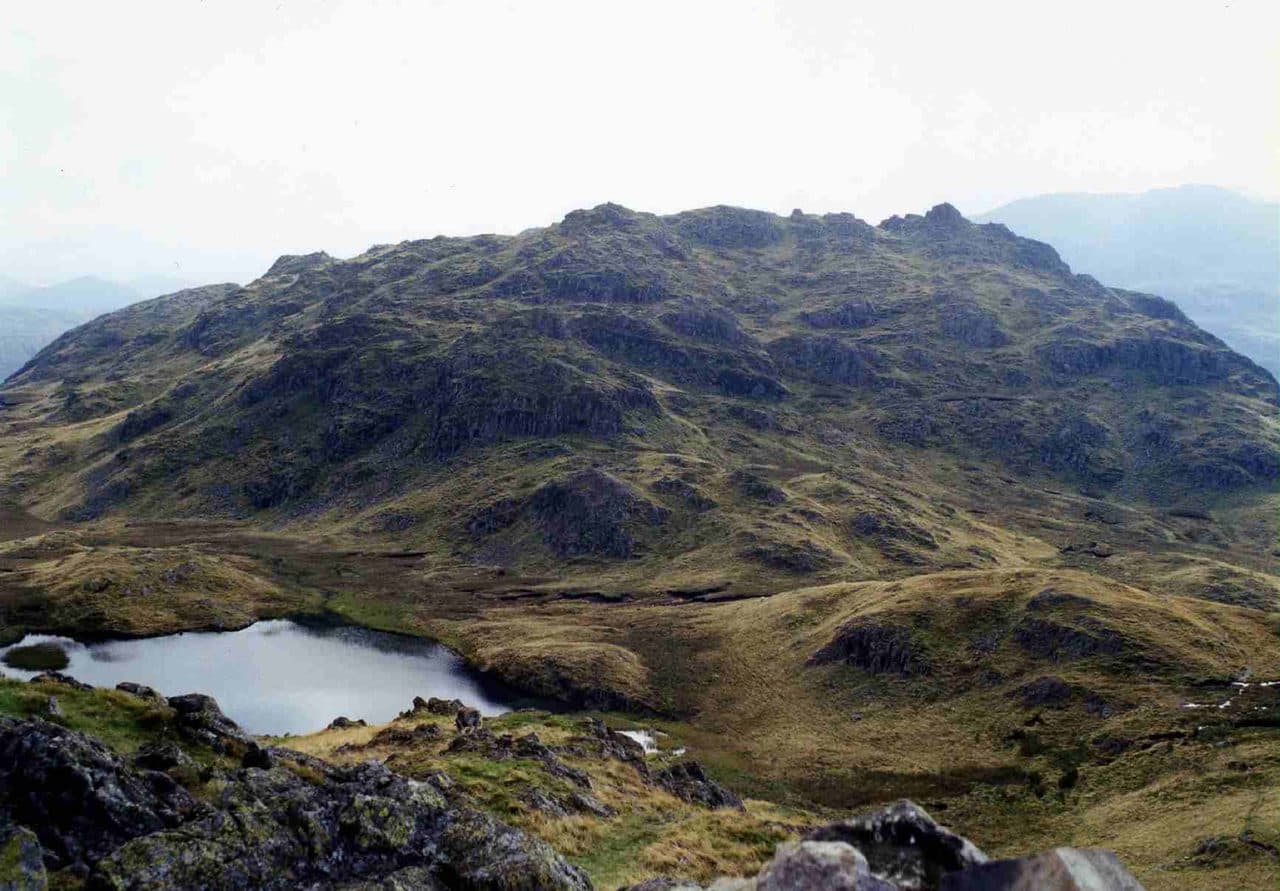
Photo: Mick Knapton via Wikimedia Commons
About Rosthwaite Fell (Bessyboot)
A craggy fell above Borrowdale, all knolls, rock and marshy hollows around Tarn at Leaves. A short, steep climb beside Big Stanger Gill leads to a small summit with views of the Helvellyn range and Glaramara. Quiet ground with room to wander.
Wainwright took Bessyboot, at 551 metres, as the summit of Rosthwaite Fell, although Rosthwaite Cam, 800 metres to the south, is higher at 612 metres. Between the two lies Tarn at Leaves, a small tarn about 100 metres long.
Three sides of the fell are steep and craggy, and there is no simple way up. In Stonethwaite there are a few spaces by the telephone box and more along the approach lane. Walk past the Langstrath Hotel towards the campsite, where a gate leads to a path climbing through the woods beside Big Stanger Gill, with waterfalls and stone-pitched steps. It passes Bull Crag, crosses the gill below a waterfall and follows its north bank to near 500 metres. A short walk round a marsh then brings you to Tarn at Leaves and the summit cairn. Allow about 1.75 miles and 1,600 feet of ascent. From the Borrowdale road between Seatoller and Rosthwaite, a path goes up Combe Gill for a kilometre and then climbs steeply up its east flank. The north ridge from behind Chapel Farm, keeping west of Papelay Crag, needs some mild scrambling.
Getting onto the summit rocks of Rosthwaite Cam also takes a mild scramble, which is one reason most walkers stop at Bessyboot.
From Bessyboot you look north-east to the Helvellyn range, with Rosthwaite Cam and Glaramara close by to the south. For a longer day the ridge goes on over Dovenest Top towards Glaramara. The fell was made a Site of Special Scientific Interest in 1985.
In winter
The stone-pitched path up Big Stanger Gill gets icy in cold spells, and the steps are slippery when wet. The top is a maze of knolls and marsh around Tarn at Leaves, easy to get lost in when snow covers the faint paths.
- Great Views
- Family Walk
- Dog Friendly
- Summit Tarn
Sources: Wikipedia: Rosthwaite Fell, Wainwright Routes: Rosthwaite Fell Route One. Updated .
Summit
- OS grid ref
- NY 258 124
- Latitude
- 54.50218° N
- Longitude
- 3.14683° W
- Area
- Southern Fells
Walking up Rosthwaite Fell (Bessyboot)
The nearest car park on foot is Seatoller NT car park, 2.9 km (1.8 miles) from the summit along mapped paths. Directions to the car park
Route from Seatoller NT car park
- Distance
- 2.9 km
- 1.8 miles, one way
- Ascent
- 444 m
- Total climb to the summit
- Time up
- 1 h 16 min
- Allow 1 to 2 hours
Times use Naismith’s rule, 5 km/h on the flat plus extra time for the climb, with Langmuir’s corrections. It’s a rule of thumb for the way up only, so add stops, weather and the walk back down.
The route follows paths mapped by OpenStreetMap contributors and isn’t a guided line. Check the mountain forecast before you go and carry a map and compass.
Rosthwaite Fell (Bessyboot) questions
Is Rosthwaite Fell (Bessyboot) a Wainwright?
How high is Rosthwaite Fell (Bessyboot)?
Where do you park for Rosthwaite Fell (Bessyboot)?
How long does it take to climb Rosthwaite Fell (Bessyboot)?
How hard is Rosthwaite Fell (Bessyboot)?
Which Wainwrights are near Rosthwaite Fell (Bessyboot)?
What is the grid reference for the summit of Rosthwaite Fell (Bessyboot)?
Often walked with Rosthwaite Fell (Bessyboot)
Fells people usually take in on the same day.
Rosthwaite Fell (Bessyboot) in our guides
Wainwrights near Rosthwaite Fell (Bessyboot)
Straight-line distance and direction from the summit.
 Eagle Crag525 m1.7 km E
 Sergeant's Crag571 m1.9 km SE
 Glaramara783 m2.2 km SW
 Great Crag449 m2.5 km NE
 Ullscarf726 m3.3 km E
 Base Brown646 m3.5 km W
More in the Southern Fells
- Scafell Pike978 m
- Scafell964 m
- Great End910 m
- Bowfell903 m
- Esk Pike885 m
- Crinkle Crags (Long Top)859 m
- Lingmell807 m
- Coniston Old Man802 m
- Swirl How802 m
- Brim Fell796 m
- Allen Crags785 m
- Great Carrs785 m
- Glaramara783 m
- Dow Crag778 m
- Grey Friar773 m
- Wetherlam763 m
- Slight Side762 m
- Pike o'Blisco705 m
- Cold Pike701 m
- Harter Fell [Eskdale]654 m
- Rossett Pike651 m
- Illgill Head609 m
- Seathwaite Fell601 m
- Hard Knott549 m
- Whin Rigg537 m
- Green Crag489 m
- Lingmoor Fell470 m
- Black Fell323 m
- Holme Fell317 m
Bag Rosthwaite Fell (Bessyboot) with Upfell
Reach the summit and capture Rosthwaite Fell (Bessyboot), even with no signal. It goes on your round of the 214 with its own patch.
Coming soon to theApp Store