Western Fells · Book 7
Base Brown
Base Brown is a Wainwright, one of the 214 Lake District fells in Alfred Wainwright’s Pictorial Guides. At 646 m (2,119 ft) it is the 117th highest of the 214 and the 17th highest in the Western Fells.
- Height
- 646 m
- 2,119 ft
- Rank
- 117
- of 214
- In area
- 17
- of 33
- Difficulty
- Moderate
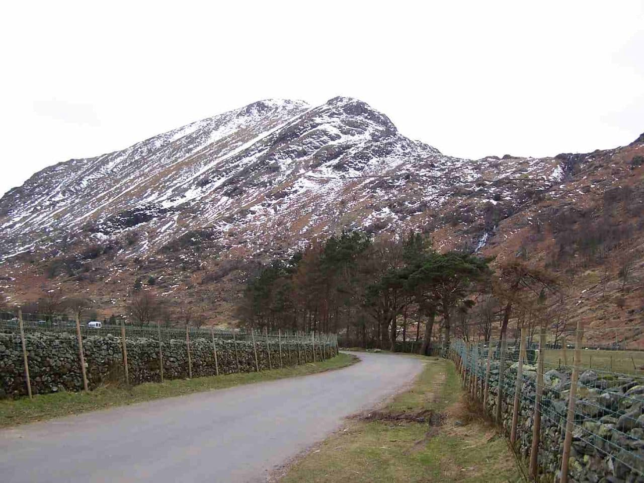
Photo: Mick Knapton via Wikimedia Commons
About Base Brown
A wedge of crag and grass at the head of Borrowdale, below Green Gable and Great Gable. Short steep climbs lead to a broad top, a natural first step towards the Gables, with a view down Borrowdale to Skiddaw.
Seathwaite, at the end of the road into the head of Borrowdale, is where almost every ascent of Base Brown begins. Parking is on the verge of the lane and fills early at weekends and in summer, so leave room for tractors and field gates. The 78 bus and the seasonal 77 Honister Rambler run from Keswick to Seatoller, at the foot of the lane. Seathwaite is also known as the wettest place in England.
Go through the farmyard, cross the footbridge and climb the stone-pitched path beside Sour Milk Gill, which falls out of the hanging valley of Gillercomb in a chain of cascades. There are a few easy scrambly moves before a gate in the wall. From there you have a choice. The gentle way follows the Gillercomb path to the damp col of Blackmoor Pols and doubles back to the summit. The direct way leaves the path at a small cairn, heads for the foot of the north east crags and follows a clear path under the cliff before zigzagging up steep grass to the ridge. It looks much worse from below than it is. On the rim of those crags sits the Hanging Stone, a large boulder poised as if about to drop. Near the farm, novice rock climbers learn the basics on the Seathwaite Slabs.
The top itself is grass and scattered boulders with a cairn. Higher fells block much of the view, but you see straight down Borrowdale to Derwentwater, Skiddaw and the Helvellyn range, and the north face of the Scafells is close by in the other direction. Green Gable is the obvious next step, and Great Gable beyond it.
In winter
The pitched path beside Sour Milk Gill is steep and slippery even in summer, and its short rocky steps ice over. The direct line under the Hanging Stone uses a narrow shelf and steep grass, so in frost take the Gillercomb path to Blackmoor Pols and walk back to the top from there.
- Waterfall Route
- Dog Friendly
Sources: Wikipedia: Base Brown, Walk Lakes: Base Brown, Green Gable, Great Gable and Seathwaite Fell. Updated .
Summit
- OS grid ref
- NY 225 114
- Latitude
- 54.49257° N
- Longitude
- 3.19774° W
- Area
- Western Fells
Walking up Base Brown
The nearest car park on foot is Seatoller NT car park, 4.1 km (2.5 miles) from the summit along mapped paths. Directions to the car park
Route from Seatoller NT car park
- Distance
- 4.1 km
- 2.5 miles, one way
- Ascent
- 554 m
- Total climb to the summit
- Time up
- 1 h 39 min
- Allow 1 to 3 hours
Times use Naismith’s rule, 5 km/h on the flat plus extra time for the climb, with Langmuir’s corrections. It’s a rule of thumb for the way up only, so add stops, weather and the walk back down.
The route follows paths mapped by OpenStreetMap contributors and isn’t a guided line. Check the mountain forecast before you go and carry a map and compass.
Base Brown questions
Is Base Brown a Wainwright?
How high is Base Brown?
Where do you park for Base Brown?
How long does it take to climb Base Brown?
How hard is Base Brown?
Which Wainwrights are near Base Brown?
What is the grid reference for the summit of Base Brown?
Often walked with Base Brown
Fells people usually take in on the same day.
Base Brown in our guides
Wainwrights near Base Brown
Straight-line distance and direction from the summit.
 Brandreth715 m1.1 km NW
 Green Gable801 m1.3 km SW
 Seathwaite Fell601 m1.3 km S
 Grey Knotts697 m1.4 km NW
 Great Gable899 m1.8 km SW
 Glaramara783 m2.4 km E
More in the Western Fells
- Great Gable899 m
- Pillar892 m
- Scoat Fell841 m
- Red Pike [Wasdale]826 m
- Steeple819 m
- High Stile806 m
- Kirk Fell802 m
- Green Gable801 m
- Haycock797 m
- Red Pike [Buttermere]755 m
- High Crag744 m
- Brandreth715 m
- Caw Fell697 m
- Grey Knotts697 m
- Seatallan692 m
- Fleetwith Pike649 m
- Starling Dodd633 m
- Yewbarrow627 m
- Great Borne616 m
- Haystacks597 m
- Middle Fell582 m
- Blake Fell573 m
- Lank Rigg541 m
- Gavel Fell526 m
- Crag Fell523 m
- Mellbreak (south top)512 m
- Hen Comb509 m
- Grike488 m
- Burnbank Fell475 m
- Buckbarrow423 m
- Low Fell423 m
- Fellbarrow416 m
Bag Base Brown with Upfell
Reach the summit and capture Base Brown, even with no signal. It goes on your round of the 214 with its own patch.
Coming soon to theApp Store