Western Fells · Book 7
Haystacks
Haystacks is a Wainwright, one of the 214 Lake District fells in Alfred Wainwright’s Pictorial Guides. At 597 m (1,959 ft) it is the 131st highest of the 214 and the 21st highest in the Western Fells.
- Height
- 597 m
- 1,959 ft
- Rank
- 131
- of 214
- In area
- 21
- of 33
- Difficulty
- Moderate
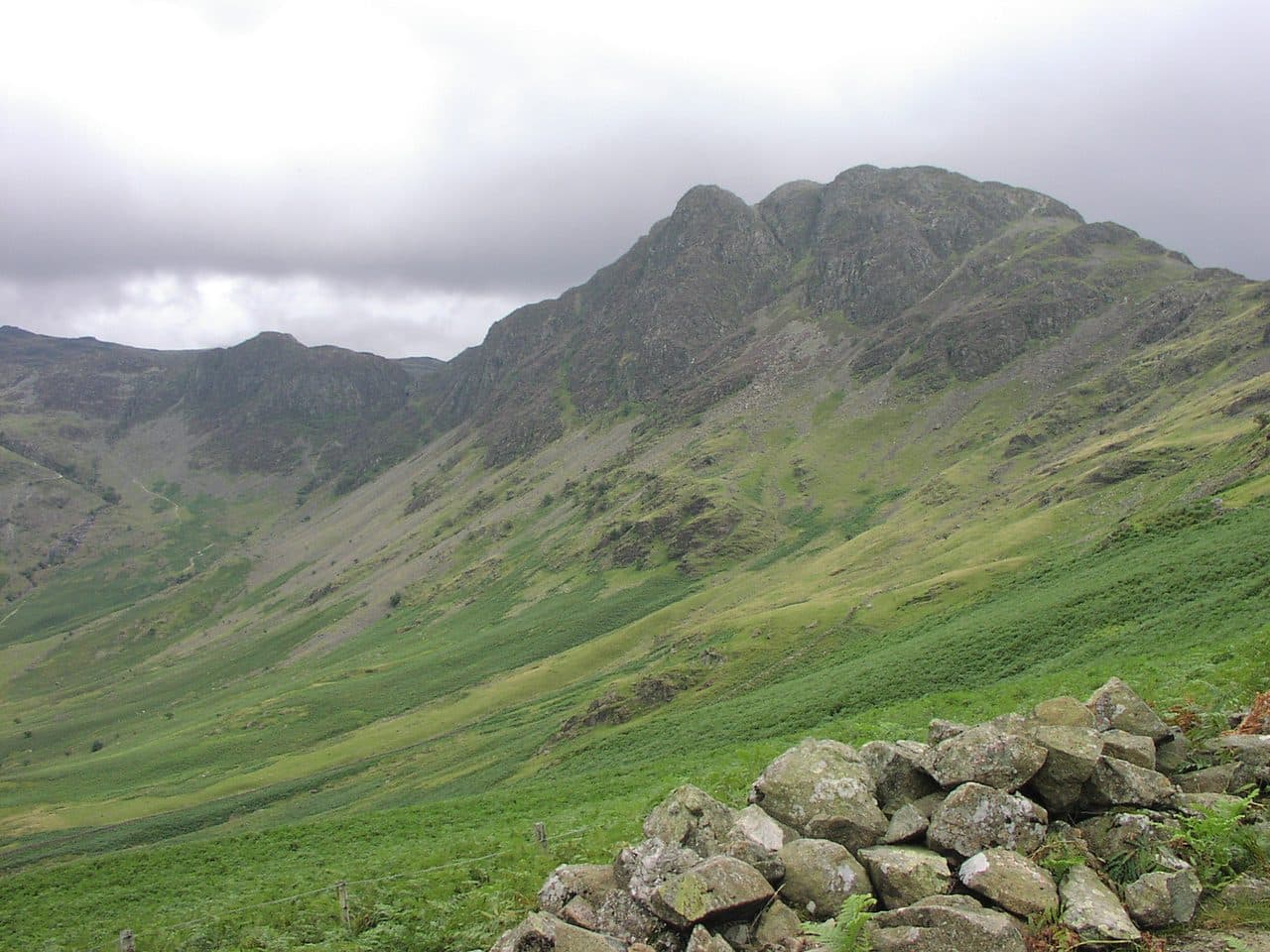
Photo: Tango22 via Wikimedia Commons
About Haystacks
A rocky Western Fells top above Buttermere, all knolls, heather and small tarns. The climb from Scarth Gap needs your hands in places, and the views take in Buttermere, Crummock Water, Ennerdale and Gable Crag. Worth an unhurried hour on top, and far more than its height suggests.
Gatesgarth Farm, at the head of Buttermere, has the car park most walkers use for Haystacks, and the Honister Rambler bus (77) runs past it in season. Cross the valley floor by Peggy's Bridge and climb the path to Scarth Gap, the pass between Haystacks and High Crag. From the pass a zigzag path goes up the rocky end of the fell, with a few short sections where you need your hands. None of it is difficult.
The usual way back is east past Innominate Tarn and Blackbeck Tarn, then down into Warnscale on loose scree and gravel, crossing the beck on stepping stones. A shorter approach starts at the top of Honister Pass: take the old quarry track to the Drum House and on past Dubs Quarry, which saves a lot of climbing. From Ennerdale, Scarth Gap is close to Black Sail youth hostel.
The top
This is not a smooth summit. The top is a short rocky spine lying across the line of the ridge, with a cairn at each end and a small tarn between them. The northern cairn is the accepted highest point. Around it are knolls, heather, crags and pools, and you can easily spend an hour wandering among them. You look across to Gable Crag, down Ennerdale to its lake, and along Buttermere to Crummock Water.
Alfred Wainwright's ashes were scattered at Innominate Tarn, just east of the summit, as he had asked. The crag on the north face above Gatesgarth has no name on Ordnance Survey maps, but it is known as Big Stack.
In winter
The rock steps on the climb from Scarth Gap and the loose, gravelly descent towards Warnscale are the slippery parts once they freeze. The summit is a maze of knolls and small tarns, and the north face drops away in crags above Warnscale, so it is easy to go wrong in mist or snow.
- Great Views
- Popular
- Summit Tarn
- Dog Friendly
Sources: Wikipedia: Haystacks, Walk Lakes: Haystacks. Updated .
Summit
- OS grid ref
- NY 193 132
- Latitude
- 54.50770° N
- Longitude
- 3.24729° W
- Area
- Western Fells
Walking up Haystacks
The nearest car park on foot is Gatesgarth Farm, 2.9 km (1.8 miles) from the summit along mapped paths. Directions to the car park
Route from Gatesgarth Farm
- Distance
- 2.9 km
- 1.8 miles, one way
- Ascent
- 494 m
- Total climb to the summit
- Time up
- 1 h 20 min
- Allow 1 to 2 hours
Times use Naismith’s rule, 5 km/h on the flat plus extra time for the climb, with Langmuir’s corrections. It’s a rule of thumb for the way up only, so add stops, weather and the walk back down.
The route follows paths mapped by OpenStreetMap contributors and isn’t a guided line. Check the mountain forecast before you go and carry a map and compass.
Haystacks questions
Is Haystacks a Wainwright?
How high is Haystacks?
Where do you park for Haystacks?
How long does it take to climb Haystacks?
How hard is Haystacks?
Which Wainwrights are near Haystacks?
What is the grid reference for the summit of Haystacks?
Often walked with Haystacks
Fells people usually take in on the same day.
Haystacks in our guides
Wainwrights near Haystacks
Straight-line distance and direction from the summit.
 High Crag744 m1.5 km NW
 Fleetwith Pike649 m1.6 km NE
 Pillar892 m2.5 km SW
 Grey Knotts697 m2.5 km E
 Brandreth715 m2.5 km SE
 Kirk Fell802 m2.7 km S
More in the Western Fells
- Great Gable899 m
- Pillar892 m
- Scoat Fell841 m
- Red Pike [Wasdale]826 m
- Steeple819 m
- High Stile806 m
- Kirk Fell802 m
- Green Gable801 m
- Haycock797 m
- Red Pike [Buttermere]755 m
- High Crag744 m
- Brandreth715 m
- Caw Fell697 m
- Grey Knotts697 m
- Seatallan692 m
- Fleetwith Pike649 m
- Base Brown646 m
- Starling Dodd633 m
- Yewbarrow627 m
- Great Borne616 m
- Middle Fell582 m
- Blake Fell573 m
- Lank Rigg541 m
- Gavel Fell526 m
- Crag Fell523 m
- Mellbreak (south top)512 m
- Hen Comb509 m
- Grike488 m
- Burnbank Fell475 m
- Buckbarrow423 m
- Low Fell423 m
- Fellbarrow416 m
Bag Haystacks with Upfell
Reach the summit and capture Haystacks, even with no signal. It goes on your round of the 214 with its own patch.
Coming soon to theApp Store