Western Fells · Book 7
Gavel Fell
Gavel Fell is a Wainwright, one of the 214 Lake District fells in Alfred Wainwright’s Pictorial Guides. At 526 m (1,726 ft) it is the joint 158th highest of the 214 and the 25th highest in the Western Fells.
- Height
- 526 m
- 1,726 ft
- Rank
- =158
- of 214
- In area
- 25
- of 33
- Difficulty
- Easy
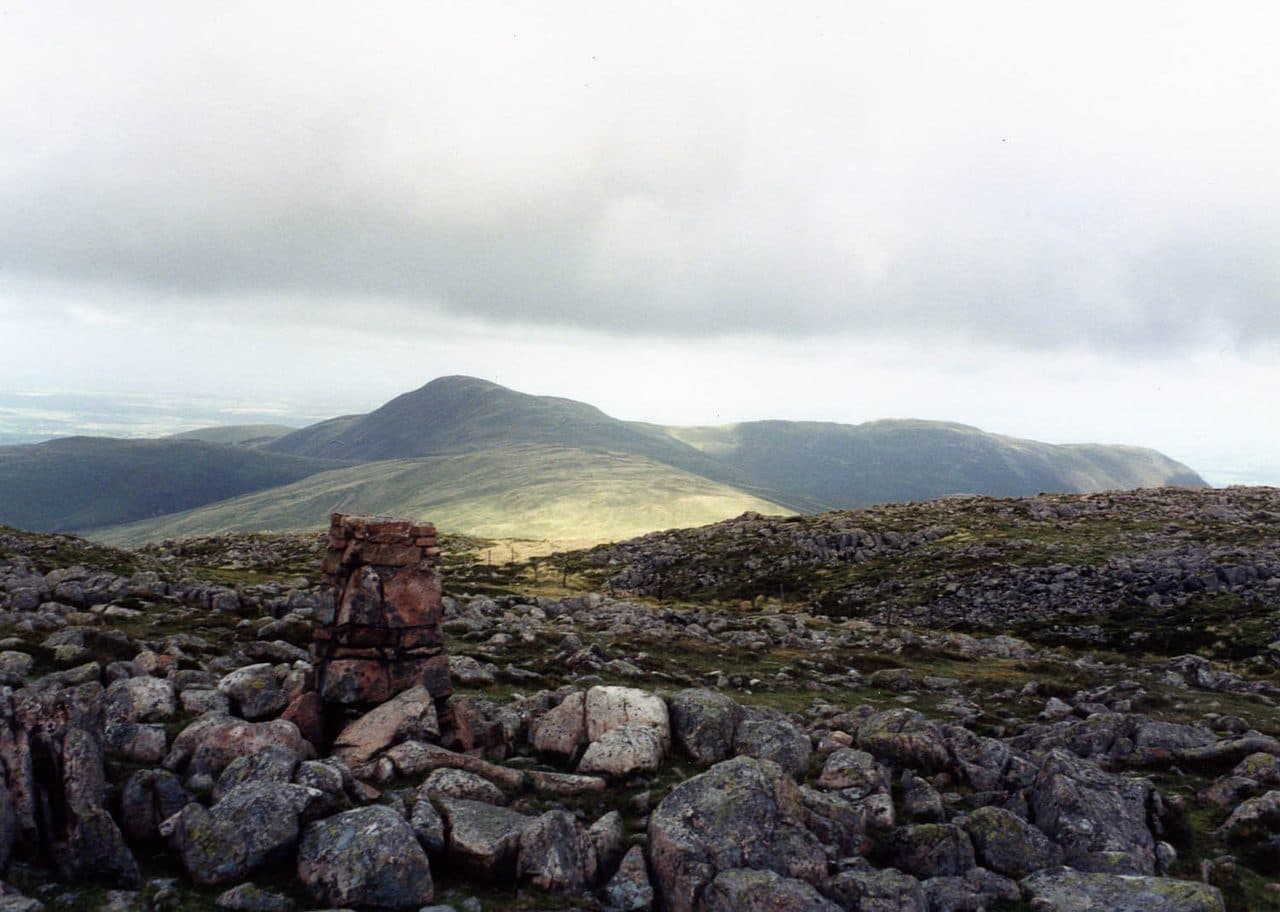
Photo: Mick Knapton via Wikimedia Commons
About Gavel Fell
The middle finger of the Loweswater Fells, with easy walking on grassy ridges and the Grasmoor fells along the skyline. Usually paired with Blake Fell on a loop from Maggie's Bridge.
Loweswater's five fells spread south west from the village like the fingers of a hand, and Gavel Fell is the middle one. Its long ridge rises gently past High Nook Farm, then steepens up the face of Black Crag onto a broad, damp plateau.
Start from the National Trust car park at Maggie's Bridge, just west of Loweswater village. It holds six to eight cars. The farm track goes through High Nook, where cattle may be about in summer, and climbs beside the ravine of Highnook Beck. Leave it for the saddle behind Black Crag and follow a narrow path along the crest above the crag. The views back to the Vale of Lorton, Fellbarrow and the Grasmoor fells are the best part of the walk. Beyond a cairn on the subsidiary top of High Nook, a step stile crosses the fence to the summit. Most people continue north west along the fence to Blake Fell and return down Highnook Beck, about 10 km in all.
The fell is grass, moss, bilberry and heather, boggy wherever it flattens, with faint paths in places. There is no scrambling.
The highest point is a large cairn on the grassy plateau. Blake Fell blocks part of the sea view, but the fells to the east make a fine line, with the Grasmoor group the pick of them.
Two tarns
High Nook Tarn, below Black Crag, is a small pool held back by a low earth dam, a short detour off the path. Floutern Tarn, on the southern boundary, lies beside the old Floutern Pass between Buttermere and Ennerdale. On the western side, walkers are no longer welcome on the direct line up Croasdale Beck, so an approach from Croasdale goes round by the west ridge of Banna Fell.
In winter
Above Black Crag the ridge flattens into wet moss and heather with faint paths, and in snow the fences are the only reliable guides. The steep grass zigzags down beside Highnook Beck get slippery when frozen, and the path keeps close to the edge of a deep ravine.
- Quiet & Remote
- Family Walk
- Dog Friendly
Sources: Wikipedia: Gavel Fell, Walk Lakes: Gavel Fell and Blake Fell from Maggie's Bridge. Updated .
Summit
- OS grid ref
- NY 116 183
- Latitude
- 54.55297° N
- Longitude
- 3.36678° W
- Area
- Western Fells
Walking up Gavel Fell
The nearest car park on foot is Maggie's Bridge Car Park, 3.9 km (2.4 miles) from the summit along mapped paths. Directions to the car park
Route from Maggie's Bridge Car Park
- Distance
- 3.9 km
- 2.4 miles, one way
- Ascent
- 397 m
- Total climb to the summit
- Time up
- 1 h 24 min
- Allow 1 to 2 hours
Times use Naismith’s rule, 5 km/h on the flat plus extra time for the climb, with Langmuir’s corrections. It’s a rule of thumb for the way up only, so add stops, weather and the walk back down.
The route follows paths mapped by OpenStreetMap contributors and isn’t a guided line. This car park was picked automatically and hasn’t been checked by hand yet, so compare it with a map. Check the mountain forecast before you go and carry a map and compass.
Gavel Fell questions
Is Gavel Fell a Wainwright?
How high is Gavel Fell?
Where do you park for Gavel Fell?
How long does it take to climb Gavel Fell?
How hard is Gavel Fell?
Which Wainwrights are near Gavel Fell?
What is the grid reference for the summit of Gavel Fell?
Often walked with Gavel Fell
Fells people usually take in on the same day.
Wainwrights near Gavel Fell
Straight-line distance and direction from the summit.
 Blake Fell573 m1.5 km NW
 Hen Comb509 m1.5 km E
 Great Borne616 m2.1 km S
 Burnbank Fell475 m2.7 km N
 Mellbreak (south top)512 m3.1 km E
 Starling Dodd633 m3.6 km SE
More in the Western Fells
- Great Gable899 m
- Pillar892 m
- Scoat Fell841 m
- Red Pike [Wasdale]826 m
- Steeple819 m
- High Stile806 m
- Kirk Fell802 m
- Green Gable801 m
- Haycock797 m
- Red Pike [Buttermere]755 m
- High Crag744 m
- Brandreth715 m
- Caw Fell697 m
- Grey Knotts697 m
- Seatallan692 m
- Fleetwith Pike649 m
- Base Brown646 m
- Starling Dodd633 m
- Yewbarrow627 m
- Great Borne616 m
- Haystacks597 m
- Middle Fell582 m
- Blake Fell573 m
- Lank Rigg541 m
- Crag Fell523 m
- Mellbreak (south top)512 m
- Hen Comb509 m
- Grike488 m
- Burnbank Fell475 m
- Buckbarrow423 m
- Low Fell423 m
- Fellbarrow416 m
Bag Gavel Fell with Upfell
Reach the summit and capture Gavel Fell, even with no signal. It goes on your round of the 214 with its own patch.
Coming soon to theApp Store