Western Fells · Book 7
Lank Rigg
Lank Rigg is a Wainwright, one of the 214 Lake District fells in Alfred Wainwright’s Pictorial Guides. At 541 m (1,775 ft) it is the 153rd highest of the 214 and the 24th highest in the Western Fells.
- Height
- 541 m
- 1,775 ft
- Rank
- 153
- of 214
- In area
- 24
- of 33
- Difficulty
- Moderate
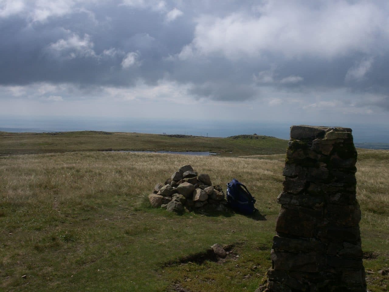
Photo: Bobble Hat via Wikimedia Commons
About Lank Rigg
Lonely western country with heathery tops and sea views. Gentle lines and a simple summit make it a restorative wander. A good place to chase evening light.
Far out on the western edge of the park, Lank Rigg rises from a grassy upland about 3 km square between the River Calder and Worm Gill, south of Ennerdale. You reach it from the unfenced Coldfell road between Ennerdale Bridge and Calder Bridge. Walk Lakes uses rough informal parking at NY 060 138, at the end of a track over Scaly Moss, and other walkers use the verge at Coldfell Gate by the Kinniside stone circle. The circle has twelve stones and may be largely a modern restoration.
From the road a path heads east between Blakeley Raise and Burn Edge into the upper Calder valley and up to the col between Whoap and Lank Rigg. Further south a lane reaches the Calder opposite Tongue How for a long climb up the south-west slopes. Walk Lakes adds Grike and Crag Fell for a circuit of 13.5 km with about 600 m of ascent.
The slopes are gentle and grassy, but paths are faint or missing and the hollows hold peat and water. On the Whoap Beck return there are two fords that are dangerous after rain.
Wainwright's coin
The summit has an Ordnance Survey trig pillar, with a small tarn just below it and a tumulus nearby. Wainwright buried a two-shilling piece under a stone here and mentioned it in the last of his Pictorial Guides, so the first reader to arrive could claim it. Walkers still leave coins in his memory. The Lakeland view is thin apart from a surprise glimpse of Blencathra, but the coast is laid out below you, with the Irish Sea, Ravenglass and Sellafield all in sight.
In winter
The two fords on the Whoap Beck and Calder return have no bridges and run high after rain or snowmelt. The grassy upland has so few landmarks that mist or snow cover makes navigation hard, so be sure of your compass work before setting out.
- Great Views
- Quiet & Remote
- Dog Friendly
- Summit Tarn
Sources: Wikipedia: Lank Rigg, Walk Lakes: Grike, Crag Fell, Lank Rigg, Andrew's Walks: Lank Rigg and Latterbarrow. Updated .
Summit
- OS grid ref
- NY 091 119
- Latitude
- 54.49478° N
- Longitude
- 3.40394° W
- Area
- Western Fells
Walking up Lank Rigg
The nearest car park on foot is Bleach Green Car Park, 5.3 km (3.3 miles) from the summit along mapped paths. Directions to the car park
Route from Bleach Green Car Park
- Distance
- 5.3 km
- 3.3 miles, one way
- Ascent
- 609 m
- Total climb to the summit
- Time up
- 1 h 57 min
- Allow 1 to 3 hours
Times use Naismith’s rule, 5 km/h on the flat plus extra time for the climb, with Langmuir’s corrections. It’s a rule of thumb for the way up only, so add stops, weather and the walk back down.
The route follows paths mapped by OpenStreetMap contributors and isn’t a guided line. Check the mountain forecast before you go and carry a map and compass.
Lank Rigg questions
Is Lank Rigg a Wainwright?
How high is Lank Rigg?
Where do you park for Lank Rigg?
How long does it take to climb Lank Rigg?
How hard is Lank Rigg?
Which Wainwrights are near Lank Rigg?
What is the grid reference for the summit of Lank Rigg?
Often walked with Lank Rigg
Fells people usually take in on the same day.
Lank Rigg in our guides
Wainwrights near Lank Rigg
Straight-line distance and direction from the summit.
 Grike488 m2.2 km N
 Crag Fell523 m2.5 km N
 Caw Fell697 m4.1 km E
 Haycock797 m5.4 km E
 Great Borne616 m5.5 km NE
 Seatallan692 m5.9 km SE
More in the Western Fells
- Great Gable899 m
- Pillar892 m
- Scoat Fell841 m
- Red Pike [Wasdale]826 m
- Steeple819 m
- High Stile806 m
- Kirk Fell802 m
- Green Gable801 m
- Haycock797 m
- Red Pike [Buttermere]755 m
- High Crag744 m
- Brandreth715 m
- Caw Fell697 m
- Grey Knotts697 m
- Seatallan692 m
- Fleetwith Pike649 m
- Base Brown646 m
- Starling Dodd633 m
- Yewbarrow627 m
- Great Borne616 m
- Haystacks597 m
- Middle Fell582 m
- Blake Fell573 m
- Gavel Fell526 m
- Crag Fell523 m
- Mellbreak (south top)512 m
- Hen Comb509 m
- Grike488 m
- Burnbank Fell475 m
- Buckbarrow423 m
- Low Fell423 m
- Fellbarrow416 m
Bag Lank Rigg with Upfell
Reach the summit and capture Lank Rigg, even with no signal. It goes on your round of the 214 with its own patch.
Coming soon to theApp Store