Western Fells · Book 7
Great Gable
Great Gable is a Wainwright, one of the 214 Lake District fells in Alfred Wainwright’s Pictorial Guides. At 899 m (2,949 ft) it is the 7th highest of the 214 and the highest in the Western Fells.
- Height
- 899 m
- 2,949 ft
- Rank
- 7
- of 214
- In area
- 1
- of 33
- Difficulty
- Difficult
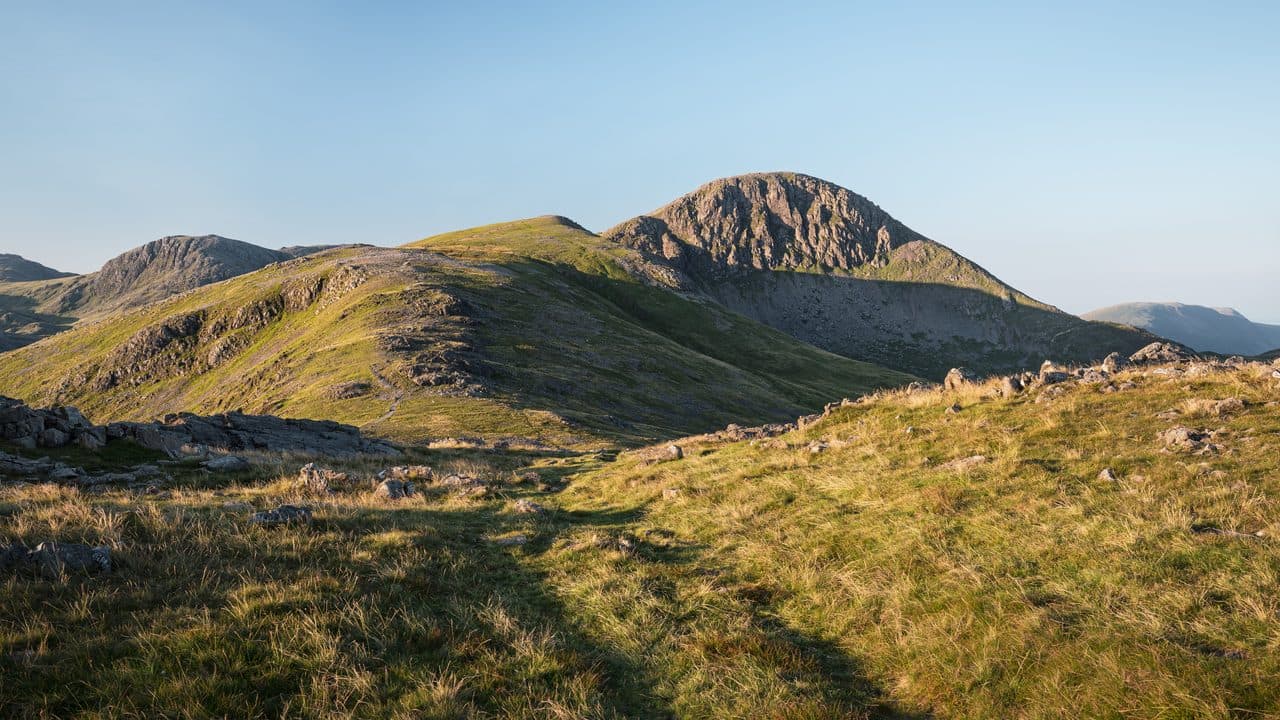
Photo: Julian Herzog via Wikimedia Commons
About Great Gable
A compact pyramid guarding Wasdale with steep, stony paths and boulder fields. Routes from Sty Head and Green Gable build to a rocky finale that feels adventurous without being technical. The summit is known for its Remembrance Sunday gatherings and for one of the best panoramas in the district. Small in footprint, big in presence.
There are three usual starting points. Honister Pass gives you the most height for free. From the top of the pass, follow the old quarry track to the Drum House, then either traverse on Moses Trod or go over Grey Knotts and Brandreth to Green Gable. The Honister Rambler bus (77) stops at the pass in season. From Seathwaite in Borrowdale, where you park on the roadside lane, a steep path beside Sourmilk Gill involves a little scrambling on the way to Base Brown, Green Gable and Windy Gap. From Wasdale Head the direct way is Gavel Neese, a relentless slope between Lingmell Beck and Gable Beck.
Every route ends on steep, rocky ground. From Windy Gap the path climbs through boulder fields that need your hands in places but never feel exposed. The stepped path down to Sty Head, the busy crossroads of paths below the south-east ridge, is an easy descent, and from there Styhead Gill and Grains Gill lead back to Seathwaite.
The war memorial
The summit is a rocky dome with a bronze plaque on the rock, the Fell and Rock Climbing Club's First World War memorial. A service is held beside it every Remembrance Sunday. About 100 yards south-west, the Westmorland Cairn stands on the edge above the Napes. Two brothers built it in 1876 to mark what they judged the finest view in the district, straight down to Wast Water. Ennerdale, Buttermere and the Scafells are all in sight from the summit.
Below that cairn is Napes Needle, the pinnacle Walter Haskett Smith climbed in June 1886. That climb is widely taken as the start of rock climbing as a sport in England.
In winter
The boulder slopes above Windy Gap and the long stepped path down to Sty Head both ice up badly. In mist the summit plateau is a sea of stones between Gable Crag on the north side and the Napes cliffs on the south, so take a bearing before you leave the top.
- Great Views
- Potentially Dangerous
- Popular
- Dog Friendly
Sources: Wikipedia: Great Gable, Walking Englishman: Green Gable and Great Gable from Seathwaite. Updated .
Summit
- OS grid ref
- NY 211 103
- Latitude
- 54.48207° N
- Longitude
- 3.21927° W
- Area
- Western Fells
Walking up Great Gable
The nearest car park on foot is Lake Head Car Park, 5.2 km (3.2 miles) from the summit along mapped paths. Directions to the car park
Route from Lake Head Car Park
- Distance
- 5.2 km
- 3.2 miles, one way
- Ascent
- 836 m
- Total climb to the summit
- Time up
- 2 h 21 min
- Allow 1 to 3 hours
Times use Naismith’s rule, 5 km/h on the flat plus extra time for the climb, with Langmuir’s corrections. It’s a rule of thumb for the way up only, so add stops, weather and the walk back down.
The route follows paths mapped by OpenStreetMap contributors and isn’t a guided line. Check the mountain forecast before you go and carry a map and compass.
Great Gable questions
Is Great Gable a Wainwright?
How high is Great Gable?
Where do you park for Great Gable?
How long does it take to climb Great Gable?
How hard is Great Gable?
Which Wainwrights are near Great Gable?
What is the grid reference for the summit of Great Gable?
Often walked with Great Gable
Fells people usually take in on the same day.

Great Gable in our guides
Wainwrights near Great Gable
Straight-line distance and direction from the summit.
 Green Gable801 m0.5 km NE
 Kirk Fell802 m1.6 km W
 Brandreth715 m1.7 km N
 Seathwaite Fell601 m1.8 km E
 Base Brown646 m1.8 km NE
 Lingmell807 m2.1 km S
More in the Western Fells
- Pillar892 m
- Scoat Fell841 m
- Red Pike [Wasdale]826 m
- Steeple819 m
- High Stile806 m
- Kirk Fell802 m
- Green Gable801 m
- Haycock797 m
- Red Pike [Buttermere]755 m
- High Crag744 m
- Brandreth715 m
- Caw Fell697 m
- Grey Knotts697 m
- Seatallan692 m
- Fleetwith Pike649 m
- Base Brown646 m
- Starling Dodd633 m
- Yewbarrow627 m
- Great Borne616 m
- Haystacks597 m
- Middle Fell582 m
- Blake Fell573 m
- Lank Rigg541 m
- Gavel Fell526 m
- Crag Fell523 m
- Mellbreak (south top)512 m
- Hen Comb509 m
- Grike488 m
- Burnbank Fell475 m
- Buckbarrow423 m
- Low Fell423 m
- Fellbarrow416 m
Bag Great Gable with Upfell
Reach the summit and capture Great Gable, even with no signal. It goes on your round of the 214 with its own patch.
Coming soon to theApp Store