Western Fells · Book 7
Pillar
Pillar is a Wainwright, one of the 214 Lake District fells in Alfred Wainwright’s Pictorial Guides. At 892 m (2,927 ft) it is the 8th highest of the 214 and the 2nd highest in the Western Fells.
- Height
- 892 m
- 2,927 ft
- Rank
- 8
- of 214
- In area
- 2
- of 33
- Difficulty
- Difficult
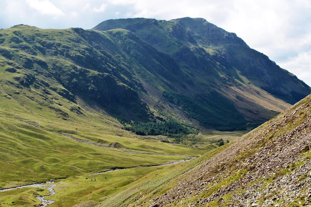
Photo: Kreuzschnabel via Wikimedia Commons
About Pillar
The dominant wall of Ennerdale, with the famous buttress of Pillar Rock below the summit on the Ennerdale face. Long approaches from Wasdale or Ennerdale give a remote, big-day feel, and the High Level Route adds airy excitement. Craggy scenery, intricate paths and constant views make this a connoisseur's outing. A Western Fells heavyweight with real character.
Pillar is a big day from Wasdale Head. Walk up Mosedale to Black Sail Pass, the main foot pass between Wasdale and Ennerdale, which tops out at around 545m. There is no bus into Wasdale. Park at Wasdale Head or, for the full Mosedale Horseshoe, at Overbeck Bridge on the shore of Wast Water. From the top of the pass the east ridge goes over Looking Stead and up to the summit on a clear path.
The High Level Route
At around 640m on the ridge, a narrow path branches off to the right and traverses the Ennerdale face. It passes Robinson's Cairn, put up by friends of the climber John Wilson Robinson after his death in 1907, and crosses the Shamrock Traverse, an exposed but clear ledge path over an open gully. It leads to the foot of Pillar Rock and then climbs steeply to the summit. It is a walkers' path, but you need a steady head and dry rock.
Pillar Rock is the big buttress below the summit on the Ennerdale side. John Atkinson of Ennerdale made the first recorded ascent in 1826, and it is often called the birthplace of Lakeland rock climbing. It is the only summit on the Nuttall list that you cannot reach without climbing.
The top of Pillar is surprisingly broad and grassy, with a trig pillar, a cairn and a wind shelter. A second shelter on the northern edge marks the way down to the High Level Route. On a clear day you can see almost every major group except the Coniston fells, along with Ennerdale Water and Loweswater. Strong walkers carry on over Scoat Fell and Red Pike and finish over Yewbarrow, though the climb up Stirrup Crag onto Yewbarrow is a real scramble.
In winter
The High Level Route and the Shamrock Traverse face north into Ennerdale and hold snow and ice long after the ridge has cleared. Do not go there without an axe and crampons. It is a long day from Wasdale, so on short winter days the ridge path over Looking Stead is the sensible choice.
- Great Views
- Quiet & Remote
- Potentially Dangerous
- Dog Friendly
Sources: Wikipedia: Pillar (Lake District), Walking Englishman: Pillar, Scoat Fell, Red Pike and Yewbarrow. Updated .
Summit
- OS grid ref
- NY 171 121
- Latitude
- 54.49746° N
- Longitude
- 3.28111° W
- Area
- Western Fells
Walking up Pillar
The nearest car park on foot is Lake Head Car Park, 6.8 km (4.2 miles) from the summit along mapped paths. Directions to the car park
Route from Lake Head Car Park
- Distance
- 6.8 km
- 4.2 miles, one way
- Ascent
- 1065 m
- Total climb to the summit
- Time up
- 3 h
- Allow 2 to 4 hours
Times use Naismith’s rule, 5 km/h on the flat plus extra time for the climb, with Langmuir’s corrections. It’s a rule of thumb for the way up only, so add stops, weather and the walk back down.
The route follows paths mapped by OpenStreetMap contributors and isn’t a guided line. This car park was picked automatically and hasn’t been checked by hand yet, so compare it with a map. Check the mountain forecast before you go and carry a map and compass.
Pillar questions
Is Pillar a Wainwright?
How high is Pillar?
Where do you park for Pillar?
How long does it take to climb Pillar?
How hard is Pillar?
Which Wainwrights are near Pillar?
What is the grid reference for the summit of Pillar?
Often walked with Pillar
Fells people usually take in on the same day.

Pillar in our guides
Wainwrights near Pillar
Straight-line distance and direction from the summit.
 Scoat Fell841 m1.4 km SW
 Steeple819 m1.4 km W
 Red Pike [Wasdale]826 m1.6 km S
 High Crag744 m2.1 km NE
 Haystacks597 m2.5 km NE
 High Stile806 m2.7 km N
More in the Western Fells
- Great Gable899 m
- Scoat Fell841 m
- Red Pike [Wasdale]826 m
- Steeple819 m
- High Stile806 m
- Kirk Fell802 m
- Green Gable801 m
- Haycock797 m
- Red Pike [Buttermere]755 m
- High Crag744 m
- Brandreth715 m
- Caw Fell697 m
- Grey Knotts697 m
- Seatallan692 m
- Fleetwith Pike649 m
- Base Brown646 m
- Starling Dodd633 m
- Yewbarrow627 m
- Great Borne616 m
- Haystacks597 m
- Middle Fell582 m
- Blake Fell573 m
- Lank Rigg541 m
- Gavel Fell526 m
- Crag Fell523 m
- Mellbreak (south top)512 m
- Hen Comb509 m
- Grike488 m
- Burnbank Fell475 m
- Buckbarrow423 m
- Low Fell423 m
- Fellbarrow416 m
Bag Pillar with Upfell
Reach the summit and capture Pillar, even with no signal. It goes on your round of the 214 with its own patch.
Coming soon to theApp Store