Western Fells · Book 7
Fellbarrow
Fellbarrow is a Wainwright, one of the 214 Lake District fells in Alfred Wainwright’s Pictorial Guides. At 416 m (1,365 ft) it is the 200th highest of the 214 and the lowest in the Western Fells.
- Height
- 416 m
- 1,365 ft
- Rank
- 200
- of 214
- In area
- 33
- of 33
- Difficulty
- Easy
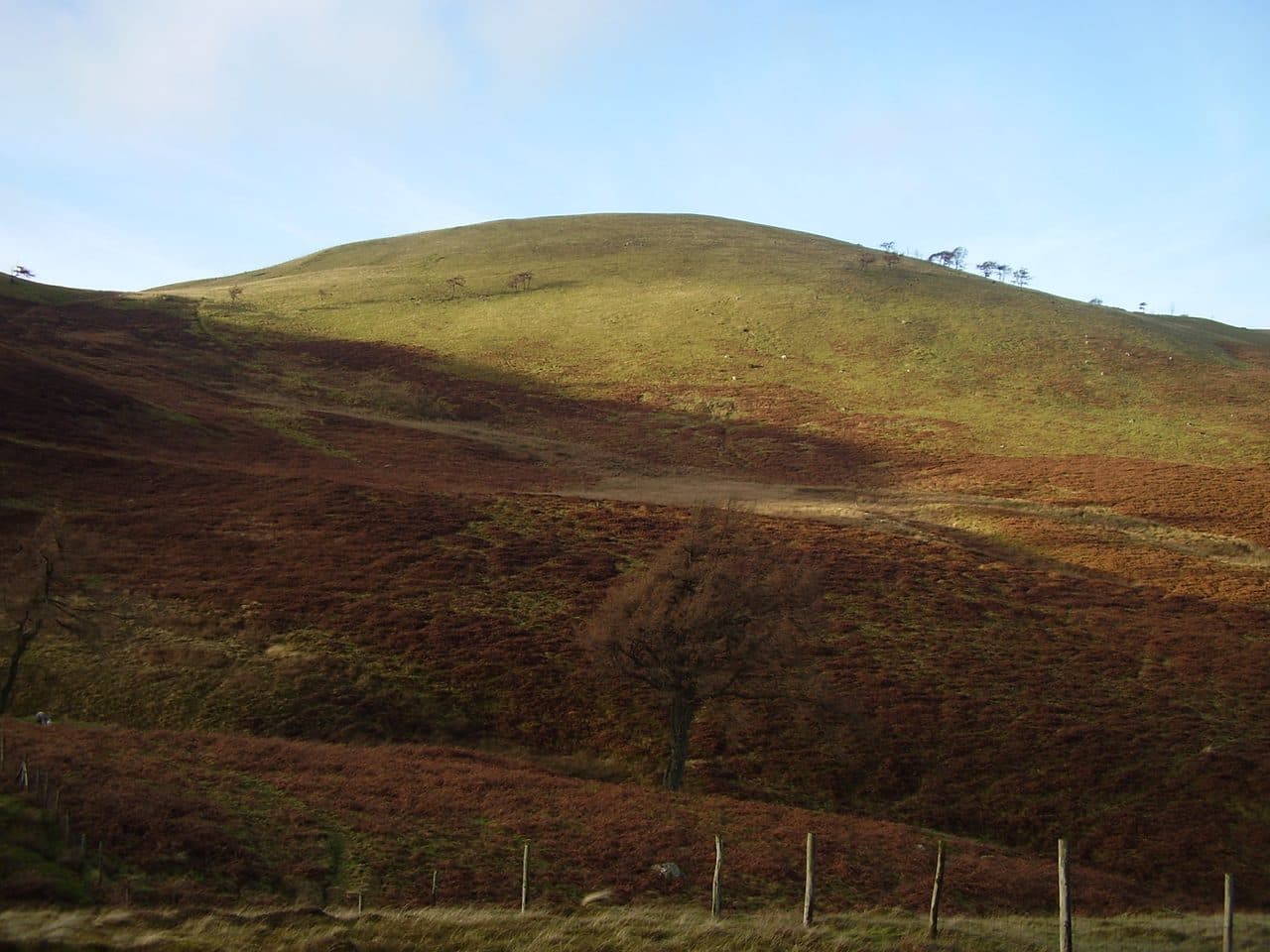
Photo: Freddyj66 via Wikimedia Commons
About Fellbarrow
A rounded grassy ridge at the northern end of the Loweswater Fells, above the Vale of Lorton. Short climbs from Thackthwaite or Low Lorton lead to a trig point with the sea one way and the Grasmoor fells the other.
A two mile grassy ridge runs north from Low Fell to Fellbarrow, the last outpost of the Western Fells before the farmland of west Cumberland. The Vale of Lorton lies below it to the east.
Thackthwaite, a hamlet on the west side of the vale, is the best start. Parking is tight: a short layby just north of the hamlet takes a couple of cars. Go into the yard at Thackthwaite farm and up the lane signed for Low Fell, which is steep and rough. Field edges lead to an old drove road that climbs over the shoulder of Watching Crag. Near its top, turn north along the fence to Fellbarrow. Carrying on south over Smithy Fell and Sourfoot Fell brings you to Low Fell, and the round is about 8 km with 445 metres of ascent. From Low Lorton a lane leads west to the track for Hatteringill and the north east ridge over Broadmoor Hill.
It is grass and moss nearly all the way, with fences running along and across the ridge and no difficulties underfoot.
The summit is a curving grassy dome with a trig pillar and a small cairn, just over a low fence from the path. To the west and north the Irish Sea and the Solway Firth lie beyond the Cumberland plain. East, across Lorton, the Whiteside and Grisedale Pike ridge stands out, with Skiddaw and Blencathra behind, and further round you see the northern wall of Ennerdale backed by Pillar and the Scafells. No lake is visible from the top.
When Wainwright surveyed the ridge he had to estimate the heights and took Fellbarrow to be the higher end. The Ordnance Survey now gives Low Fell 423 metres to Fellbarrow's 416.
In winter
The lane up from Thackthwaite runs like a beck after heavy rain, and the dips between the tops hold bog. Otherwise it is a short grassy walk that fits a winter day, and the fences running along the ridge make easy handrails in mist.
- Great Views
- Family Walk
- Dog Friendly
Sources: Wikipedia: Fellbarrow, Walk Lakes: Fellbarrow from Thackthwaite, Lorton Vale. Updated .
Summit
- OS grid ref
- NY 132 242
- Latitude
- 54.60591° N
- Longitude
- 3.34495° W
- Area
- Western Fells
Walking up Fellbarrow
The nearest car park on foot is Lanthwaite Wood National Trust car park, 4.3 km (2.7 miles) from the summit along mapped paths. Directions to the car park
Route from Lanthwaite Wood National Trust car park
- Distance
- 4.3 km
- 2.7 miles, one way
- Ascent
- 399 m
- Total climb to the summit
- Time up
- 1 h 28 min
- Allow 1 to 2 hours
Times use Naismith’s rule, 5 km/h on the flat plus extra time for the climb, with Langmuir’s corrections. It’s a rule of thumb for the way up only, so add stops, weather and the walk back down.
The route follows paths mapped by OpenStreetMap contributors and isn’t a guided line. This car park was picked automatically and hasn’t been checked by hand yet, so compare it with a map. Check the mountain forecast before you go and carry a map and compass.
Fellbarrow questions
Is Fellbarrow a Wainwright?
How high is Fellbarrow?
Where do you park for Fellbarrow?
How long does it take to climb Fellbarrow?
How hard is Fellbarrow?
Which Wainwrights are near Fellbarrow?
What is the grid reference for the summit of Fellbarrow?
Wainwrights near Fellbarrow
Straight-line distance and direction from the summit.
 Low Fell423 m2.0 km S
 Burnbank Fell475 m4.0 km SW
 Whiteside (west top)707 m4.4 km SE
 Graystones452 m5.0 km NE
 Blake Fell573 m5.0 km SW
 Hopegill Head770 m5.7 km E
More in the Western Fells
- Great Gable899 m
- Pillar892 m
- Scoat Fell841 m
- Red Pike [Wasdale]826 m
- Steeple819 m
- High Stile806 m
- Kirk Fell802 m
- Green Gable801 m
- Haycock797 m
- Red Pike [Buttermere]755 m
- High Crag744 m
- Brandreth715 m
- Caw Fell697 m
- Grey Knotts697 m
- Seatallan692 m
- Fleetwith Pike649 m
- Base Brown646 m
- Starling Dodd633 m
- Yewbarrow627 m
- Great Borne616 m
- Haystacks597 m
- Middle Fell582 m
- Blake Fell573 m
- Lank Rigg541 m
- Gavel Fell526 m
- Crag Fell523 m
- Mellbreak (south top)512 m
- Hen Comb509 m
- Grike488 m
- Burnbank Fell475 m
- Buckbarrow423 m
- Low Fell423 m
Bag Fellbarrow with Upfell
Reach the summit and capture Fellbarrow, even with no signal. It goes on your round of the 214 with its own patch.
Coming soon to theApp Store