Western Fells · Book 7
Crag Fell
Crag Fell is a Wainwright, one of the 214 Lake District fells in Alfred Wainwright’s Pictorial Guides. At 523 m (1,716 ft) it is the 162nd highest of the 214 and the 26th highest in the Western Fells.
- Height
- 523 m
- 1,716 ft
- Rank
- 162
- of 214
- In area
- 26
- of 33
- Difficulty
- Moderate
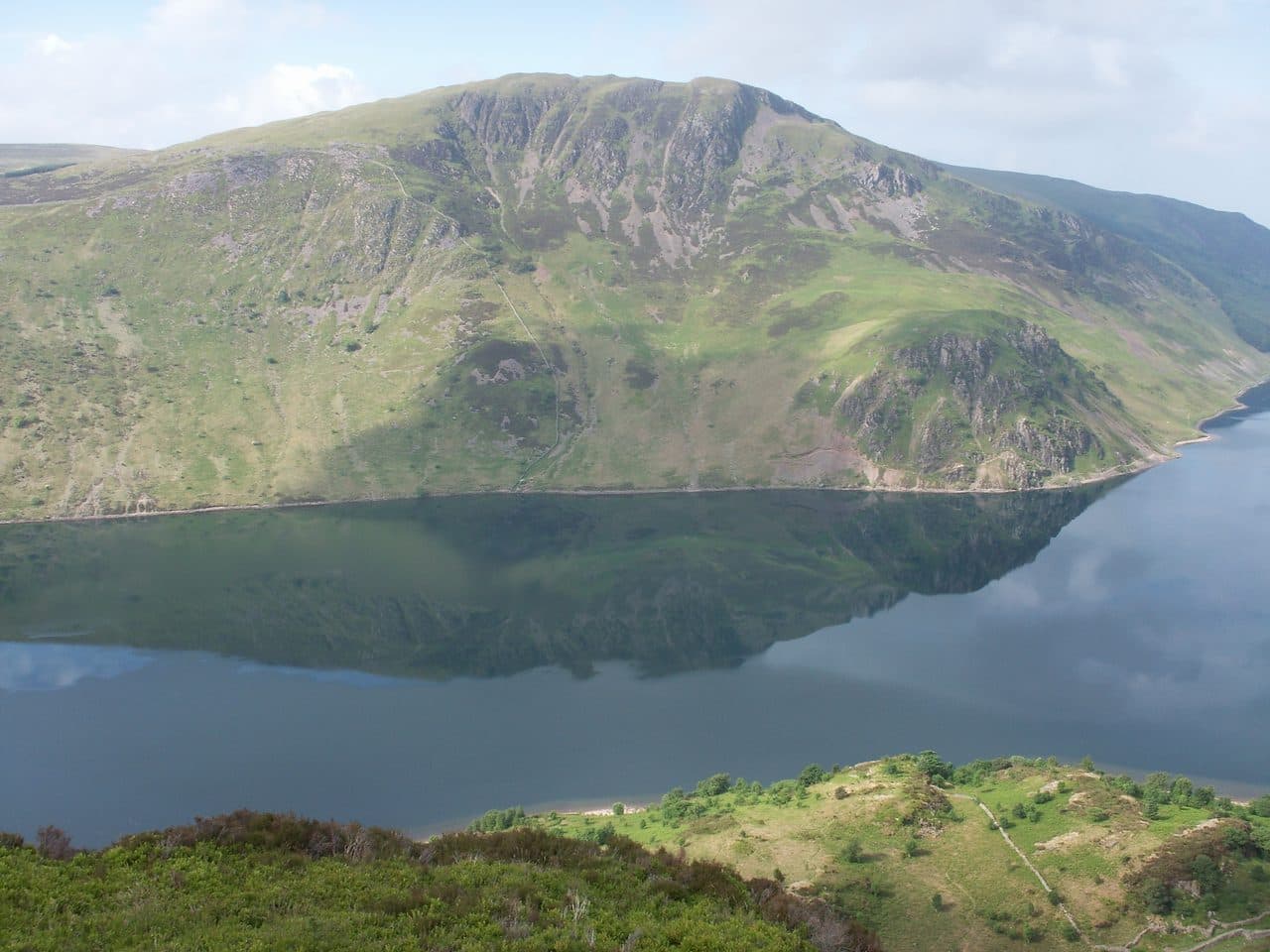
Photo: Bobble Hat via Wikimedia Commons
About Crag Fell
A western edge with sudden crags over Ennerdale Water. Open moor tops and a satisfying summit make it a solid half day. Pair with Grike for a tidy round.
Look across Ennerdale Water from the car park at Bowness Knott and the name explains itself. Two tiers of crag drop down the north face, Revelin Crag below the summit and Anglers Crag, also called Robin Hood's Chair, right on the shore.
A narrow road runs east from Ennerdale Bridge to two car parks near the outflow of the lake, Bleach Green and Bowness Knott. From there you can follow Ben Gill up beside the plantation and swing left to the top. The better route takes the lakeshore path to Anglers Crag, where a short stretch needs your hands, climbs to the col behind it and then works up round the west side of Revelin Crag. That line passes the Crag Fell Pinnacles, a broken spine of rock standing about 80 feet proud of the slope. They are easy to miss from above, so climb up to them on a first visit. From the Cold Fell road to the south, a bridleway and the old mine road climb over Grike, and the whole Lank Rigg group makes a round from there.
The top is undulating grass with boggy hollows and scattered outcrops. Of the two mounds, the north western one is the summit. A lower knoll just north of the cairn gives the best view down the lake to the head of Ennerdale, ringed by the high Western Fells, and Fairfield and Ullscarf appear through gaps. Seawards you look over the coast to the nuclear site at Sellafield.
Iron miners drove trial levels under Revelin Crag, above Anglers Crag and above Red Beck. They found haematite, but never enough, and all had closed by 1896. On the shore path under Anglers Crag, the rock is the red Ennerdale granite.
In winter
The lakeshore path under Anglers Crag has a short hands-on section that is greasy in the wet and dangerous with ice, and the ground around the pinnacles is steep. In winter the Ben Gill path beside the plantation is the steadier way up.
- Family Walk
- Dog Friendly
Sources: Wikipedia: Crag Fell, Walk Lakes: Grike, Crag Fell, Lank Rigg, Walk Lakes: Ennerdale Water. Updated .
Summit
- OS grid ref
- NY 097 143
- Latitude
- 54.51669° N
- Longitude
- 3.39604° W
- Area
- Western Fells
Walking up Crag Fell
The nearest car park on foot is Bleach Green Car Park, 2.2 km (1.4 miles) from the summit along mapped paths. Directions to the car park
Route from Bleach Green Car Park
- Distance
- 2.2 km
- 1.4 miles, one way
- Ascent
- 411 m
- Total climb to the summit
- Time up
- 1 h 5 min
- Allow 1 to 2 hours
Times use Naismith’s rule, 5 km/h on the flat plus extra time for the climb, with Langmuir’s corrections. It’s a rule of thumb for the way up only, so add stops, weather and the walk back down.
The route follows paths mapped by OpenStreetMap contributors and isn’t a guided line. Check the mountain forecast before you go and carry a map and compass.
Crag Fell questions
Is Crag Fell a Wainwright?
How high is Crag Fell?
Where do you park for Crag Fell?
How long does it take to climb Crag Fell?
How hard is Crag Fell?
Which Wainwrights are near Crag Fell?
What is the grid reference for the summit of Crag Fell?
Often walked with Crag Fell
Fells people usually take in on the same day.
Crag Fell in our guides
Wainwrights near Crag Fell
Straight-line distance and direction from the summit.
 Grike488 m1.3 km W
 Lank Rigg541 m2.5 km S
 Great Borne616 m3.3 km NE
 Gavel Fell526 m4.5 km NE
 Starling Dodd633 m4.7 km E
 Caw Fell697 m4.8 km SE
More in the Western Fells
- Great Gable899 m
- Pillar892 m
- Scoat Fell841 m
- Red Pike [Wasdale]826 m
- Steeple819 m
- High Stile806 m
- Kirk Fell802 m
- Green Gable801 m
- Haycock797 m
- Red Pike [Buttermere]755 m
- High Crag744 m
- Brandreth715 m
- Caw Fell697 m
- Grey Knotts697 m
- Seatallan692 m
- Fleetwith Pike649 m
- Base Brown646 m
- Starling Dodd633 m
- Yewbarrow627 m
- Great Borne616 m
- Haystacks597 m
- Middle Fell582 m
- Blake Fell573 m
- Lank Rigg541 m
- Gavel Fell526 m
- Mellbreak (south top)512 m
- Hen Comb509 m
- Grike488 m
- Burnbank Fell475 m
- Buckbarrow423 m
- Low Fell423 m
- Fellbarrow416 m
Bag Crag Fell with Upfell
Reach the summit and capture Crag Fell, even with no signal. It goes on your round of the 214 with its own patch.
Coming soon to theApp Store