Northern Fells · Book 5
Souther Fell
Souther Fell is a Wainwright, one of the 214 Lake District fells in Alfred Wainwright’s Pictorial Guides. At 522 m (1,713 ft) it is the 163rd highest of the 214 and the 20th highest in the Northern Fells.
- Height
- 522 m
- 1,713 ft
- Rank
- 163
- of 214
- In area
- 20
- of 24
- Difficulty
- Easy
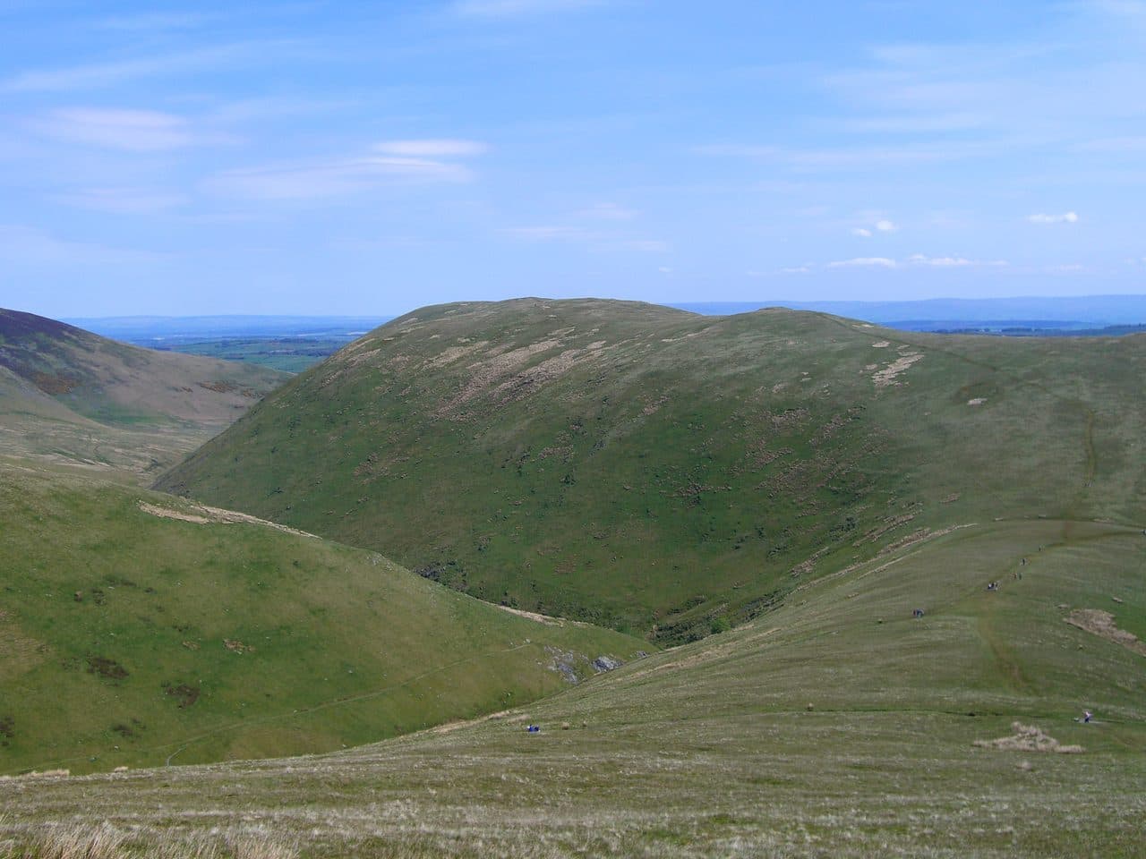
Photo: Mick Knapton via Wikimedia Commons
About Souther Fell
Rolling turf above Mungrisdale, with a famous tale of a spectral army seen marching along the ridge at Midsummer in 1745. Gentle, sociable walking and far looks to Blencathra. Great for groups and newcomers.
Souther Fell is usually climbed from Scales, just off the A66, where there is a small parking area above the hamlet. The X4 and X5 between Penrith and Keswick run along the A66 past Scales. A path climbs into Mousthwaite Comb, a neat hollow at the fell's southern end, and the steepest, roughest part of the day is the climb out of it to the col. From there the ridge runs north-east for about two miles towards Mungrisdale. A circuit that drops off the ridge before Mungrisdale and returns along the quiet gated road to Scales comes to about 8 km with 340 m of climbing.
From Mungrisdale there's parking opposite the village hall, where a donation is asked for. Wainwright's direct line across the fields behind the Mill Inn is not a right of way, so use the signed paths.
It is mostly grass, with a couple of soggy flat sections on the ridge. There is no scrambling. The western side is rougher, with scree above the River Glenderamackin, which almost circles the fell. Bannerdale Crags rise on the far bank.
The highest point is at the north-east end and is not much to look at: a small cairn on a flat bit of rock in the grass. The southern top, about 30 feet lower, has the better cairn. Nothing higher stands to the east, so the view to the Pennines is open, and to the west you look across to Blencathra, Great Gable and the Scafells.
The spectral army
At Midsummer in 1745, people watching from below said they saw troops, horsemen and carriages marching along the ridge for hours. Twenty-six witnesses later swore to it before a magistrate. When people went up to look, there were no footprints anywhere on the soft ground.
In winter
The ridge faces straight into easterly winds off the Pennines with nothing to break them, and the climb out of Mousthwaite Comb is a steep, rough slope that holds ice. In snow the flat, boggy top gives you little to aim for between the cairn and the true summit.
- Ridge Walk
- Popular
- Dog Friendly
Sources: Wikipedia: Souther Fell, Walk Lakes: Souther Fell. Updated .
Summit
- OS grid ref
- NY 354 291
- Latitude
- 54.65322° N
- Longitude
- 3.00164° W
- Area
- Northern Fells
Walking up Souther Fell
The nearest car park on foot is Threlkeld Car Park, 5.9 km (3.7 miles) from the summit along mapped paths. Directions to the car park
Route from Threlkeld Car Park
- Distance
- 5.9 km
- 3.7 miles, one way
- Ascent
- 413 m
- Total climb to the summit
- Time up
- 1 h 49 min
- Allow 1 to 3 hours
Times use Naismith’s rule, 5 km/h on the flat plus extra time for the climb, with Langmuir’s corrections. It’s a rule of thumb for the way up only, so add stops, weather and the walk back down.
The route follows paths mapped by OpenStreetMap contributors and isn’t a guided line. Check the mountain forecast before you go and carry a map and compass.
Souther Fell questions
Is Souther Fell a Wainwright?
How high is Souther Fell?
Where do you park for Souther Fell?
How long does it take to climb Souther Fell?
How hard is Souther Fell?
Which Wainwrights are near Souther Fell?
What is the grid reference for the summit of Souther Fell?
Often walked with Souther Fell
Fells people usually take in on the same day.
Wainwrights near Souther Fell
Straight-line distance and direction from the summit.
 Bannerdale Crags683 m1.9 km W
 Bowscale Fell702 m2.5 km NW
 Blencathra868 m3.4 km SW
 Mungrisdale Common633 m4.4 km W
 Carrock Fell663 m4.7 km N
 Great Mell Fell537 m5.6 km SE
More in the Northern Fells
- Skiddaw931 m
- Blencathra868 m
- Skiddaw Little Man865 m
- Carl Side746 m
- Long Side734 m
- Lonscale Fell715 m
- Knott710 m
- Bowscale Fell702 m
- Great Calva690 m
- Ullock Pike690 m
- Bannerdale Crags683 m
- Bakestall673 m
- Carrock Fell663 m
- High Pike [Caldbeck]658 m
- Great Sca Fell651 m
- Mungrisdale Common633 m
- Brae Fell586 m
- Meal Fell550 m
- Great Cockup526 m
- Dodd502 m
- Longlands Fell483 m
- Binsey447 m
- Latrigg368 m
Bag Souther Fell with Upfell
Reach the summit and capture Souther Fell, even with no signal. It goes on your round of the 214 with its own patch.
Coming soon to theApp Store