Northern Fells · Book 5
Long Side
Long Side is a Wainwright, one of the 214 Lake District fells in Alfred Wainwright’s Pictorial Guides. At 734 m (2,408 ft) it is the 71st highest of the 214 and the 5th highest in the Northern Fells.
- Height
- 734 m
- 2,408 ft
- Rank
- 71
- of 214
- In area
- 5
- of 24
- Difficulty
- Moderate
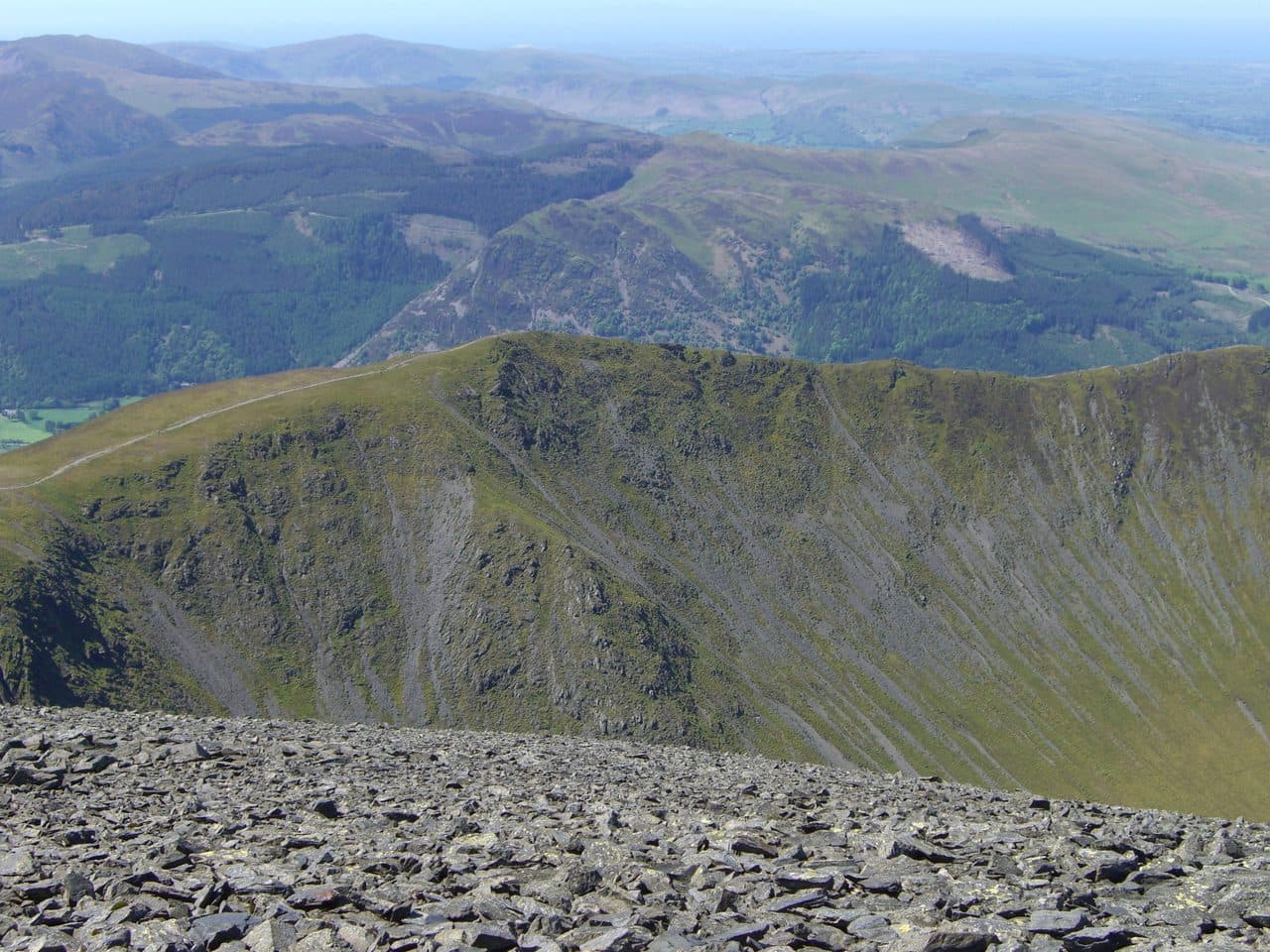
Photo: Mick Knapton via Wikimedia Commons
About Long Side
Part of the elegant Longside Edge leading to Carl Side and Skiddaw. The ridge is swift and scenic, with big looks over Bassenthwaite Lake.
Longside Edge is the middle of the ridge that climbs from Bassenthwaite Lake towards Skiddaw, and Long Side is the highest point along it. On one side broken crags fall into Southerndale. On the other, steep slopes drop through conifers to the lake.
Two starts serve it. The Old Sawmill tearoom on the A591 has a pay car park, and the Ravenstone Hotel, a little further north, has a bus stop but not much parking. From the Old Sawmill, coloured marker posts lead up through Dodd Wood, over Sandbeds Gill and out onto the open fell by a small gate. Turn right at the crossroads on the ridge to go over Ullock Pike, then follow the edge about 600 metres to Long Side. From Ravenstone you climb Ullock Pike's northern ridge. Walk Lakes' round goes on from Long Side past Carlside Tarn to Carl Side and then drops back via Long Doors to the car park, 10 km with 700 metres of climbing. There is also a direct way up from the Old Sawmill on a waymarked Forestry trail through Longside Wood.
The ridge is grassy Skiddaw Slate, with short steep sections of loose stone. Walk Lakes grades the round as steep, with loose scree and a little hands on rock.
A pile of stones marks the summit. Skiddaw fills the view east, and Bassenthwaite Lake lies below to the west. The north west ridge is a quiet way up Skiddaw, and Long Side is roughly halfway along it.
In winter
Longside Edge is a narrow crest facing west over Bassenthwaite Lake and takes the full force of a winter westerly. The slate path down from Carl Side by White Stones, the usual way back, is loose and slippery when frozen.
- Ridge Walk
- Great Views
- Dog Friendly
Sources: Wikipedia: Long Side, Walk Lakes: Ullock Pike, Longside Edge, Carl Side. Updated .
Summit
- OS grid ref
- NY 248 284
- Latitude
- 54.64548° N
- Longitude
- 3.16559° W
- Area
- Northern Fells
Walking up Long Side
The nearest car park on foot is Dodd Wood car park, 4.0 km (2.5 miles) from the summit along mapped paths. Directions to the car park
Route from Dodd Wood car park
- Distance
- 4.0 km
- 2.5 miles, one way
- Ascent
- 660 m
- Total climb to the summit
- Time up
- 1 h 50 min
- Allow 1 to 3 hours
Times use Naismith’s rule, 5 km/h on the flat plus extra time for the climb, with Langmuir’s corrections. It’s a rule of thumb for the way up only, so add stops, weather and the walk back down.
The route follows paths mapped by OpenStreetMap contributors and isn’t a guided line. Check the mountain forecast before you go and carry a map and compass.
Long Side questions
Is Long Side a Wainwright?
How high is Long Side?
Where do you park for Long Side?
How long does it take to climb Long Side?
How hard is Long Side?
Which Wainwrights are near Long Side?
What is the grid reference for the summit of Long Side?
Often walked with Long Side
Fells people usually take in on the same day.
Wainwrights near Long Side
Straight-line distance and direction from the summit.
 Ullock Pike690 m0.5 km NW
 Carl Side746 m0.7 km SE
 Dodd502 m1.2 km S
 Skiddaw931 m1.3 km NE
 Skiddaw Little Man865 m1.9 km E
 Bakestall673 m3.0 km NE
More in the Northern Fells
- Skiddaw931 m
- Blencathra868 m
- Skiddaw Little Man865 m
- Carl Side746 m
- Lonscale Fell715 m
- Knott710 m
- Bowscale Fell702 m
- Great Calva690 m
- Ullock Pike690 m
- Bannerdale Crags683 m
- Bakestall673 m
- Carrock Fell663 m
- High Pike [Caldbeck]658 m
- Great Sca Fell651 m
- Mungrisdale Common633 m
- Brae Fell586 m
- Meal Fell550 m
- Great Cockup526 m
- Souther Fell522 m
- Dodd502 m
- Longlands Fell483 m
- Binsey447 m
- Latrigg368 m
Bag Long Side with Upfell
Reach the summit and capture Long Side, even with no signal. It goes on your round of the 214 with its own patch.
Coming soon to theApp Store