Northern Fells · Book 5
Carl Side
Carl Side is a Wainwright, one of the 214 Lake District fells in Alfred Wainwright’s Pictorial Guides. At 746 m (2,448 ft) it is the 64th highest of the 214 and the 4th highest in the Northern Fells.
- Height
- 746 m
- 2,448 ft
- Rank
- 64
- of 214
- In area
- 4
- of 24
- Difficulty
- Moderate
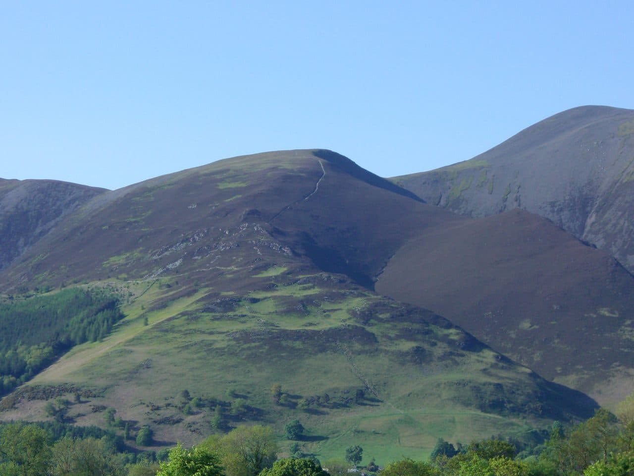
Photo: Mick Knapton via Wikimedia Commons
About Carl Side
A broad, slanting shoulder of Skiddaw with quick gains from Dodd or via Longside Edge. A fine way to see the Skiddaw group without the full crowds.
Few people climb Carl Side for its own sake. It is usually the middle of a round, and the popular one starts at the Old Sawmill tearoom car park at Dodd Wood, on the A591 between Keswick and Bassenthwaite. The car park reads your number plate and you pay as you leave. Marker posts lead up through the forest to open fell and then along the ridge over Ullock Pike and Longside Edge, with Southerndale on one side and Bassenthwaite Lake on the other.
From Long Side the path drops to Carlside Tarn and climbs a short way to the summit. The way back goes steeply down the south ridge past White Stones to Long Doors, the gap between Carl Side and Dodd, then along forest tracks to the car. A short, steep direct route also comes up the south ridge from Millbeck, near Applethwaite.
It is Skiddaw Slate underfoot the whole way. The ridges are mostly grass, but the steep parts are loose, slatey scree and slick in the wet. Ullock Pike has a few rocky steps with easy paths round them, so you will not need to scramble.
The summit is a broad, grassy top with a cairn. Look south, down Derwentwater to the Borrowdale fells. Carlside Tarn, in the col towards Skiddaw, is the only standing water in the whole Skiddaw group. It is very shallow and often dries up in summer.
Ospreys nest in the valley, and in season, usually April to October, you can look for them from the Dodd Wood viewpoints on the way back to the car. Miners dug a trial level into the fell in the 1870s, looking for baryte and lead ore.
In winter
The steep slate path down past White Stones to Long Doors, and the south ridge above Millbeck, are hard work when frozen, because the Skiddaw Slate is loose as well as slippery. Longside Edge is a narrow crest facing west over Bassenthwaite Lake and takes the full force of a winter westerly.
- Great Views
- Popular
- Dog Friendly
Sources: Wikipedia: Carl Side, Walk Lakes: Ullock Pike, Longside Edge, Carl Side. Updated .
Summit
- OS grid ref
- NY 254 280
- Latitude
- 54.64237° N
- Longitude
- 3.15596° W
- Area
- Northern Fells
Walking up Carl Side
The nearest car park on foot is Dodd Wood car park, 3.3 km (2.0 miles) from the summit along mapped paths. Directions to the car park
Route from Dodd Wood car park
- Distance
- 3.3 km
- 2.0 miles, one way
- Ascent
- 622 m
- Total climb to the summit
- Time up
- 1 h 38 min
- Allow 1 to 3 hours
Times use Naismith’s rule, 5 km/h on the flat plus extra time for the climb, with Langmuir’s corrections. It’s a rule of thumb for the way up only, so add stops, weather and the walk back down.
The route follows paths mapped by OpenStreetMap contributors and isn’t a guided line. Check the mountain forecast before you go and carry a map and compass.
Carl Side questions
Is Carl Side a Wainwright?
How high is Carl Side?
Where do you park for Carl Side?
How long does it take to climb Carl Side?
How hard is Carl Side?
Which Wainwrights are near Carl Side?
What is the grid reference for the summit of Carl Side?
Often walked with Carl Side
Fells people usually take in on the same day.
Wainwrights near Carl Side
Straight-line distance and direction from the summit.
 Long Side734 m0.7 km NW
 Skiddaw931 m1.1 km NE
 Skiddaw Little Man865 m1.2 km E
 Ullock Pike690 m1.2 km NW
 Dodd502 m1.3 km SW
 Bakestall673 m3.0 km N
More in the Northern Fells
- Skiddaw931 m
- Blencathra868 m
- Skiddaw Little Man865 m
- Long Side734 m
- Lonscale Fell715 m
- Knott710 m
- Bowscale Fell702 m
- Great Calva690 m
- Ullock Pike690 m
- Bannerdale Crags683 m
- Bakestall673 m
- Carrock Fell663 m
- High Pike [Caldbeck]658 m
- Great Sca Fell651 m
- Mungrisdale Common633 m
- Brae Fell586 m
- Meal Fell550 m
- Great Cockup526 m
- Souther Fell522 m
- Dodd502 m
- Longlands Fell483 m
- Binsey447 m
- Latrigg368 m
Bag Carl Side with Upfell
Reach the summit and capture Carl Side, even with no signal. It goes on your round of the 214 with its own patch.
Coming soon to theApp Store