Northern Fells · Book 5
Mungrisdale Common
Mungrisdale Common is a Wainwright, one of the 214 Lake District fells in Alfred Wainwright’s Pictorial Guides. At 633 m (2,077 ft) it is the joint 121st highest of the 214 and the 16th highest in the Northern Fells.
- Height
- 633 m
- 2,077 ft
- Rank
- =121
- of 214
- In area
- 16
- of 24
- Difficulty
- Moderate
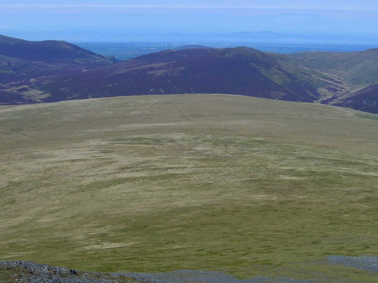
Photo: Mick Knapton via Wikimedia Commons
About Mungrisdale Common
A broad, boggy dome behind Blencathra, on the Eden and Derwent watershed. Rarely climbed for itself, it is usually a detour from Blencathra or Bannerdale Crags. Best paired with Bannerdale Crags and Bowscale Fell.
Despite the name, this grassy lump is miles from Mungrisdale village, in a different river catchment. It is a spur of Blencathra, running north west from Atkinson Pike with only a few feet of rise at the end. Wainwright had nothing good to say about it, and the small cairn only appeared after his book sent people looking for it. Bill Birkett left it out of his Complete Lakeland Fells.
It is usually collected on the way over Blencathra. Walk Lakes starts from the small parking area above Scales, climbs Scales Fell to the top, then drops down Blue Screes from Atkinson Pike and heads for the highest ground of the Common. It comes back over Bannerdale Crags and down the Glenderamackin, about 13 km with 860 metres of climbing. From Mungrisdale village you can follow the Glenderamackin to the col, and from Keswick or Threlkeld the Glenderaterra valley leads up from the south.
It is grass and bog underfoot. Plenty of paths cross the Common, and none of them makes navigation easy. Expect wet feet.
The summit is hard to pin down. The cairn stands a little way west of, and slightly below, an unmarked highest point. What makes the trip is a gap to the south west between Lonscale Fell and Blencathra, which frames the high fells from Pillar round to Crinkle Crags.
The Cloven Stone
This boundary stone stands on the Eden and Derwent watershed, which crosses the Common. Rain on one side reaches the sea at Workington. On the other it heads for Carlisle and the Solway Firth.
In winter
The Common is a wide, featureless bog with many crossing paths and no clear summit, and Walk Lakes says it is no place to be in mist or poor weather. Snow hides the paths, so take a bearing from Atkinson Pike before you set off across it.
- Great Views
- Quiet & Remote
- Dog Friendly
Sources: Wikipedia: Mungrisdale Common, Walk Lakes: A Walker's Blencathra, The Wandering Wildflower: Souther Fell, Mungrisdale Common and Bannerdale Crags. Updated .
Summit
- OS grid ref
- NY 310 292
- Latitude
- 54.65341° N
- Longitude
- 3.07011° W
- Area
- Northern Fells
Walking up Mungrisdale Common
The nearest car park on foot is Threlkeld Car Park, 5.2 km (3.2 miles) from the summit along mapped paths. Directions to the car park
Route from Threlkeld Car Park
- Distance
- 5.2 km
- 3.2 miles, one way
- Ascent
- 669 m
- Total climb to the summit
- Time up
- 2 h 2 min
- Allow 1 to 3 hours
Times use Naismith’s rule, 5 km/h on the flat plus extra time for the climb, with Langmuir’s corrections. It’s a rule of thumb for the way up only, so add stops, weather and the walk back down.
The route follows paths mapped by OpenStreetMap contributors and isn’t a guided line. Check the mountain forecast before you go and carry a map and compass.
Mungrisdale Common questions
Is Mungrisdale Common a Wainwright?
How high is Mungrisdale Common?
Where do you park for Mungrisdale Common?
How long does it take to climb Mungrisdale Common?
How hard is Mungrisdale Common?
Which Wainwrights are near Mungrisdale Common?
What is the grid reference for the summit of Mungrisdale Common?
Often walked with Mungrisdale Common
Fells people usually take in on the same day.
Wainwrights near Mungrisdale Common
Straight-line distance and direction from the summit.
 Blencathra868 m2.0 km SE
 Bannerdale Crags683 m2.6 km E
 Bowscale Fell702 m2.6 km NE
 Great Calva690 m2.8 km NW
 Lonscale Fell715 m3.2 km SW
 Knott710 m4.0 km N
More in the Northern Fells
- Skiddaw931 m
- Blencathra868 m
- Skiddaw Little Man865 m
- Carl Side746 m
- Long Side734 m
- Lonscale Fell715 m
- Knott710 m
- Bowscale Fell702 m
- Great Calva690 m
- Ullock Pike690 m
- Bannerdale Crags683 m
- Bakestall673 m
- Carrock Fell663 m
- High Pike [Caldbeck]658 m
- Great Sca Fell651 m
- Brae Fell586 m
- Meal Fell550 m
- Great Cockup526 m
- Souther Fell522 m
- Dodd502 m
- Longlands Fell483 m
- Binsey447 m
- Latrigg368 m
Bag Mungrisdale Common with Upfell
Reach the summit and capture Mungrisdale Common, even with no signal. It goes on your round of the 214 with its own patch.
Coming soon to theApp Store