Northern Fells · Book 5
Bowscale Fell
Bowscale Fell is a Wainwright, one of the 214 Lake District fells in Alfred Wainwright’s Pictorial Guides. At 702 m (2,303 ft) it is the 87th highest of the 214 and the 8th highest in the Northern Fells.
- Height
- 702 m
- 2,303 ft
- Rank
- 87
- of 214
- In area
- 8
- of 24
- Difficulty
- Moderate
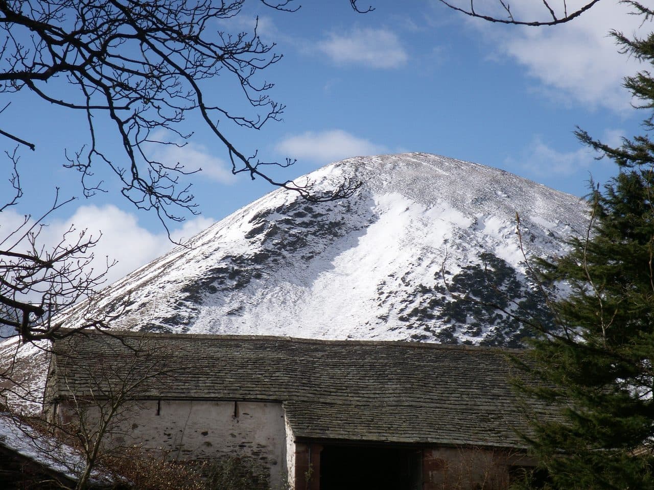
Photo: Bobble Hat via Wikimedia Commons
About Bowscale Fell
Wide northern shoulders and a lofty view towards the Caldew valley. Pleasant grassy tracks make it approachable, even on a breezy day. The high corrie of Bowscale Tarn sits tucked away below.
Mungrisdale sits right under Bowscale Fell, and the direct route leaves from the village. Park at the Recreation Rooms or by the telephone box, where there are honesty boxes. Go north past the church and up a lane beside an old quarry, then climb a steep grass path through gorse on Raven Crags. Once you reach the ridge it eases into a broad, sometimes boggy walk over two tops to the summit, which has a windshelter and cairns. Carry on over the col to Bannerdale Crags and come back down the Glenderamackin, crossing the footbridge that replaced the one lost in the Storm Desmond floods of 2015. The loop is about 8 km with 500 metres of climbing.
A gentler line follows the track up the Glenderamackin to the col at the head of Bannerdale. There is no scrambling on any of the usual routes, though the ground is rough and wet in places.
The summit ridge is grassy, with small pools. From the top you see Blencathra and Sharp Edge, and a gap at Glenderaterra opens up a view across to the North Western Fells.
The tarn
Bowscale Tarn lies well below the top, in a hollow scooped out of the northern face, dammed by a moraine and about 17 or 18 metres deep. The Victorians rode up to it on ponies, and their track still starts at the hamlet of Bowscale, where there is a small parking area. Local legend says the tarn holds two fish that never die, and in one version of the tale one of them can speak.
In winter
The steep grass climb over Raven Crags straight out of Mungrisdale is the awkward part when frozen. On the broad top, two false summits and scattered cairns make it easy to go wrong in mist or snow, and the eastern edges above Bannerdale and the tarn are craggy.
- Great Views
- Dog Friendly
Sources: Wikipedia: Bowscale Fell, Walk Lakes: Bowscale Fell, Walk Lakes: Bowscale Tarn, Tarn of the Immortal Fish. Updated .
Summit
- OS grid ref
- NY 333 305
- Latitude
- 54.66552° N
- Longitude
- 3.03502° W
- Area
- Northern Fells
Walking up Bowscale Fell
The nearest car park on foot is Threlkeld Car Park, 5.9 km (3.7 miles) from the summit along mapped paths. Directions to the car park
Route from Threlkeld Car Park
- Distance
- 5.9 km
- 3.7 miles, one way
- Ascent
- 756 m
- Total climb to the summit
- Time up
- 2 h 20 min
- Allow 1 to 3 hours
Times use Naismith’s rule, 5 km/h on the flat plus extra time for the climb, with Langmuir’s corrections. It’s a rule of thumb for the way up only, so add stops, weather and the walk back down.
The route follows paths mapped by OpenStreetMap contributors and isn’t a guided line. Check the mountain forecast before you go and carry a map and compass.
Bowscale Fell questions
Is Bowscale Fell a Wainwright?
How high is Bowscale Fell?
Where do you park for Bowscale Fell?
How long does it take to climb Bowscale Fell?
How hard is Bowscale Fell?
Which Wainwrights are near Bowscale Fell?
What is the grid reference for the summit of Bowscale Fell?
Often walked with Bowscale Fell
Fells people usually take in on the same day.
Wainwrights near Bowscale Fell
Straight-line distance and direction from the summit.
 Bannerdale Crags683 m1.5 km S
 Souther Fell522 m2.5 km SE
 Mungrisdale Common633 m2.6 km SW
 Blencathra868 m3.0 km S
 Carrock Fell663 m3.2 km N
 Great Calva690 m4.3 km W
More in the Northern Fells
- Skiddaw931 m
- Blencathra868 m
- Skiddaw Little Man865 m
- Carl Side746 m
- Long Side734 m
- Lonscale Fell715 m
- Knott710 m
- Great Calva690 m
- Ullock Pike690 m
- Bannerdale Crags683 m
- Bakestall673 m
- Carrock Fell663 m
- High Pike [Caldbeck]658 m
- Great Sca Fell651 m
- Mungrisdale Common633 m
- Brae Fell586 m
- Meal Fell550 m
- Great Cockup526 m
- Souther Fell522 m
- Dodd502 m
- Longlands Fell483 m
- Binsey447 m
- Latrigg368 m
Bag Bowscale Fell with Upfell
Reach the summit and capture Bowscale Fell, even with no signal. It goes on your round of the 214 with its own patch.
Coming soon to theApp Store