Southern Fells · Book 4
Cold Pike
Cold Pike is a Wainwright, one of the 214 Lake District fells in Alfred Wainwright’s Pictorial Guides. At 701 m (2,300 ft) it is the 88th highest of the 214 and the 19th highest in the Southern Fells.
- Height
- 701 m
- 2,300 ft
- Rank
- 88
- of 214
- In area
- 19
- of 30
- Difficulty
- Moderate
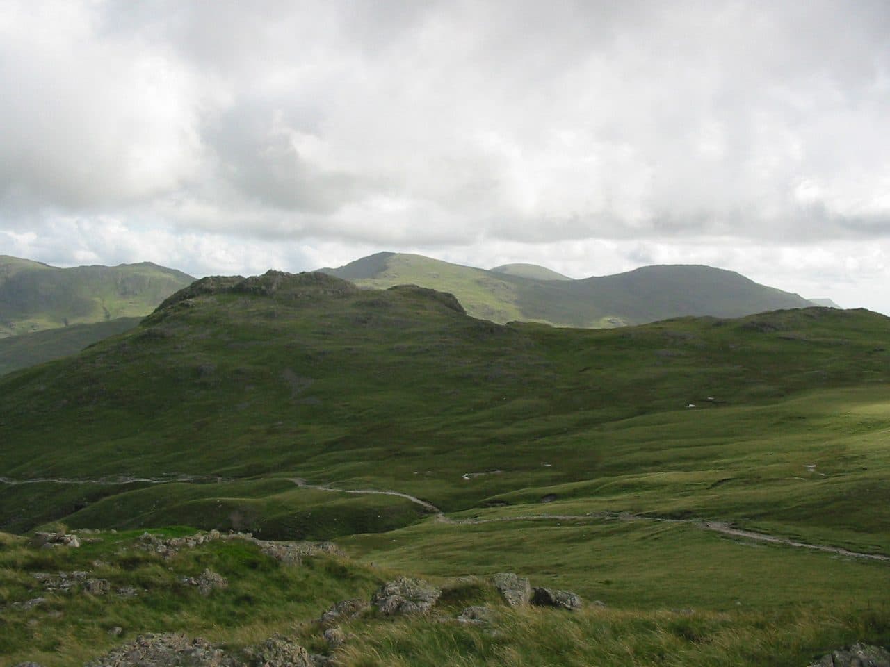
Photo: StephenDawson via Wikimedia Commons
About Cold Pike
A rugged outlier overlooking the Wrynose Pass. Broken crags and knurled rock give a miniature mountain feel. Often linked with Pike of Blisco or Crinkle Crags for a big day out.
Three rocky knobs make up the top of Cold Pike, each with its own cairn, a small copy of Crinkle Crags next door. The highest cairn is well built. The fell looks down on Wrynose Bottom, and plenty of walkers take it in as a side trip on the way to Crinkle Crags.
Almost everyone parks at the top of Wrynose Pass, by the Three Shire Stone. The few spaces there fill early at weekends and in the holidays. From the stone, a faint sheep track heads north-west over boggy patches straight to the summit. For an easier gradient, take the wide path north towards Red Tarn and climb Cold Pike from the tarn. That path was made to serve Red Crag Mine, which was worked for iron between 1860 and 1875 and never paid its way. Great Langdale by Oxendale is another start, and there is a pathless line from Wrynose Bottom that means fording the Duddon.
Walk Lakes grades the ground as very rough and boggy, and the path on Cold Pike fades in places. The usual lines need no scrambling, though the south side drops in tiers of crag.
From the summit you look across to Crinkle Crags, the Langdale Pikes and the northern Coniston fells. On a clear day the Pennines show beyond Windermere, and Morecambe Bay lies down the Duddon. Red Tarn, below, is long and shallow, about 1.5 metres deep. A circuit from the pass that adds Pike o'Blisco is about 6.5 km with 486 metres of climbing.
In winter
The start is the top of Wrynose Pass, a steep and narrow mountain road, so check it is passable before driving up in ice or snow. The faint path onto Cold Pike crosses boggy ground that is easy to lose under snow.
- Great Views
- Dog Friendly
Sources: Wikipedia: Cold Pike, Walk Lakes: Cold Pike and Pike of Blisco. Updated .
Summit
- OS grid ref
- NY 262 036
- Latitude
- 54.42259° N
- Longitude
- 3.13756° W
- Area
- Southern Fells
Walking up Cold Pike
The nearest car park on foot is Blea Tarn National Trust Parking, 4.5 km (2.8 miles) from the summit along mapped paths. Directions to the car park
Route from Blea Tarn National Trust Parking
- Distance
- 4.5 km
- 2.8 miles, one way
- Ascent
- 680 m
- Total climb to the summit
- Time up
- 2 h 1 min
- Allow 1 to 3 hours
Times use Naismith’s rule, 5 km/h on the flat plus extra time for the climb, with Langmuir’s corrections. It’s a rule of thumb for the way up only, so add stops, weather and the walk back down.
The route follows paths mapped by OpenStreetMap contributors and isn’t a guided line. Check the mountain forecast before you go and carry a map and compass.
Cold Pike questions
Is Cold Pike a Wainwright?
How high is Cold Pike?
Where do you park for Cold Pike?
How long does it take to climb Cold Pike?
How hard is Cold Pike?
Which Wainwrights are near Cold Pike?
What is the grid reference for the summit of Cold Pike?
Often walked with Cold Pike
Fells people usually take in on the same day.
Wainwrights near Cold Pike
Straight-line distance and direction from the summit.
 Pike o'Blisco705 m1.0 km NE
 Crinkle Crags (Long Top)859 m1.9 km NW
 Great Carrs785 m2.8 km S
 Swirl How802 m3.2 km S
 Grey Friar773 m3.3 km S
 Hard Knott549 m3.3 km SW
More in the Southern Fells
- Scafell Pike978 m
- Scafell964 m
- Great End910 m
- Bowfell903 m
- Esk Pike885 m
- Crinkle Crags (Long Top)859 m
- Lingmell807 m
- Coniston Old Man802 m
- Swirl How802 m
- Brim Fell796 m
- Allen Crags785 m
- Great Carrs785 m
- Glaramara783 m
- Dow Crag778 m
- Grey Friar773 m
- Wetherlam763 m
- Slight Side762 m
- Pike o'Blisco705 m
- Harter Fell [Eskdale]654 m
- Rossett Pike651 m
- Illgill Head609 m
- Seathwaite Fell601 m
- Rosthwaite Fell (Bessyboot)551 m
- Hard Knott549 m
- Whin Rigg537 m
- Green Crag489 m
- Lingmoor Fell470 m
- Black Fell323 m
- Holme Fell317 m
Bag Cold Pike with Upfell
Reach the summit and capture Cold Pike, even with no signal. It goes on your round of the 214 with its own patch.
Coming soon to theApp Store