Southern Fells · Book 4
Brim Fell
Brim Fell is a Wainwright, one of the 214 Lake District fells in Alfred Wainwright’s Pictorial Guides. At 796 m (2,612 ft) it is the 37th highest of the 214 and the 10th highest in the Southern Fells.
- Height
- 796 m
- 2,612 ft
- Rank
- 37
- of 214
- In area
- 10
- of 30
- Difficulty
- Moderate
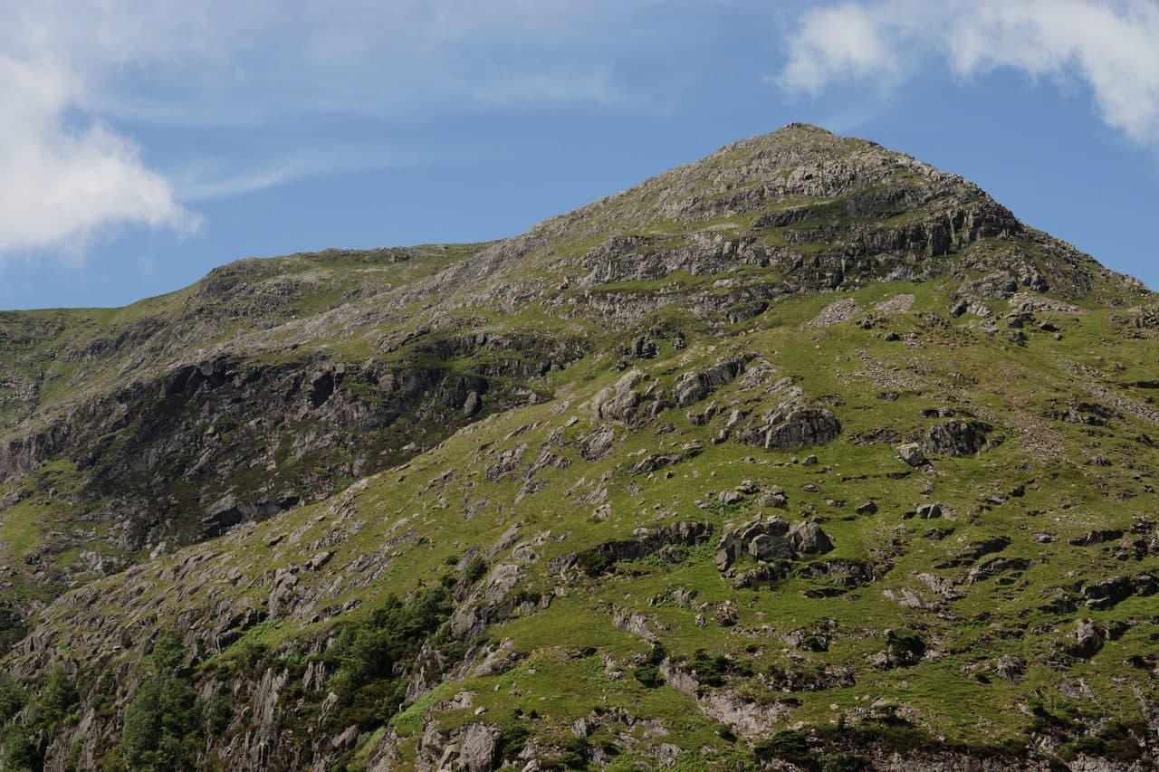
Photo: Peter Trimming via Geograph, CC BY-SA 2.0
About Brim Fell
A gentle, grassy shoulder on the Coniston chain linking Old Man to Swirl How. Broad views and easy going make it a fine breather between rockier neighbours.
North of the Old Man of Coniston, the ridge to Swirl How crosses the broad, grassy top of Brim Fell. Far more walkers pass over it that way than climb it directly.
To climb it on its own, start at the fell gate car park where the tarmac ends above Coniston. An old quarry track leads round towards Crowberry Haws, and a miners' path contours into Boulder Valley, where huge boulders lie among the old copper workings. From there a grass rake slants up across the south side of Raven Tor, past the abandoned Gnospelious Level, to the col behind the Tor, and the east ridge takes you to the top. The whole climb is about 2.3 miles and 2,050 feet. You can also come up from Coniston by Levers Water to Levers Hawse, or from the Duddon side along the Walna Scar Road to Goat's Hawse.
The two sides are nothing alike. To the west, smooth grass runs down to Tarn Head Beck. The Coniston face is all crag, including the broken cliffs of Raven Tor, and pathless lines up the Tor give a rougher finish if you want one.
On top there is a good slate cairn on grass, with a second big cairn to the north-east. The view is wide, though the long ridge hides the ground close by. Levers Water, below, was dammed for the mines and is about 125 feet deep. The smaller Low Water lies in its corrie under the Old Man.
In winter
The summit is a broad whaleback with the crags of Raven Tor and Low Water on its Coniston side, so in snow or mist keep well back from the eastern edge. The north-east cairn helps you find the line of the ridge in poor visibility.
- Great Views
- Dog Friendly
Sources: Wikipedia: Brim Fell, Wainwright Routes: Brim Fell Route One. Updated .
Summit
- OS grid ref
- SD 270 985
- Latitude
- 54.37727° N
- Longitude
- 3.12417° W
- Area
- Southern Fells
Walking up Brim Fell
The nearest car park on foot is Coppermines and Old Man Car Park, 4.1 km (2.5 miles) from the summit along mapped paths. Directions to the car park
Route from Coppermines and Old Man Car Park
- Distance
- 4.1 km
- 2.5 miles, one way
- Ascent
- 641 m
- Total climb to the summit
- Time up
- 1 h 48 min
- Allow 1 to 3 hours
Times use Naismith’s rule, 5 km/h on the flat plus extra time for the climb, with Langmuir’s corrections. It’s a rule of thumb for the way up only, so add stops, weather and the walk back down.
The route follows paths mapped by OpenStreetMap contributors and isn’t a guided line. Check the mountain forecast before you go and carry a map and compass.
Brim Fell questions
Is Brim Fell a Wainwright?
How high is Brim Fell?
Where do you park for Brim Fell?
How long does it take to climb Brim Fell?
How hard is Brim Fell?
Which Wainwrights are near Brim Fell?
What is the grid reference for the summit of Brim Fell?
Often walked with Brim Fell
Fells people usually take in on the same day.
Brim Fell in our guides
Wainwrights near Brim Fell
Straight-line distance and direction from the summit.
 Coniston Old Man802 m0.8 km S
 Dow Crag778 m1.1 km SW
 Swirl How802 m2.0 km N
 Grey Friar773 m2.1 km NW
 Great Carrs785 m2.4 km N
 Wetherlam763 m3.1 km NE
More in the Southern Fells
- Scafell Pike978 m
- Scafell964 m
- Great End910 m
- Bowfell903 m
- Esk Pike885 m
- Crinkle Crags (Long Top)859 m
- Lingmell807 m
- Coniston Old Man802 m
- Swirl How802 m
- Allen Crags785 m
- Great Carrs785 m
- Glaramara783 m
- Dow Crag778 m
- Grey Friar773 m
- Wetherlam763 m
- Slight Side762 m
- Pike o'Blisco705 m
- Cold Pike701 m
- Harter Fell [Eskdale]654 m
- Rossett Pike651 m
- Illgill Head609 m
- Seathwaite Fell601 m
- Rosthwaite Fell (Bessyboot)551 m
- Hard Knott549 m
- Whin Rigg537 m
- Green Crag489 m
- Lingmoor Fell470 m
- Black Fell323 m
- Holme Fell317 m
Bag Brim Fell with Upfell
Reach the summit and capture Brim Fell, even with no signal. It goes on your round of the 214 with its own patch.
Coming soon to theApp Store