Southern Fells · Book 4
Coniston Old Man
Coniston Old Man is a Wainwright, one of the 214 Lake District fells in Alfred Wainwright’s Pictorial Guides. At 802 m (2,631 ft) it is the joint 31st highest of the 214 and the joint 8th highest in the Southern Fells.
- Height
- 802 m
- 2,631 ft
- Rank
- =31
- of 214
- In area
- =8
- of 30
- Difficulty
- Moderate
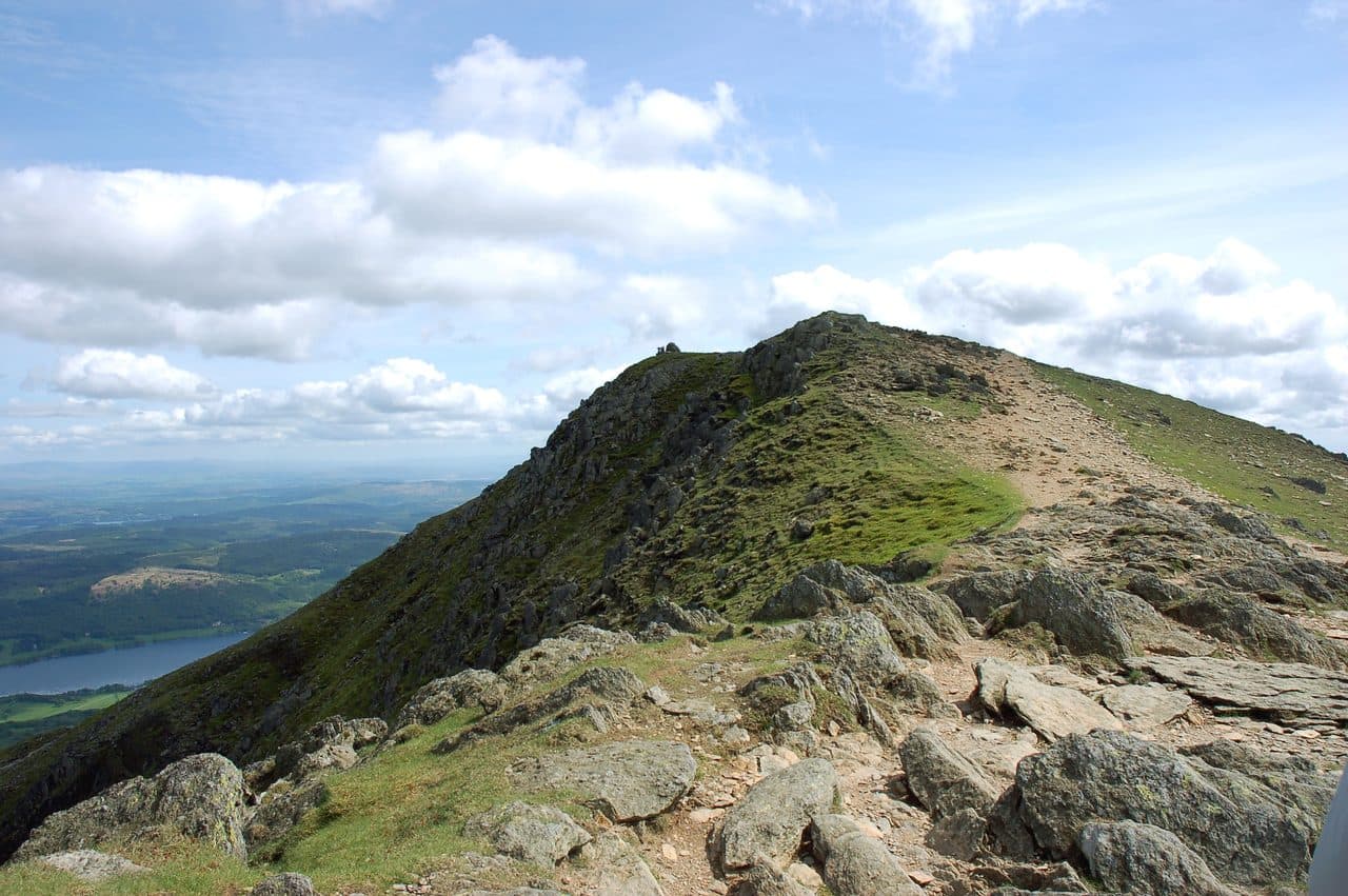
Photo: slippymark
About Coniston Old Man
The Coniston skyline’s signature summit, with quarry scars, broad terraces and grand views over Coniston Water and the southern fells. Often linked with Brim Fell and Swirl How for a classic horseshoe. A big, satisfying hill with history baked into the stone.
The busiest start is the Walna Scar Road car park, where the tarmac ends above Coniston village. Space there is limited and it fills early at weekends. Otherwise use the village car parks on Ruskin Avenue or the Bluebird car and coach park. Coniston also has a bus service from Windermere and Ambleside.
The tourist route from the village goes up the lane past the Sun Inn and into Coppermines Valley beside Church Beck. A quarry track then climbs through old slate workings, past ruined buildings and spoil heaps, to Low Water, a corrie tarn under the summit. The last section zigzags steeply up the shoulder above the tarn. From the Walna Scar car park a path heads north through the bracken to join the same track.
For a quieter climb, follow the stony Walna Scar Road west and fork up to Goat's Water, under the cliffs of Dow Crag. Climb to Goat's Hawse and turn east for the last rise to the top. Neither route needs your hands, only a tolerance for loose slate and one steep pull.
The summit is a slate platform with a big cairn. On a clear day you can see Morecambe Bay, Blackpool Tower and the Isle of Man, but the best of the view is nearer: the cliffs of Dow Crag, across the hollow that holds Goat's Water. Swirl How, along the ridge over Brim Fell, is effectively the same height.
Slate has been quarried on this fell since the Middle Ages, and the Old Man's quarries grew into some of the largest in England. The copper mines in the valley went down around 2,000 feet. The tourist path climbs straight through what both industries left behind.
In winter
The steep zigzags above Low Water are the part of the tourist route that ices first, and old snow lies on the quarry path long after the village has thawed. The broad ridge north to Brim Fell has few features in cloud, so take a bearing before you leave the summit.
- Great Views
- Popular
- Family Walk
- Dog Friendly
Sources: Wikipedia: Old Man of Coniston, The Coppermines: Five Coniston Old Man routes. Updated .
Summit
- OS grid ref
- SD 272 978
- Latitude
- 54.37065° N
- Longitude
- 3.12142° W
- Area
- Southern Fells
Walking up Coniston Old Man
The nearest car park on foot is Coppermines and Old Man Car Park, 3.3 km (2.0 miles) from the summit along mapped paths. Directions to the car park
Route from Coppermines and Old Man Car Park
- Distance
- 3.3 km
- 2.0 miles, one way
- Ascent
- 629 m
- Total climb to the summit
- Time up
- 1 h 38 min
- Allow 1 to 3 hours
Times use Naismith’s rule, 5 km/h on the flat plus extra time for the climb, with Langmuir’s corrections. It’s a rule of thumb for the way up only, so add stops, weather and the walk back down.
The route follows paths mapped by OpenStreetMap contributors and isn’t a guided line. Check the mountain forecast before you go and carry a map and compass.
Coniston Old Man questions
Is Coniston Old Man a Wainwright?
How high is Coniston Old Man?
Where do you park for Coniston Old Man?
How long does it take to climb Coniston Old Man?
How hard is Coniston Old Man?
Which Wainwrights are near Coniston Old Man?
What is the grid reference for the summit of Coniston Old Man?
Often walked with Coniston Old Man
Fells people usually take in on the same day.
Coniston Old Man in our guides
Wainwrights near Coniston Old Man
Straight-line distance and direction from the summit.
 Brim Fell796 m0.8 km N
 Dow Crag778 m1.0 km W
 Swirl How802 m2.7 km N
 Grey Friar773 m2.8 km NW
 Great Carrs785 m3.1 km N
 Wetherlam763 m3.6 km NE
More in the Southern Fells
- Scafell Pike978 m
- Scafell964 m
- Great End910 m
- Bowfell903 m
- Esk Pike885 m
- Crinkle Crags (Long Top)859 m
- Lingmell807 m
- Swirl How802 m
- Brim Fell796 m
- Allen Crags785 m
- Great Carrs785 m
- Glaramara783 m
- Dow Crag778 m
- Grey Friar773 m
- Wetherlam763 m
- Slight Side762 m
- Pike o'Blisco705 m
- Cold Pike701 m
- Harter Fell [Eskdale]654 m
- Rossett Pike651 m
- Illgill Head609 m
- Seathwaite Fell601 m
- Rosthwaite Fell (Bessyboot)551 m
- Hard Knott549 m
- Whin Rigg537 m
- Green Crag489 m
- Lingmoor Fell470 m
- Black Fell323 m
- Holme Fell317 m
Bag Coniston Old Man with Upfell
Reach the summit and capture Coniston Old Man, even with no signal. It goes on your round of the 214 with its own patch.
Coming soon to theApp Store