Southern Fells · Book 4
Whin Rigg
Whin Rigg is a Wainwright, one of the 214 Lake District fells in Alfred Wainwright’s Pictorial Guides. At 537 m (1,762 ft) it is the joint 154th highest of the 214 and the 26th highest in the Southern Fells.
- Height
- 537 m
- 1,762 ft
- Rank
- =154
- of 214
- In area
- 26
- of 30
- Difficulty
- Easy
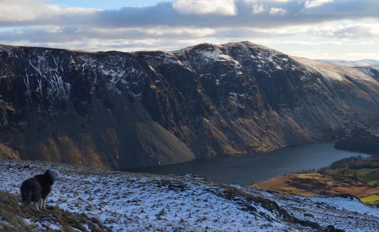
Photo: Doug Sim via Wikimedia Commons
About Whin Rigg
The southern end of the Wasdale Screes ridge, with springy turf and wide views over Wast Water to the sea. Gentle from the west, with a sheer drop of crags and gullies to the lake.
From its summit, Whin Rigg drops over 450 metres to Wast Water in the Screes, one of the best known scree slopes in Britain. Great Gully, cut into the face, has seventeen near-vertical pitches and the wreckage of an aeroplane inside it.
On the Wasdale side, walkers start at Nether Wasdale or the foot of the lake and climb beside Greathall Gill. The path up the east side of the ravine has become the popular line, though it is badly eroded in places. From Eskdale, start at Eskdale Green, where there is free parking by the public toilets on Smithybrow Lane, or at the Miterdale Forestry car park. A bridleway through the forestry leads to Irton Fell and the west ridge, and the last 230 metres of climbing are on grass beside stone walls.
Most walkers carry on to Illgill Head. A narrow path follows the crag edge between the two, looking down gullies and ribs such as the Broken Rib, with near-vertical drops alongside. A plainer path runs down the middle of the ridge. Between the two summits is a dip with several small tarns. Walk the Wainwrights describes a 17 km loop from Eskdale Green over both tops that returns by Burnmoor Tarn and Miterdale.
A cairn marks the summit. Come for the view down Wast Water, which carries on over the coastal plain and out to the Isle of Man. Greathall Gill, a granite ravine on the south-west side, supports an unusual mix of mosses, ferns and herbs.
In winter
The best path runs along the top of the crags and gullies above the Screes, with near-vertical drops beside it, so in snow or mist use the broad path down the middle of the ridge. The descent beside Greathall Gill is steep and eroded, and slippery in the wet.
- Great Views
- Dog Friendly
Sources: Wikipedia: Whin Rigg, Walk the Wainwrights: Whin Rigg and Illgill Head, Walk Lakes: Illgill Head and Whin Rigg. Updated .
Summit
- OS grid ref
- NY 151 035
- Latitude
- 54.42015° N
- Longitude
- 3.30989° W
- Area
- Southern Fells
Walking up Whin Rigg
The nearest car park on foot is Irton Road Station, 5.2 km (3.2 miles) from the summit along mapped paths. Directions to the car park
Route from Irton Road Station
- Distance
- 5.2 km
- 3.2 miles, one way
- Ascent
- 512 m
- Total climb to the summit
- Time up
- 1 h 51 min
- Allow 1 to 3 hours
Times use Naismith’s rule, 5 km/h on the flat plus extra time for the climb, with Langmuir’s corrections. It’s a rule of thumb for the way up only, so add stops, weather and the walk back down.
The route follows paths mapped by OpenStreetMap contributors and isn’t a guided line. This car park was picked automatically and hasn’t been checked by hand yet, so compare it with a map. Check the mountain forecast before you go and carry a map and compass.
Whin Rigg questions
Is Whin Rigg a Wainwright?
How high is Whin Rigg?
Where do you park for Whin Rigg?
How long does it take to climb Whin Rigg?
How hard is Whin Rigg?
Which Wainwrights are near Whin Rigg?
What is the grid reference for the summit of Whin Rigg?
Often walked with Whin Rigg
Fells people usually take in on the same day.
Whin Rigg in our guides
Wainwrights near Whin Rigg
Straight-line distance and direction from the summit.
 Illgill Head609 m1.9 km NE
 Buckbarrow423 m3.0 km NW
 Middle Fell582 m3.7 km N
 Seatallan692 m5.0 km N
 Yewbarrow627 m5.4 km NE
 Slight Side762 m6.1 km E
More in the Southern Fells
- Scafell Pike978 m
- Scafell964 m
- Great End910 m
- Bowfell903 m
- Esk Pike885 m
- Crinkle Crags (Long Top)859 m
- Lingmell807 m
- Coniston Old Man802 m
- Swirl How802 m
- Brim Fell796 m
- Allen Crags785 m
- Great Carrs785 m
- Glaramara783 m
- Dow Crag778 m
- Grey Friar773 m
- Wetherlam763 m
- Slight Side762 m
- Pike o'Blisco705 m
- Cold Pike701 m
- Harter Fell [Eskdale]654 m
- Rossett Pike651 m
- Illgill Head609 m
- Seathwaite Fell601 m
- Rosthwaite Fell (Bessyboot)551 m
- Hard Knott549 m
- Green Crag489 m
- Lingmoor Fell470 m
- Black Fell323 m
- Holme Fell317 m
Bag Whin Rigg with Upfell
Reach the summit and capture Whin Rigg, even with no signal. It goes on your round of the 214 with its own patch.
Coming soon to theApp Store