Western Fells · Book 7
Buckbarrow
Buckbarrow is a Wainwright, one of the 214 Lake District fells in Alfred Wainwright’s Pictorial Guides. At 423 m (1,388 ft) it is the joint 196th highest of the 214 and the joint 31st highest in the Western Fells.
- Height
- 423 m
- 1,388 ft
- Rank
- =196
- of 214
- In area
- =31
- of 33
- Difficulty
- Moderate
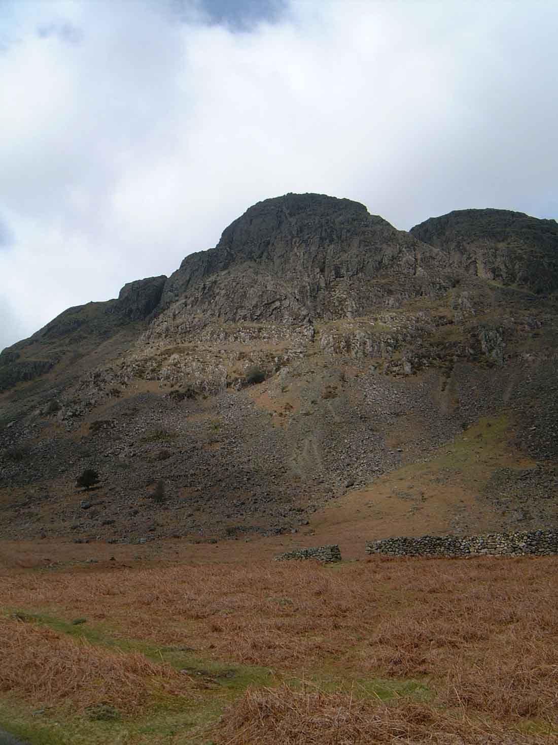
Photo: Mick Knapton via Wikimedia Commons
About Buckbarrow
A craggy outlier of Seatallan above the foot of Wast Water. The crags look fierce from the road, but grassy lines lead round them to a rim with a view along the whole lake to Great Gable and the Scafells. Often linked with Seatallan and Middle Fell.
From the road near the foot of Wast Water, Buckbarrow looks like a wall of rock. Long Crag, Pike Crag, Bull Crag and Broad Crag run for about three quarters of a mile, dropping nearly 900 feet to the road, and they are a popular climbing venue. It is not really a separate hill but the craggy end of a spur off Seatallan. The name means the hill of the buck or goat, from Old English or Old Norse.
Walkers park on a patch of free, rough ground beside the cottages at Greendale, where there is a public footpath sign. You don't need to tackle the crags. Walk west to Harrow Head farm and follow Gill Beck up to about 350 metres, then bear north east to the high ground above the cliffs. The other way in is up Greendale Gill and Tongues Gills. Many people add Buckbarrow at the end of a Greendale round over Middle Fell and Seatallan, coming down past Cat Bields and Glade How. That round is 8.5 km with about 720 metres of ascent.
The ground is rough and knotted, boggy in places, and the paths come and go. In clear weather navigation is simple, but in mist you need a map and compass.
Pike Crag
The true top is a rocky mound set back from the rim. Go down to the knoll above Pike Crag for the better view, which takes in the full length of Wast Water, the Wasdale Screes, Great Gable and the Scafells. North east of the summit stands a tall, slender cairn named after the fell runner Joss Naylor, said to have been built on the site of an ancient burial cairn.
In winter
The knotted top is criss-crossed by confusing paths above a long wall of crag, so in mist take a bearing for the Joss Naylor cairn, which marks the way down to Greendale Gill. The steep grass beside Tongues Gills below it is treacherous when wet or frozen.
- Great Views
- Dog Friendly
Sources: Wikipedia: Buckbarrow, Walk Lakes: Middle Fell, Seatallan, Buckbarrow, a Greendale round. Updated .
Summit
- OS grid ref
- NY 135 061
- Latitude
- 54.44315° N
- Longitude
- 3.33425° W
- Area
- Western Fells
Walking up Buckbarrow
The nearest car park on foot is Bridge Inn car park, 6.5 km (4.0 miles) from the summit along mapped paths. Directions to the car park
Route from Bridge Inn car park
- Distance
- 6.5 km
- 4.0 miles, one way
- Ascent
- 451 m
- Total climb to the summit
- Time up
- 1 h 59 min
- Allow 1 to 3 hours
Times use Naismith’s rule, 5 km/h on the flat plus extra time for the climb, with Langmuir’s corrections. It’s a rule of thumb for the way up only, so add stops, weather and the walk back down.
The route follows paths mapped by OpenStreetMap contributors and isn’t a guided line. This car park was picked automatically and hasn’t been checked by hand yet, so compare it with a map. Check the mountain forecast before you go and carry a map and compass.
Buckbarrow questions
Is Buckbarrow a Wainwright?
How high is Buckbarrow?
Where do you park for Buckbarrow?
How long does it take to climb Buckbarrow?
How hard is Buckbarrow?
Which Wainwrights are near Buckbarrow?
What is the grid reference for the summit of Buckbarrow?
Often walked with Buckbarrow
Fells people usually take in on the same day.
Buckbarrow in our guides
Wainwrights near Buckbarrow
Straight-line distance and direction from the summit.
 Middle Fell582 m1.9 km NE
 Seatallan692 m2.3 km N
 Whin Rigg537 m3.0 km SE
 Illgill Head609 m3.2 km SE
 Yewbarrow627 m4.4 km NE
 Haycock797 m4.7 km N
More in the Western Fells
- Great Gable899 m
- Pillar892 m
- Scoat Fell841 m
- Red Pike [Wasdale]826 m
- Steeple819 m
- High Stile806 m
- Kirk Fell802 m
- Green Gable801 m
- Haycock797 m
- Red Pike [Buttermere]755 m
- High Crag744 m
- Brandreth715 m
- Caw Fell697 m
- Grey Knotts697 m
- Seatallan692 m
- Fleetwith Pike649 m
- Base Brown646 m
- Starling Dodd633 m
- Yewbarrow627 m
- Great Borne616 m
- Haystacks597 m
- Middle Fell582 m
- Blake Fell573 m
- Lank Rigg541 m
- Gavel Fell526 m
- Crag Fell523 m
- Mellbreak (south top)512 m
- Hen Comb509 m
- Grike488 m
- Burnbank Fell475 m
- Low Fell423 m
- Fellbarrow416 m
Bag Buckbarrow with Upfell
Reach the summit and capture Buckbarrow, even with no signal. It goes on your round of the 214 with its own patch.
Coming soon to theApp Store