Western Fells · Book 7
Caw Fell
Caw Fell is a Wainwright, one of the 214 Lake District fells in Alfred Wainwright’s Pictorial Guides. At 697 m (2,287 ft) it is the joint 91st highest of the 214 and the joint 13th highest in the Western Fells.
- Height
- 697 m
- 2,287 ft
- Rank
- =91
- of 214
- In area
- =13
- of 33
- Difficulty
- Moderate
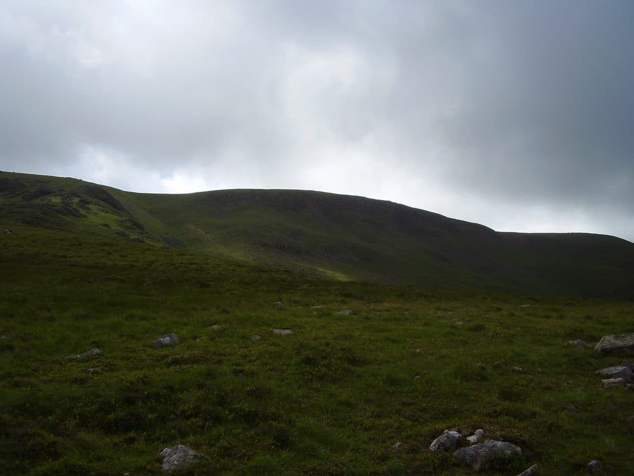
Photo: Freddyj66 via Wikimedia Commons
About Caw Fell
A broad, grassy shoulder on the ridge west of Haycock, between Ennerdale and Blengdale. The walk in is long from either valley, and it is quiet when you get there. Usually paired with Haycock along the wall.
By Lakeland standards Caw Fell is a long way from any road. It stands where the ridge between Ennerdale and Wasdale runs out west, and by this point the two valleys are about 10 km apart, with Blengdale and Worm Gill draining the ground between.
Most walkers come from Ennerdale. Park at the pay and display car park below Bowness Knott, at the end of the public road, and follow the track along the shore of Ennerdale Water. Cross Char Dub by the Irish Bridge and go through the Ling Mell plantations, where Galloway cattle graze to keep the bracken down. The Tongue End spur then climbs between Silvercove Beck and Deep Gill to the summit. Strong walkers make a day of it with Steeple, Scoat Fell and Haycock, following the wall west from Scoat Fell. That round is about 18 km with over 1,000 metres of ascent. From the south, a route from Bleng Bridge over Stockdale Moor is more than 8 km each way, and Grike and Crag Fell give an indirect approach from the Kinniside Stone Circle.
The paths are narrow and often hard to see among rock and heather. There is no scrambling on the usual routes, but the going is slow.
The cairn stands just north of the wall, and you need to cross it for the full view. With no higher fells close by, you see the Western Fells and the Scafells.
Iron and old settlements
Iron Crag Mine worked haematite below the crag of that name from about 1864 to 1896. It raised 500 tons in 1881 but never paid. Down the south west ridge, Stockdale Moor is scattered with burial mounds, hut circles and enclosures left by early settlers.
In winter
Every approach is long, and from Ennerdale a round with Haycock takes most of a winter day on rough, heathery paths. On the broad top the Ennerdale wall is the one sure handrail in cloud or snow.
- Ridge Walk
- Quiet & Remote
- Dog Friendly
Sources: Wikipedia: Caw Fell, Walk Lakes: Steeple, Scoat Fell, Haycock and Caw Fell from Ennerdale, Andrews Walks: Haycock and Caw Fell. Updated .
Summit
- OS grid ref
- NY 131 109
- Latitude
- 54.48688° N
- Longitude
- 3.34161° W
- Area
- Western Fells
Walking up Caw Fell
The nearest car park on foot is Bowness Knott Car Park, 6.2 km (3.9 miles) from the summit along mapped paths. Directions to the car park
Route from Bowness Knott Car Park
- Distance
- 6.2 km
- 3.9 miles, one way
- Ascent
- 605 m
- Total climb to the summit
- Time up
- 2 h 10 min
- Allow 1 to 3 hours
Times use Naismith’s rule, 5 km/h on the flat plus extra time for the climb, with Langmuir’s corrections. It’s a rule of thumb for the way up only, so add stops, weather and the walk back down.
The route follows paths mapped by OpenStreetMap contributors and isn’t a guided line. Check the mountain forecast before you go and carry a map and compass.
Caw Fell questions
Is Caw Fell a Wainwright?
How high is Caw Fell?
Where do you park for Caw Fell?
How long does it take to climb Caw Fell?
How hard is Caw Fell?
Which Wainwrights are near Caw Fell?
What is the grid reference for the summit of Caw Fell?
Often walked with Caw Fell
Fells people usually take in on the same day.
Caw Fell in our guides
Wainwrights near Caw Fell
Straight-line distance and direction from the summit.
 Haycock797 m1.3 km E
 Steeple819 m2.6 km E
 Seatallan692 m2.7 km S
 Scoat Fell841 m2.8 km E
 Red Pike [Wasdale]826 m3.4 km E
 Pillar892 m4.1 km E
More in the Western Fells
- Great Gable899 m
- Pillar892 m
- Scoat Fell841 m
- Red Pike [Wasdale]826 m
- Steeple819 m
- High Stile806 m
- Kirk Fell802 m
- Green Gable801 m
- Haycock797 m
- Red Pike [Buttermere]755 m
- High Crag744 m
- Brandreth715 m
- Grey Knotts697 m
- Seatallan692 m
- Fleetwith Pike649 m
- Base Brown646 m
- Starling Dodd633 m
- Yewbarrow627 m
- Great Borne616 m
- Haystacks597 m
- Middle Fell582 m
- Blake Fell573 m
- Lank Rigg541 m
- Gavel Fell526 m
- Crag Fell523 m
- Mellbreak (south top)512 m
- Hen Comb509 m
- Grike488 m
- Burnbank Fell475 m
- Buckbarrow423 m
- Low Fell423 m
- Fellbarrow416 m
Bag Caw Fell with Upfell
Reach the summit and capture Caw Fell, even with no signal. It goes on your round of the 214 with its own patch.
Coming soon to theApp Store