Western Fells · Book 7
Burnbank Fell
Burnbank Fell is a Wainwright, one of the 214 Lake District fells in Alfred Wainwright’s Pictorial Guides. At 475 m (1,558 ft) it is the joint 182nd highest of the 214 and the 30th highest in the Western Fells.
- Height
- 475 m
- 1,558 ft
- Rank
- =182
- of 214
- In area
- 30
- of 33
- Difficulty
- Easy
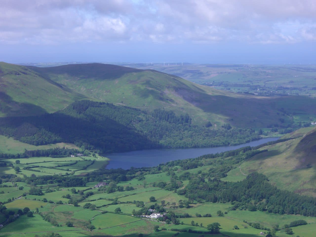
Photo: Mick Knapton via Wikimedia Commons
About Burnbank Fell
Western Fells pasture rising above Loweswater’s tranquil shore. A steady track gains the ridge, linking neatly to Blake Fell and Gavel Fell for a friendly round. Calm, open views to the coast and the high Crummock fells.
Burnbank Fell sits right on the north west edge of the National Park, the most westerly of the Loweswater Fells, with the Marron valley and the coastal towns beyond. Its steep slopes above Holme Wood look impressive from the lake for a hill of 475 metres.
The layby by the telephone box at Waterend, at the northern end of Loweswater, has room for about a dozen cars. A footpath crosses Dub Beck to Hudson Place farm, where cattle graze the fields in spring as well as summer, and enters the National Trust's Holme Wood. A rough track climbs past Holme Force, a pair of waterfalls side by side, to a terraced track along the fellside with a bench and wide views over Loweswater to the Grasmoor fells. From a gate on the terrace a faint path climbs steep grass above an old mine level to a pair of cairns, then crosses boggy ground to the summit. Maggie's Bridge car park is the other start, and Blake Fell is an easy walk south along the broad ridge. From Lamplugh on the west the obvious line is up Owsen Fell, but access there is uncertain.
The fell is almost all grass. There is no scrambling, though the faint paths on the steep upper slope are not ideal in poor visibility.
The top is a rounded grassy dome with an old fence post and a small cairn. Blake Fell blocks much of Lakeland, Loweswater is hidden by the slope, and Crummock Water appears a few paces north east. The view the other way is wide open: the coast, the Solway Firth, Criffel and the Isle of Man.
Below the fell, outside the park, Mockerkin Tarn has water lilies and a local legend of a town drowned beneath it.
In winter
The walk is short enough for a winter afternoon, but the tracks through Holme Wood stay wet and soft and the faint path on the steep grass above the old mine level needs care when frozen. On top, a fence corner is the only mark on a broad boggy expanse.
- Ridge Walk
- Great Views
- Quiet & Remote
- Family Walk
- Dog Friendly
Sources: Wikipedia: Burnbank Fell, Walk Lakes: Burnbank Fell, Holme Force and the woods. Updated .
Summit
- OS grid ref
- NY 110 209
- Latitude
- 54.57593° N
- Longitude
- 3.37831° W
- Area
- Western Fells
Walking up Burnbank Fell
The nearest car park on foot is Maggie's Bridge Car Park, 3.8 km (2.4 miles) from the summit along mapped paths. Directions to the car park
Route from Maggie's Bridge Car Park
- Distance
- 3.8 km
- 2.4 miles, one way
- Ascent
- 376 m
- Total climb to the summit
- Time up
- 1 h 21 min
- Allow 1 to 2 hours
Times use Naismith’s rule, 5 km/h on the flat plus extra time for the climb, with Langmuir’s corrections. It’s a rule of thumb for the way up only, so add stops, weather and the walk back down.
The route follows paths mapped by OpenStreetMap contributors and isn’t a guided line. Check the mountain forecast before you go and carry a map and compass.
Burnbank Fell questions
Is Burnbank Fell a Wainwright?
How high is Burnbank Fell?
Where do you park for Burnbank Fell?
How long does it take to climb Burnbank Fell?
How hard is Burnbank Fell?
Which Wainwrights are near Burnbank Fell?
What is the grid reference for the summit of Burnbank Fell?
Often walked with Burnbank Fell
Fells people usually take in on the same day.
Burnbank Fell in our guides
Wainwrights near Burnbank Fell
Straight-line distance and direction from the summit.
 Blake Fell573 m1.3 km S
 Gavel Fell526 m2.7 km S
 Low Fell423 m2.9 km NE
 Hen Comb509 m3.6 km SE
 Fellbarrow416 m4.0 km NE
 Mellbreak (south top)512 m4.5 km SE
More in the Western Fells
- Great Gable899 m
- Pillar892 m
- Scoat Fell841 m
- Red Pike [Wasdale]826 m
- Steeple819 m
- High Stile806 m
- Kirk Fell802 m
- Green Gable801 m
- Haycock797 m
- Red Pike [Buttermere]755 m
- High Crag744 m
- Brandreth715 m
- Caw Fell697 m
- Grey Knotts697 m
- Seatallan692 m
- Fleetwith Pike649 m
- Base Brown646 m
- Starling Dodd633 m
- Yewbarrow627 m
- Great Borne616 m
- Haystacks597 m
- Middle Fell582 m
- Blake Fell573 m
- Lank Rigg541 m
- Gavel Fell526 m
- Crag Fell523 m
- Mellbreak (south top)512 m
- Hen Comb509 m
- Grike488 m
- Buckbarrow423 m
- Low Fell423 m
- Fellbarrow416 m
Bag Burnbank Fell with Upfell
Reach the summit and capture Burnbank Fell, even with no signal. It goes on your round of the 214 with its own patch.
Coming soon to theApp Store