Western Fells · Book 7
Kirk Fell
Kirk Fell is a Wainwright, one of the 214 Lake District fells in Alfred Wainwright’s Pictorial Guides. At 802 m (2,631 ft) it is the joint 31st highest of the 214 and the 7th highest in the Western Fells.
- Height
- 802 m
- 2,631 ft
- Rank
- =31
- of 214
- In area
- 7
- of 33
- Difficulty
- Difficult
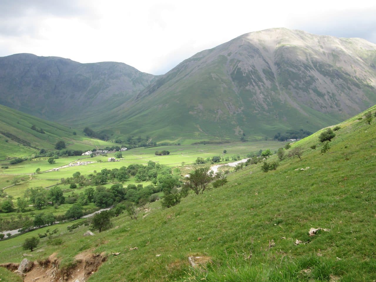
Photo: Peter S via Geograph, CC BY-SA 2.0
About Kirk Fell
A steep, flat-topped fell between Great Gable and Pillar. The direct climb from Wasdale Head is relentless, and the top holds two summits, the Kirkfell Tarns and crags on the Ennerdale side.
Kirk Fell fills the view north from Wasdale Head. The name comes from Old English for the hill above the church, and St Olaf's church sits in the hamlet below. Park on the village green at Wasdale Head or at the National Trust car park at Lake Head, a little over a kilometre down the road.
The direct way up is the south-west slope: 2,000 feet of grass and scree with little variation and almost nowhere to stand upright and rest. The gentler line follows Black Sail Pass from the Wasdale Head Inn, past Row Head and over Gatherstone Beck. From the top of the pass a path climbs the western side of the fell by a loose scree gully with a couple of chockstones that need care. From Great Gable you come up from Beck Head on loose stones.
The plateau
In plan the top is a figure of eight. The main summit, at the western end, has a cairn and a wind shelter. The east top, 787 m, has its cairn on a rocky outcrop, and between the two lie Kirkfell Tarns, two small, shallow pools that can dry out. Old posts from the Ennerdale Fence cross both tops. Great Gable fills the eastern view, the Scafells rise across Wasdale, and the High Stile and Grasmoor ranges are in sight to the north.
Kirk Fell and Great Gable make a good round together. Go up Black Sail Pass, over both tops, down to Beck Head and its small tarn, then up Great Gable and back via Sty Head. It is about 13 km with nearly 1,100 m of ascent.
In June 2022 three Cumbrians went up and down the direct route thirteen times in three days, climbing the height of Everest.
In winter
The direct route from Wasdale Head is steep grass and scree all the way with no easy line off it, a poor place to be on frozen ground and worse in descent. On the plateau the two tops, the tarns and the broken fence look alike in mist, and the Ennerdale side is rimmed with crags.
- Ridge Walk
- Great Views
- Summit Tarn
Sources: Wikipedia: Kirk Fell, Walk Lakes: Kirk Fell and Great Gable. Updated .
Summit
- OS grid ref
- NY 194 104
- Latitude
- 54.48331° N
- Longitude
- 3.24410° W
- Area
- Western Fells
Walking up Kirk Fell
The nearest car park on foot is Lake Head Car Park, 3.6 km (2.3 miles) from the summit along mapped paths. Directions to the car park
Route from Lake Head Car Park
- Distance
- 3.6 km
- 2.3 miles, one way
- Ascent
- 748 m
- Total climb to the summit
- Time up
- 1 h 54 min
- Allow 1 to 3 hours
Times use Naismith’s rule, 5 km/h on the flat plus extra time for the climb, with Langmuir’s corrections. It’s a rule of thumb for the way up only, so add stops, weather and the walk back down.
The route follows paths mapped by OpenStreetMap contributors and isn’t a guided line. Check the mountain forecast before you go and carry a map and compass.
Kirk Fell questions
Is Kirk Fell a Wainwright?
How high is Kirk Fell?
Where do you park for Kirk Fell?
How long does it take to climb Kirk Fell?
How hard is Kirk Fell?
Which Wainwrights are near Kirk Fell?
What is the grid reference for the summit of Kirk Fell?
Often walked with Kirk Fell
Fells people usually take in on the same day.
Kirk Fell in our guides
Wainwrights near Kirk Fell
Straight-line distance and direction from the summit.
 Great Gable899 m1.6 km E
 Green Gable801 m2.0 km E
 Brandreth715 m2.5 km NE
 Lingmell807 m2.7 km SE
 Haystacks597 m2.7 km N
 Pillar892 m2.9 km NW
More in the Western Fells
- Great Gable899 m
- Pillar892 m
- Scoat Fell841 m
- Red Pike [Wasdale]826 m
- Steeple819 m
- High Stile806 m
- Green Gable801 m
- Haycock797 m
- Red Pike [Buttermere]755 m
- High Crag744 m
- Brandreth715 m
- Caw Fell697 m
- Grey Knotts697 m
- Seatallan692 m
- Fleetwith Pike649 m
- Base Brown646 m
- Starling Dodd633 m
- Yewbarrow627 m
- Great Borne616 m
- Haystacks597 m
- Middle Fell582 m
- Blake Fell573 m
- Lank Rigg541 m
- Gavel Fell526 m
- Crag Fell523 m
- Mellbreak (south top)512 m
- Hen Comb509 m
- Grike488 m
- Burnbank Fell475 m
- Buckbarrow423 m
- Low Fell423 m
- Fellbarrow416 m
Bag Kirk Fell with Upfell
Reach the summit and capture Kirk Fell, even with no signal. It goes on your round of the 214 with its own patch.
Coming soon to theApp Store