Western Fells · Book 7
Blake Fell
Blake Fell is a Wainwright, one of the 214 Lake District fells in Alfred Wainwright’s Pictorial Guides. At 573 m (1,880 ft) it is the 140th highest of the 214 and the 23rd highest in the Western Fells.
- Height
- 573 m
- 1,880 ft
- Rank
- 140
- of 214
- In area
- 23
- of 33
- Difficulty
- Moderate
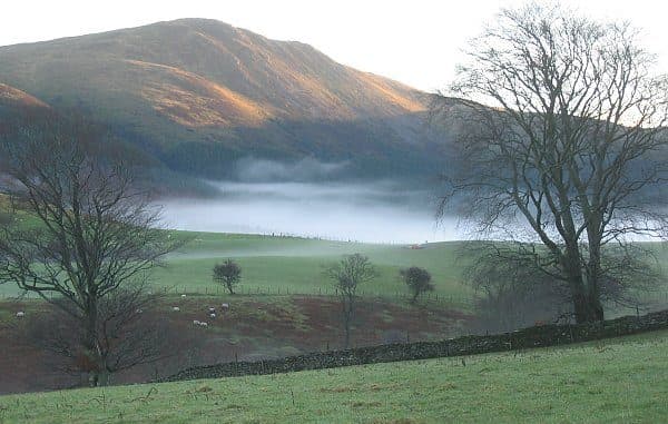
Photo: N/A
About Blake Fell
The highest of the Loweswater Fells, a grassy dome with open sea views to the west and the Grasmoor fells to the east. A long, easy day with no scrambling.
The Loweswater Fells spread from the village like the fingers of a hand, and Blake Fell, 573 metres, is the highest of them. Because the group stands apart from the rest of the Western Fells, Blake Fell counts as a Marilyn.
The small National Trust car park at Maggie's Bridge, just west of the village, holds six to eight cars, so arrive early. From there a loop takes in Gavel Fell first. Follow the track through High Nook Farm, where cattle may be in the fields, climb the bilberry ridge above Black Crag, and then follow the fence north west down to Fothergill Head. The climb to Blake Fell from the col is short and steep. The round is about 10 km with 560 metres of ascent. A more direct line goes up Carling Knott from the Loweswater side, and on the west Lamplugh and Felldyke give access past the Cogra Moss reservoir.
The ground is grass, moss, bilberry and heather, with some bracken lower down. Paths are faint in places and the flat stretches are boggy. There is no scrambling.
The summit is a grassy dome with a large cairn and wind shelter where several paths meet. Nothing higher stands to the west, so the sea view is open, and eastwards the fells run from Binsey round to Grike. The Grasmoor group across Crummock Water looks better from Loweswater End, the craggy north east shoulder.
Knock Murton and Kelton Fell, on the western side, were mined for haematite from 1853 to 1914, at up to 60,000 tons a year. The line of the old railway built to serve them can still be followed up the valley.
In winter
The col at Fothergill Head and the flat ground around it stay wet and soft, and the tops have few landmarks except the fences. In mist or snow, the fence that zigzags between Gavel Fell and Blake Fell is the surest guide to the summit shelter.
- Ridge Walk
- Great Views
- Family Walk
- Dog Friendly
Sources: Wikipedia: Blake Fell, Walk Lakes: Gavel Fell and Blake Fell from Maggie's Bridge. Updated .
Summit
- OS grid ref
- NY 110 196
- Latitude
- 54.56455° N
- Longitude
- 3.37717° W
- Area
- Western Fells
Walking up Blake Fell
The nearest car park on foot is Maggie's Bridge Car Park, 4.0 km (2.5 miles) from the summit along mapped paths. Directions to the car park
Route from Maggie's Bridge Car Park
- Distance
- 4.0 km
- 2.5 miles, one way
- Ascent
- 447 m
- Total climb to the summit
- Time up
- 1 h 30 min
- Allow 1 to 2 hours
Times use Naismith’s rule, 5 km/h on the flat plus extra time for the climb, with Langmuir’s corrections. It’s a rule of thumb for the way up only, so add stops, weather and the walk back down.
The route follows paths mapped by OpenStreetMap contributors and isn’t a guided line. Check the mountain forecast before you go and carry a map and compass.
Blake Fell questions
Is Blake Fell a Wainwright?
How high is Blake Fell?
Where do you park for Blake Fell?
How long does it take to climb Blake Fell?
How hard is Blake Fell?
Which Wainwrights are near Blake Fell?
What is the grid reference for the summit of Blake Fell?
Often walked with Blake Fell
Fells people usually take in on the same day.
Wainwrights near Blake Fell
Straight-line distance and direction from the summit.
 Burnbank Fell475 m1.3 km N
 Gavel Fell526 m1.5 km SE
 Hen Comb509 m2.7 km SE
 Great Borne616 m3.6 km SE
 Low Fell423 m3.6 km NE
 Mellbreak (south top)512 m3.9 km E
More in the Western Fells
- Great Gable899 m
- Pillar892 m
- Scoat Fell841 m
- Red Pike [Wasdale]826 m
- Steeple819 m
- High Stile806 m
- Kirk Fell802 m
- Green Gable801 m
- Haycock797 m
- Red Pike [Buttermere]755 m
- High Crag744 m
- Brandreth715 m
- Caw Fell697 m
- Grey Knotts697 m
- Seatallan692 m
- Fleetwith Pike649 m
- Base Brown646 m
- Starling Dodd633 m
- Yewbarrow627 m
- Great Borne616 m
- Haystacks597 m
- Middle Fell582 m
- Lank Rigg541 m
- Gavel Fell526 m
- Crag Fell523 m
- Mellbreak (south top)512 m
- Hen Comb509 m
- Grike488 m
- Burnbank Fell475 m
- Buckbarrow423 m
- Low Fell423 m
- Fellbarrow416 m
Bag Blake Fell with Upfell
Reach the summit and capture Blake Fell, even with no signal. It goes on your round of the 214 with its own patch.
Coming soon to theApp Store