Western Fells · Book 7
Great Borne
Great Borne is a Wainwright, one of the 214 Lake District fells in Alfred Wainwright’s Pictorial Guides. At 616 m (2,021 ft) it is the 126th highest of the 214 and the 20th highest in the Western Fells.
- Height
- 616 m
- 2,021 ft
- Rank
- 126
- of 214
- In area
- 20
- of 33
- Difficulty
- Moderate
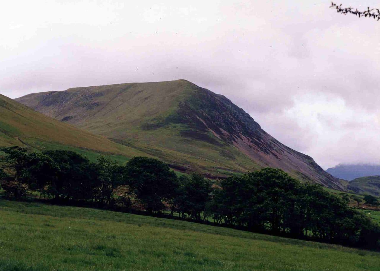
Photo: Mick Knapton via Wikimedia Commons
About Great Borne
A steep sided fell at the western end of the ridge between Ennerdale and Buttermere, known locally as Herdus. A sharp climb from Bowness Knott gains height fast, the top looks down on Ennerdale Water, and Starling Dodd is an easy walk east.
Ask in west Cumbria and you will often hear this fell called Herdus. Great Borne strictly names only the summit area, and some guidebooks list Herdus, a lower top half a kilometre west, as a separate fell. The name may mean great boundary, as the fell marked the edge of the Loweswater forest in the 13th century, or it may come from an old word for a stream.
Walkers start at the car park below Bowness Knott, at the end of the road into Ennerdale. The car park fills at holiday times. Walk back along the road about 300 metres, cross the stile before the bridge over Rake Beck and follow the beck up. The path skirts the Herdus crags on their east side, climbing steeply by a ravine, and then crosses small crags and rocky steps to the top. You can also climb the grassy east ridge of Herdus and cross to the summit. Carrying on east along the fence to Starling Dodd and dropping through a gap in the Ennerdale forest back to the valley track makes a round of about 12 km. That descent is steep and largely pathless.
The upper slopes are grass with rocky outcrops and boggy hollows.
The summit has two tops divided by a shallow dip. The southern one is slightly higher, with a trig point and a big wind shelter. The northern one has a large cairn that can be seen for miles and may be the boundary marker behind the name. The views take in the Loweswater Fells, the Grasmoor fells, Pillar and the Gables.
The southern slopes drop to Ennerdale Water in crags and scree of pink granophyre, which gives them a reddish tint. Traces of a medieval field system survive below them.
In winter
The path up beside Rake Beck is steep and runs along the side of a ravine, and the beck itself becomes a wet, slippery scramble. On the top, snow hides the boggy ground between Herdus and the summit, and the fence east to Starling Dodd is the best line in poor visibility.
Sources: Wikipedia: Great Borne, Walk Lakes: Great Borne and Starling Dodd above Ennerdale. Updated .
Summit
- OS grid ref
- NY 123 163
- Latitude
- 54.53509° N
- Longitude
- 3.35547° W
- Area
- Western Fells
Walking up Great Borne
The nearest car park on foot is Bowness Knott Car Park, 2.5 km (1.5 miles) from the summit along mapped paths. Directions to the car park
Route from Bowness Knott Car Park
- Distance
- 2.5 km
- 1.5 miles, one way
- Ascent
- 488 m
- Total climb to the summit
- Time up
- 1 h 15 min
- Allow 1 to 2 hours
Times use Naismith’s rule, 5 km/h on the flat plus extra time for the climb, with Langmuir’s corrections. It’s a rule of thumb for the way up only, so add stops, weather and the walk back down.
The route follows paths mapped by OpenStreetMap contributors and isn’t a guided line. Check the mountain forecast before you go and carry a map and compass.
Great Borne questions
Is Great Borne a Wainwright?
How high is Great Borne?
Where do you park for Great Borne?
How long does it take to climb Great Borne?
How hard is Great Borne?
Which Wainwrights are near Great Borne?
What is the grid reference for the summit of Great Borne?
Often walked with Great Borne
Fells people usually take in on the same day.
Wainwrights near Great Borne
Straight-line distance and direction from the summit.
 Hen Comb509 m1.9 km NE
 Starling Dodd633 m1.9 km E
 Gavel Fell526 m2.1 km N
 Mellbreak (south top)512 m3.3 km NE
 Crag Fell523 m3.3 km SW
 Blake Fell573 m3.6 km NW
More in the Western Fells
- Great Gable899 m
- Pillar892 m
- Scoat Fell841 m
- Red Pike [Wasdale]826 m
- Steeple819 m
- High Stile806 m
- Kirk Fell802 m
- Green Gable801 m
- Haycock797 m
- Red Pike [Buttermere]755 m
- High Crag744 m
- Brandreth715 m
- Caw Fell697 m
- Grey Knotts697 m
- Seatallan692 m
- Fleetwith Pike649 m
- Base Brown646 m
- Starling Dodd633 m
- Yewbarrow627 m
- Haystacks597 m
- Middle Fell582 m
- Blake Fell573 m
- Lank Rigg541 m
- Gavel Fell526 m
- Crag Fell523 m
- Mellbreak (south top)512 m
- Hen Comb509 m
- Grike488 m
- Burnbank Fell475 m
- Buckbarrow423 m
- Low Fell423 m
- Fellbarrow416 m
Bag Great Borne with Upfell
Reach the summit and capture Great Borne, even with no signal. It goes on your round of the 214 with its own patch.
Coming soon to theApp Store