Western Fells · Book 7
Grike
Grike is a Wainwright, one of the 214 Lake District fells in Alfred Wainwright’s Pictorial Guides. At 488 m (1,601 ft) it is the 177th highest of the 214 and the 29th highest in the Western Fells.
- Height
- 488 m
- 1,601 ft
- Rank
- 177
- of 214
- In area
- 29
- of 33
- Difficulty
- Moderate
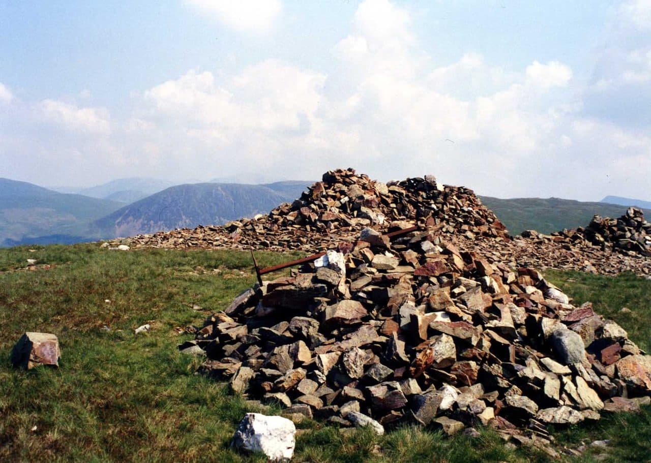
Photo: Mick Knapton via Wikimedia Commons
About Grike
A western outlier above Ennerdale, where easy forestry tracks lead onto open moor. The grassy summit, with its big stone cairn, looks across to the high fells around the head of Ennerdale. Often combined with Crag Fell and Lank Rigg for a quiet round.
Locals know Grike as Stone Man, after the massive cairn on its summit. It is a modest, grassy hill at the western edge of the fells, near the foot of Ennerdale Water.
Walkers mostly start from the Cold Fell road south of Ennerdale Bridge. There is informal parking on rough ground at the end of a track over Scaly Moss, near the Kinniside Stone Circle. A signed bridleway to Crag Fell, once the road to the iron mines, climbs round Blakeley Raise and into the plantation, much of it now felled. Follow the forest track along the fence to a step stile, then head up open ground to the top. From Ennerdale Bridge, or the car parks at the foot of the lake, the lane to Crag Farm leads to the path towards Crag Fell. Leave it at Ben Gill and climb the hillside to the right.
The ground is grass, with forestry tracks, a few step stiles and boggy dips. Nothing is steep for long.
Stone Man
The top is an otherwise grassy dome with one huge cairn and two smaller ones, built from the stones that litter it, plus a wind shelter. The sea view is wide. Crag Fell blocks much of Lakeland to the east, but the Western Fells around Ennerdale are well seen, and Fairfield, Dollywaggon Pike and Skiddaw appear in the distance. You look down on the foot of Ennerdale Water and the River Ehen flowing out of it.
Iron mines worked the northern slopes of Grike and Crag Fell from 1860 to 1896, with levels in Goat Gill and Red Gill and the main drift between them. The ore never came in the quantities hoped for, and the venture failed.
In winter
Peaty hollows between Grike and Crag Fell hold water and snow, and the broad tops have few features apart from the fence and the radio mast. If you add Lank Rigg, the return along Whoap Beck crosses two fords that are dangerous in spate.
- Quiet & Remote
- Family Walk
- Dog Friendly
Sources: Wikipedia: Grike, Walk Lakes: Grike, Crag Fell, Lank Rigg. Updated .
Summit
- OS grid ref
- NY 085 140
- Latitude
- 54.51375° N
- Longitude
- 3.41485° W
- Area
- Western Fells
Walking up Grike
The nearest car park on foot is Bleach Green Car Park, 2.9 km (1.8 miles) from the summit along mapped paths. Directions to the car park
Route from Bleach Green Car Park
- Distance
- 2.9 km
- 1.8 miles, one way
- Ascent
- 380 m
- Total climb to the summit
- Time up
- 1 h 11 min
- Allow 1 to 2 hours
Times use Naismith’s rule, 5 km/h on the flat plus extra time for the climb, with Langmuir’s corrections. It’s a rule of thumb for the way up only, so add stops, weather and the walk back down.
The route follows paths mapped by OpenStreetMap contributors and isn’t a guided line. Check the mountain forecast before you go and carry a map and compass.
Grike questions
Is Grike a Wainwright?
How high is Grike?
Where do you park for Grike?
How long does it take to climb Grike?
How hard is Grike?
Which Wainwrights are near Grike?
What is the grid reference for the summit of Grike?
Often walked with Grike
Fells people usually take in on the same day.
Grike in our guides
Wainwrights near Grike
Straight-line distance and direction from the summit.
 Crag Fell523 m1.3 km E
 Lank Rigg541 m2.2 km S
 Great Borne616 m4.5 km NE
 Gavel Fell526 m5.4 km NE
 Caw Fell697 m5.6 km SE
 Starling Dodd633 m5.9 km E
More in the Western Fells
- Great Gable899 m
- Pillar892 m
- Scoat Fell841 m
- Red Pike [Wasdale]826 m
- Steeple819 m
- High Stile806 m
- Kirk Fell802 m
- Green Gable801 m
- Haycock797 m
- Red Pike [Buttermere]755 m
- High Crag744 m
- Brandreth715 m
- Caw Fell697 m
- Grey Knotts697 m
- Seatallan692 m
- Fleetwith Pike649 m
- Base Brown646 m
- Starling Dodd633 m
- Yewbarrow627 m
- Great Borne616 m
- Haystacks597 m
- Middle Fell582 m
- Blake Fell573 m
- Lank Rigg541 m
- Gavel Fell526 m
- Crag Fell523 m
- Mellbreak (south top)512 m
- Hen Comb509 m
- Burnbank Fell475 m
- Buckbarrow423 m
- Low Fell423 m
- Fellbarrow416 m
Bag Grike with Upfell
Reach the summit and capture Grike, even with no signal. It goes on your round of the 214 with its own patch.
Coming soon to theApp Store