The hardest Wainwrights to bag are not the highest. They are the fells that sit beside the famous routes, such as Slight Side, Great End, Lingmell and Yewbarrow, and the outliers at the western and far eastern edges of the map. Walkers pass them for years on the way to somewhere better known. Then one day they are all that's left.
The register data shows how often this happens. We parsed all 955 completers on the LDWA Hillwalkers' Register (updated 27 November 2025). Four of the five most common last fells are Scafell and Wasdale fells: Slight Side (31 finishers), Yewbarrow (30), Great End (25) and Lingmell (24). Scafell has 19 and Lank Rigg 18. The Wainwright Society's larger register, which we counted on 22 September 2026, shows the same thing more strongly. Great End is its most common last fell of all, with 101 of 1,645 finishes, and Scafell (65), Yewbarrow (53), Kirk Fell (47) and Lingmell (40) are all in its top seven. People pick party fells like Castle Crag on purpose. Some of those who finished on Great End may have planned it too, but for most it was what was left.
Distances, ascent and times are from WalkLakes, which gives its times as minimums. Carry a map and compass, and check the Mountain Weather Information Service (MWIS) forecast before any of these days. Several are pathless or boggy, and some cross the highest ground in England.
The fells people leave until last
The awkward leftovers
| Rank | Fell | Height | Area | Difficulty |
|---|---|---|---|---|
| =57 | Slight SideSouthern Fells | 762 m | Southern Fells | Moderate |
| 5 | Great EndSouthern Fells | 910 m | Southern Fells | Moderate |
| 29 | LingmellSouthern Fells | 807 m | Southern Fells | Moderate |
| 2 | ScafellSouthern Fells | 964 m | Southern Fells | Difficult |
| 123 | YewbarrowWestern Fells | 627 m | Western Fells | Difficult |
| 168 | Mellbreak (south top)Western Fells | 512 m | Western Fells | Moderate |
| 177 | GrikeWestern Fells | 488 m | Western Fells | Moderate |
| 162 | Crag FellWestern Fells | 523 m | Western Fells | Moderate |
| 153 | Lank RiggWestern Fells | 541 m | Western Fells | Moderate |
| =91 | Caw FellWestern Fells | 697 m | Western Fells | Moderate |
| 36 | HaycockWestern Fells | 797 m | Western Fells | Difficult |
| 135 | Middle FellWestern Fells | 582 m | Western Fells | Moderate |
| 94 | SeatallanWestern Fells | 692 m | Western Fells | Moderate |
| =196 | BuckbarrowWestern Fells | 423 m | Western Fells | Moderate |
| 104 | Tarn Crag [Longsleddale]Far Eastern Fells | 664 m | Far Eastern Fells | Easy |
| 118 | Grey CragFar Eastern Fells | 638 m | Far Eastern Fells | Moderate |
| 81 | BranstreeFar Eastern Fells | 713 m | Far Eastern Fells | Moderate |
| 110 | Selside PikeFar Eastern Fells | 655 m | Far Eastern Fells | Easy |
Slight Side (762 m)
Why it gets left: Slight Side is the far southern end of the Scafell ridge, and it looks down Eskdale. Most people climb Scafell from Wasdale or Borrowdale and never go that far south. From Eskdale it is a long way round by car for anyone staying in Keswick or Ambleside, and in snow Hardknott Pass can be closed or unsafe.
The plan: climb it from Eskdale. The WalkLakes route up Slight Side from Eskdale starts at a small car park near Wha House Farm (about six cars) and follows Wainwright's Terrace Route: 9.9 km, 673 m of ascent, at least 3 hours 6 minutes. The path is faint in places and wet around Cow Cove. The final pull to the summit is steep, with a clamber over boulders. If Scafell is also still on your list, continue north along the ridge from Slight Side to Scafell and come back the same way.
Great End (910 m) and Lingmell (807 m)
Why they get left: both stand right beside the routes up Scafell Pike. Great End is the big wall at the northern end of the massif, and the Borrowdale path to the Pike goes past below it at Esk Hause. Lingmell sits beside the Brown Tongue path from Wasdale, and Lingmell Col is where many walkers turn for the Pike. Both are a short detour, but on a long day with England's highest summit ahead, few people take it.
The plan: do both in one round from Wasdale Head and treat the Pike as the bonus. The WalkLakes round over Great End and Lingmell goes up Mosses Trod past Burnthwaite Farm to Sty Head and Sprinkling Tarn, then to Esk Hause and up through the boulders of Calf Cove to Great End. It crosses the boulder fields to Scafell Pike, drops to Lingmell Col, climbs Lingmell, and comes down by Hollow Stones and Lingmell Gill. That is 15.4 km with 1,107 m of ascent, at least 4 hours 56 minutes. There is little water above Calf Cove until Lingmell Gill. Keep this one for a clear day, because navigating the boulder ground in cloud is slow.
Yewbarrow (627 m)
Why it gets left: Yewbarrow is only just over 2,000 ft, but both ends are steep and rocky. Adding it to a bigger Wasdale round makes a hard day harder, so people save it for a short day that never comes.
The plan: give it a morning of its own from the Overbeck Bridge car park beside Wast Water. The WalkLakes circuit of Yewbarrow is 6.7 km with 592 m of ascent, at least 2 hours 19 minutes. It climbs by the Great Door and Bell Rib, the steepest part, then heads north along the top and drops over Stirrup Crag to Dore Head. The descent of Stirrup Crag needs your hands. A lower path avoids the worst of it, and it is the better choice in the wet. With the afternoon free, you could add Lingmell or the Greendale fells below.
Mellbreak (512 m)
Why it gets left: Mellbreak stands alone between Loweswater and Crummock Water, away from the ridges walkers string together. It is too small to feel like a day out, and the direct way up its north end is loose scree.
The plan: start from Loweswater and combine it with Scale Force. The WalkLakes route over Mellbreak is 11 km with 600 m of ascent, at least 3 hours 12 minutes. It climbs the scree on the north-west slope, which WalkLakes describes as very loose. WalkLakes lists several places to park: Maggie's Bridge (about ten spaces), Scalehill Bridge by Lanthwaite Wood, and a couple of spaces in Loweswater village. Mellbreak has two tops of almost the same height, so walk over both.
The Western outliers
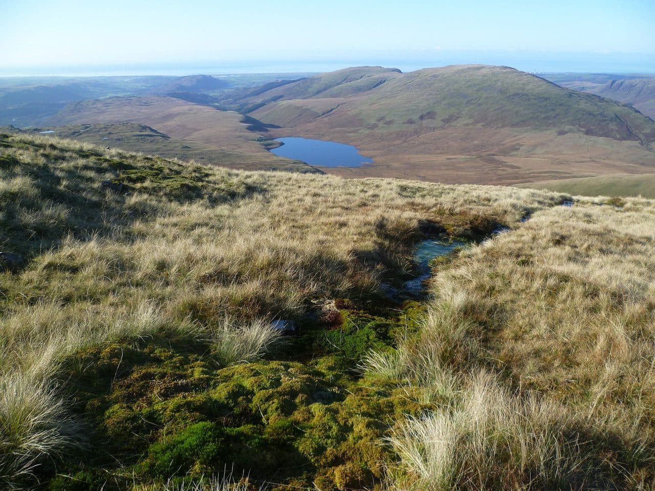
Why they get left: the fells south of Ennerdale Water and west of Wasdale are a long way from most walkers' bases. The ground is rough grass and bog rather than rock ridges, and they are not on the way to anything. Lank Rigg, with 18 finishers, is joint ninth among the most common last fells on the LDWA register.
The plans:
- Grike, Crag Fell and Lank Rigg. Start on the Cold Fell road above Ennerdale Bridge. The WalkLakes circuit of Grike, Crag Fell and Lank Rigg is 13.5 km with 607 m of ascent, at least 3 hours 43 minutes. Paths are faint and the ground is boggy. The return along Whoap Beck crosses two fords, which can be dangerous after rain.
- Caw Fell and Haycock. These are the remotest of the group. From Bowness Knott car park by Ennerdale Water, the WalkLakes Ennerdale round over Haycock and Caw Fell takes in Steeple, Scoat Fell, Haycock and Caw Fell: 17.9 km with 1,034 m of ascent, at least 5 hours 19 minutes, and rated 5 out of 5. If Steeple and Scoat Fell are already done, you still need the full walk in, so plan a whole day.
- Middle Fell, Seatallan and Buckbarrow. The WalkLakes Greendale round starts from the Wasdale road near Greendale and is 8.5 km with 720 m of ascent, at least 2 hours 54 minutes. It is wet underfoot, and in mist you will need your compass.
More fells in this corner are listed on the Western Fells area page.
The Far Eastern outliers
Why they get left: the fells around Longsleddale and the south end of Haweswater are reached from dead-end roads a long way from the central valleys. They are grassy and boggy, and they are low next to High Street and Harter Fell. People bag the High Street ridge and leave these for later.
The plans:
- Tarn Crag and Grey Crag. From Sadgill at the head of Longsleddale, the WalkLakes circuit of Tarn Crag and Grey Crag is 11.3 km with 549 m of ascent, at least 3 hours 11 minutes. WalkLakes rates the bog factor as very boggy all year. Parking at Sadgill is informal, with room for about six cars, so arrive early.
- Branstree and Selside Pike. From Mardale Head at the end of Haweswater, the WalkLakes walk over Branstree and Selside Pike climbs the Gatescarth Pass path to Branstree, crosses peat hags to Selside Pike, and comes down the old Corpse Road: 8.6 km with 551 m of ascent, at least 2 hours 36 minutes.
These two walks leave from different valleys, so they make two separate days. Both are short, which suits a day when the forecast only gives you a few dry hours. See the Far Eastern Fells area page for the rest of the book.
Getting them done
- Add the detour on the day you are already there. Great End from Esk Hause or Lingmell from Lingmell Col costs far less than a separate trip from home later.
- Group what is left by valley, not by book. Wasdale alone can clear Great End, Lingmell, Yewbarrow and the Greendale fells over two or three days.
- Keep the short ones, like Yewbarrow, Mellbreak and Branstree, for days when the forecast only gives you a morning.
- If you want to finish somewhere of your choosing, clear these first. Our essay on where people finish the Wainwrights explains why.
For the full finishing data, see the Wainwrights in numbers. For a sense of how long the whole round takes, see how long it takes to walk the Wainwrights.