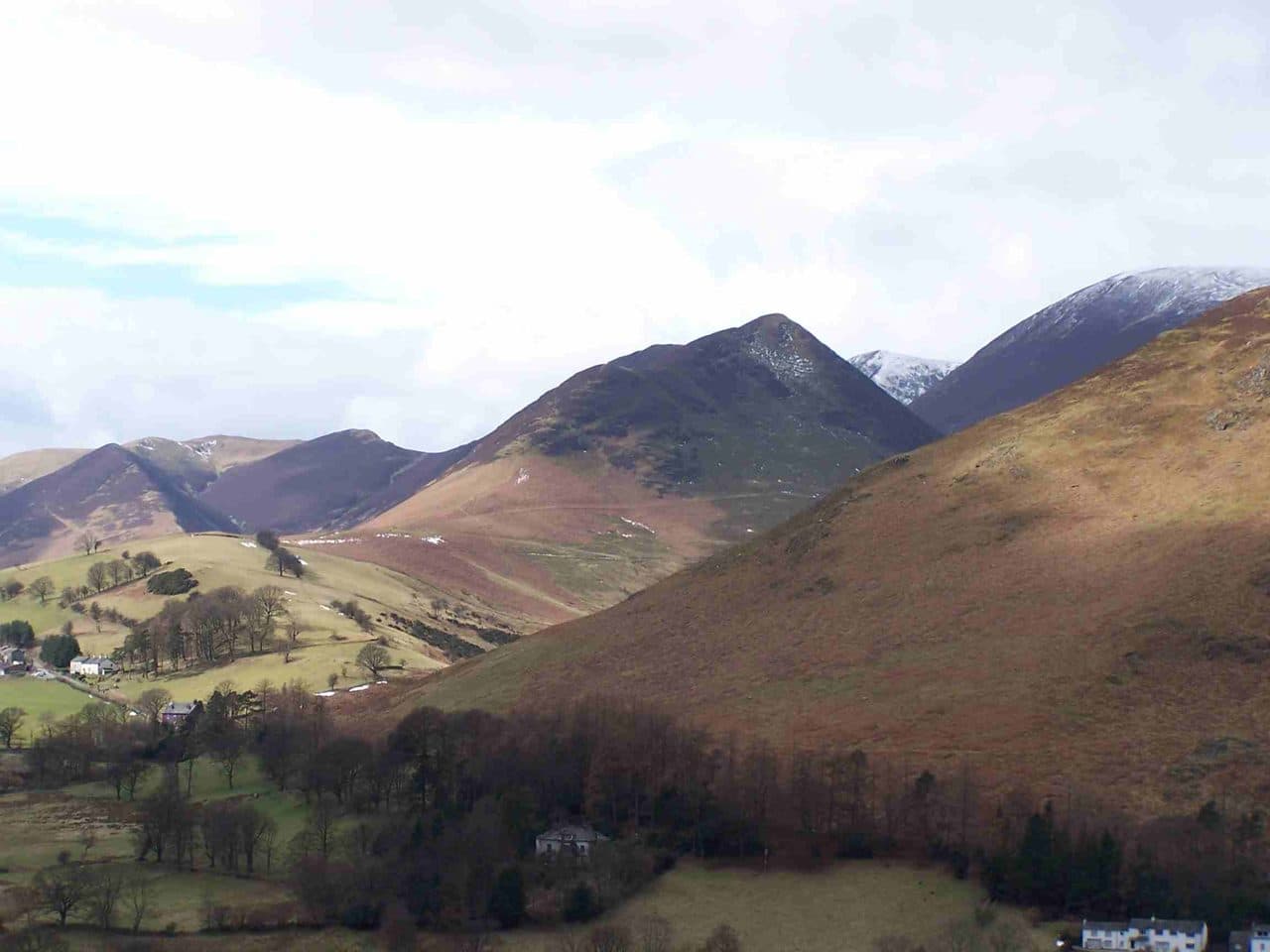
The quietest Wainwrights are in the corners of the Lake District. Back o' Skiddaw, the Northern Fells roll away from the crowds on Skiddaw and Blencathra. On the western fringe, the fells above Ennerdale and Loweswater are a long drive from anywhere. In the Far East, the outliers around Haweswater and Longsleddale end in small car parks at the ends of dead-end roads. And in the middle of the Central Fells, the wet plateau between Borrowdale and Thirlmere has few marked paths at all.
These are the fells in the Quiet and Remote collection in the Upfell app. Expect bog, faint paths and long walk-ins, and a summit to yourself.
Quiet and remote Wainwrights
| Rank | Fell | Height | Area | Difficulty |
|---|---|---|---|---|
| =136 | Ard CragsNorth Western Fells | 581 m | North Western Fells | Moderate |
| =182 | Armboth FellCentral Fells | 475 m | Central Fells | Moderate |
| 157 | Arthur's PikeFar Eastern Fells | 533 m | Far Eastern Fells | Moderate |
| =100 | BakestallNorthern Fells | 673 m | Northern Fells | Moderate |
| 161 | Bonscale PikeFar Eastern Fells | 524 m | Far Eastern Fells | Moderate |
| 134 | Brae FellNorthern Fells | 586 m | Northern Fells | Moderate |
| 81 | BranstreeFar Eastern Fells | 713 m | Far Eastern Fells | Moderate |
| 169 | Broom FellNorth Western Fells | 511 m | North Western Fells | Easy |
| =182 | Burnbank FellWestern Fells | 475 m | Western Fells | Easy |
| 105 | Carrock FellNorthern Fells | 663 m | Northern Fells | Moderate |
| =91 | Caw FellWestern Fells | 697 m | Western Fells | Moderate |
| =38 | Dove CragEastern Fells | 792 m | Eastern Fells | Easy |
| =158 | Gavel FellWestern Fells | 526 m | Western Fells | Easy |
| =95 | Great CalvaNorthern Fells | 690 m | Northern Fells | Moderate |
| =158 | Great CockupNorthern Fells | 526 m | Northern Fells | Moderate |
| =114 | Great Sca FellNorthern Fells | 651 m | Northern Fells | Moderate |
| 176 | Green CragSouthern Fells | 489 m | Southern Fells | Moderate |
| 118 | Grey CragFar Eastern Fells | 638 m | Far Eastern Fells | Moderate |
| 177 | GrikeWestern Fells | 488 m | Western Fells | Moderate |
| 36 | HaycockWestern Fells | 797 m | Western Fells | Difficult |
| =170 | Hen CombWestern Fells | 509 m | Western Fells | Easy |
| =57 | High Raise [Langdale]Central Fells | 762 m | Central Fells | Moderate |
| 167 | High ToveCentral Fells | 515 m | Central Fells | Moderate |
| 128 | Illgill HeadSouthern Fells | 609 m | Southern Fells | Moderate |
| 82 | KnottNorthern Fells | 710 m | Northern Fells | Moderate |
| 153 | Lank RiggWestern Fells | 541 m | Western Fells | Moderate |
| 103 | Loadpot HillFar Eastern Fells | 671 m | Far Eastern Fells | Easy |
| =179 | Longlands FellNorthern Fells | 483 m | Northern Fells | Moderate |
| 151 | Meal FellNorthern Fells | 550 m | Northern Fells | Moderate |
| 168 | Mellbreak (south top)Western Fells | 512 m | Western Fells | Moderate |
| =121 | Mungrisdale CommonNorthern Fells | 633 m | Northern Fells | Moderate |
| 8 | PillarWestern Fells | 892 m | Western Fells | Difficult |
| 93 | Rest DoddFar Eastern Fells | 696 m | Far Eastern Fells | Easy |
| =22 | Scoat FellWestern Fells | 841 m | Western Fells | Difficult |
| 94 | SeatallanWestern Fells | 692 m | Western Fells | Moderate |
| 110 | Selside PikeFar Eastern Fells | 655 m | Far Eastern Fells | Easy |
| 99 | Sheffield PikeEastern Fells | 676 m | Eastern Fells | Moderate |
| =121 | Starling DoddWestern Fells | 633 m | Western Fells | Easy |
| 104 | Tarn Crag [Longsleddale]Far Eastern Fells | 664 m | Far Eastern Fells | Easy |
| 138 | The NabFar Eastern Fells | 576 m | Far Eastern Fells | Easy |
| 76 | Thunacar KnottCentral Fells | 723 m | Central Fells | Easy |
| 207 | Troutbeck TongueFar Eastern Fells | 364 m | Far Eastern Fells | Moderate |
| =74 | UllscarfCentral Fells | 726 m | Central Fells | Moderate |
| =100 | Wether HillFar Eastern Fells | 673 m | Far Eastern Fells | Easy |
Back o' Skiddaw
Knott sits at the centre of the Northern Fells, a long grassy whaleback that no road comes close to. The usual route starts at the end of the Mosedale road, where about four cars fit on the verge before the Grainsgill Beck bridge. It climbs Great Calva by Wiley Gill first, then crosses a stretch of moss and tussocks with only a faint path to Knott. WalkLakes makes the loop 12 km and rates it wet and boggy.
The Uldale Fells go together as one round from Longlands, where there is informal room for about four cars. You go over Great Sca Fell and Meal Fell, drop to the ravine of Trusmadoor and climb Great Cockup, about 11 km in all. Brae Fell and Longlands Fell make a shorter loop from the same gate, about 7 km with 450 m of climbing. Carrock Fell stands above Mosedale, with a steep and loose path up the east face and a gentler one from the Caldew valley.
Back o' Skiddaw
The western fringe
Lank Rigg is far out on the western edge of the national park, on a grassy upland south of Ennerdale. Walkers park on the unfenced Coldfell road, and WalkLakes adds Grike and Crag Fell for a circuit of 13.5 km with about 600 m of ascent. Caw Fell is a long way from any road by Lakeland standards. Strong walkers make a day of it from Bowness Knott with Haycock, Scoat Fell and Steeple, a round of about 18 km with over 1,000 m of ascent.
Starling Dodd was the last fell Wainwright climbed for his Pictorial Guides. The WalkLakes loop from Bowness Knott goes over Great Borne and is 12.4 km with about 730 m of ascent. Seatallan starts from Greendale on the shore road of Wastwater. Hen Comb, above Loweswater, is reached by a ford on Mosedale Beck with no bridge, so don't try it with the beck in spate.
The western fringe


Haweswater and Longsleddale
At the head of Longsleddale the road ends at Sadgill, with room for about six cars by the bridge. Grey Crag and Tarn Crag make a round of about 11 km from there, crossing the boggy col by Greycrag Tarn. From Mardale Head, at the end of the Haweswater road, Branstree goes up the old packhorse track of Gatescarth Pass, and Selside Pike climbs the Corpse Road, where the dead of Mardale were once carried over to Shap. The car park there is small and fills early.
Further north, Loadpot Hill follows the Roman road of High Street from Pooley Bridge or Askham. Arthur's Pike and Bonscale Pike climb from Howtown on the quiet side of Ullswater. Rest Dodd is steep but straightforward from Hartsop. Its neighbour The Nab is in the Martindale deer forest, so read the estate's advice in the questions below before you go.
Around Haweswater, Longsleddale and Martindale





The wet middle
Ullscarf stands close to the geographical centre of the Lake District, on a plateau of about four square miles with few marked paths. Armboth Fell has no marked path to the top at all. From the Armboth car park on the west side of Thirlmere you pick your own way. High Tove is crossed by the old bridleway from Watendlath to Armboth, which keeps to the highest ground because the land on either side is so wet. Thunacar Knott is a grassy rise behind the Langdale Pikes that plenty of walkers pass by, though it is only a short walk out from Pavey Ark.
In the south west, Green Crag rises out of Birker Fell moor between Eskdale and the Duddon. WalkLakes puts the round from the Birker Fell road at 6.6 km with 316 m of ascent, most of it over pathless moor.
Being self-reliant
On a quiet fell nobody is coming along behind you, so plan as if you are on your own.
- Navigate with a map and compass. Many of these tops have faint paths or none. Use handrails where you can find them: the fence that runs up to Great Calva, or the Ennerdale wall along the ridge between Scoat Fell, Haycock and Caw Fell. Green Crag has no cairns, fences or built paths, so in mist you navigate entirely by map and compass.
- Expect wet ground. Hen Comb has hardly a dry approach, and the Mosedale bridleway back from it is marshy for much of its length. On the Uldale round you ford the River Ellen. After heavy rain, pick another day.
- Don't count on your phone. Mountain Rescue England and Wales says signal in the mountains is unreliable. Charge your phone fully, carry a power bank, and tell someone your route and when you expect to be back.
- Allow for daylight. Walk-ins are long. The Ennerdale rounds are close to 18 km before you have added the drive, so start early in autumn and winter.
- If you need help, dial 999 or 112, ask for the police, then mountain rescue, and stay where you are until the team contacts you.
- Give the animals room. Galloway cattle graze the Ling Mell plantations in Ennerdale, and red deer have the run of Martindale.
Check the Mountain Weather Information Service (MWIS) forecast for cloud and wind before you set out. The Wainwrights to avoid in bad weather guide covers the high ground where cloud causes real trouble.
Where to base yourself
Keswick is the nearest town for back o' Skiddaw and the Central Fells; see Wainwrights from Keswick. For Ennerdale and Loweswater, the Buttermere and Wasdale guides cover the western valleys. Pooley Bridge is the start for Loadpot Hill. If you have done the famous fells and want the opposite, the most popular Wainwrights page tells you where not to go on a sunny Saturday. Several of these fells also appear in the hardest Wainwrights to bag.