Central Fells · Book 3
Thunacar Knott
Thunacar Knott is a Wainwright, one of the 214 Lake District fells in Alfred Wainwright’s Pictorial Guides. At 723 m (2,372 ft) it is the 76th highest of the 214 and the 5th highest in the Central Fells.
- Height
- 723 m
- 2,372 ft
- Rank
- 76
- of 214
- In area
- 5
- of 27
- Difficulty
- Easy
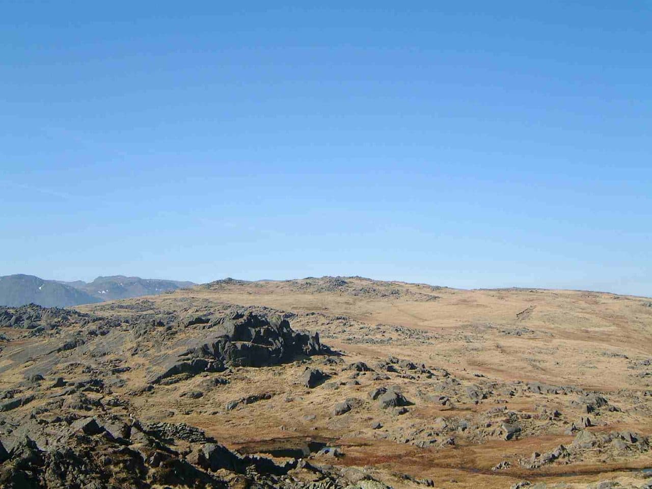
Photo: Mick Knapton via Wikimedia Commons
About Thunacar Knott
A modest, pool-dotted swelling between the Pikes and High Raise. A quiet top that stitches classic Langdale lines together.
With Pavey Ark's cliffs and the Langdale Pikes crowded round it, Thunacar Knott is an unremarkable grassy rise on the moor behind them. Plenty of walkers pass it by. Those working through the Wainwrights make a point of calling in, and the view turns out to be better than the fell looks.
From the New Dungeon Ghyll National Trust car park, climb Stickle Ghyll to Stickle Tarn, go up onto Pavey Ark and follow the intermittent path west across the plateau. The fell lies between Harrison Stickle and High Raise, so it fits easily into any round of the Pikes, and from Pavey Ark or Harrison Stickle it is only a short walk out. From Borrowdale there is a long approach from Stonethwaite up Langstrath and over Stake Pass.
Underfoot it is grass and moorland, with boggy patches, especially in Harrison Combe to the south. There's no scrambling here. The steep, rocky ground on this side of the valley belongs to the Pikes.
Two tops stand close together, with a small tarn nearby. The southern one is a little higher, but the northern top has the more prominent cairn and most walkers treat it as the summit. The view goes all the way round, and it is at its best to the west.
In winter
The plateau between Harrison Stickle and High Raise has few landmarks and boggy patches, and in mist or snow you will need a compass bearing to find the northern cairn. Pavey Ark's cliffs are close by to the east, so be sure of your position before you head that way.
- Great Views
- Quiet & Remote
- Family Walk
- Dog Friendly
- Summit Tarn
Sources: Wikipedia: Thunacar Knott, Walk Lakes: The Langdale Pikes. Updated .
Summit
- OS grid ref
- NY 279 081
- Latitude
- 54.46346° N
- Longitude
- 3.11368° W
- Area
- Central Fells
Walking up Thunacar Knott
The nearest car park on foot is New Dungeon Ghyll, 3.0 km (1.9 miles) from the summit along mapped paths. Directions to the car park
Route from New Dungeon Ghyll
- Distance
- 3.0 km
- 1.9 miles, one way
- Ascent
- 636 m
- Total climb to the summit
- Time up
- 1 h 36 min
- Allow 1 to 2 hours
Times use Naismith’s rule, 5 km/h on the flat plus extra time for the climb, with Langmuir’s corrections. It’s a rule of thumb for the way up only, so add stops, weather and the walk back down.
The route follows paths mapped by OpenStreetMap contributors and isn’t a guided line. This car park was picked automatically and hasn’t been checked by hand yet, so compare it with a map. Check the mountain forecast before you go and carry a map and compass.
Thunacar Knott questions
Is Thunacar Knott a Wainwright?
How high is Thunacar Knott?
Where do you park for Thunacar Knott?
How long does it take to climb Thunacar Knott?
How hard is Thunacar Knott?
Which Wainwrights are near Thunacar Knott?
What is the grid reference for the summit of Thunacar Knott?
Often walked with Thunacar Knott
Fells people usually take in on the same day.
Thunacar Knott in our guides
Wainwrights near Thunacar Knott
Straight-line distance and direction from the summit.
 Pavey Ark700 m0.6 km E
 Harrison Stickle736 m0.8 km S
 Pike o'Stickle708 m0.9 km SW
 Loft Crag682 m1.0 km S
 Sergeant Man736 m1.1 km NE
 High Raise [Langdale]762 m1.4 km N
More in the Central Fells
- High Raise [Langdale]762 m
- Harrison Stickle736 m
- Sergeant Man736 m
- Ullscarf726 m
- Pike o'Stickle708 m
- Pavey Ark700 m
- Loft Crag682 m
- High Seat608 m
- Bleaberry Fell590 m
- Sergeant's Crag571 m
- Blea Rigg556 m
- Steel Fell553 m
- Tarn Crag [Easedale]551 m
- Calf Crag537 m
- Eagle Crag525 m
- High Tove515 m
- Armboth Fell475 m
- Raven Crag461 m
- Great Crag449 m
- Gibson Knott420 m
- Grange Fell (Brund Fell)417 m
- Helm Crag405 m
- Silver How395 m
- Walla Crag379 m
- High Rigg357 m
- Loughrigg Fell335 m
Bag Thunacar Knott with Upfell
Reach the summit and capture Thunacar Knott, even with no signal. It goes on your round of the 214 with its own patch.
Coming soon to theApp Store