Central Fells · Book 3
Silver How
Silver How is a Wainwright, one of the 214 Lake District fells in Alfred Wainwright’s Pictorial Guides. At 395 m (1,296 ft) it is the 202nd highest of the 214 and the 24th highest in the Central Fells.
- Height
- 395 m
- 1,296 ft
- Rank
- 202
- of 214
- In area
- 24
- of 27
- Difficulty
- Moderate
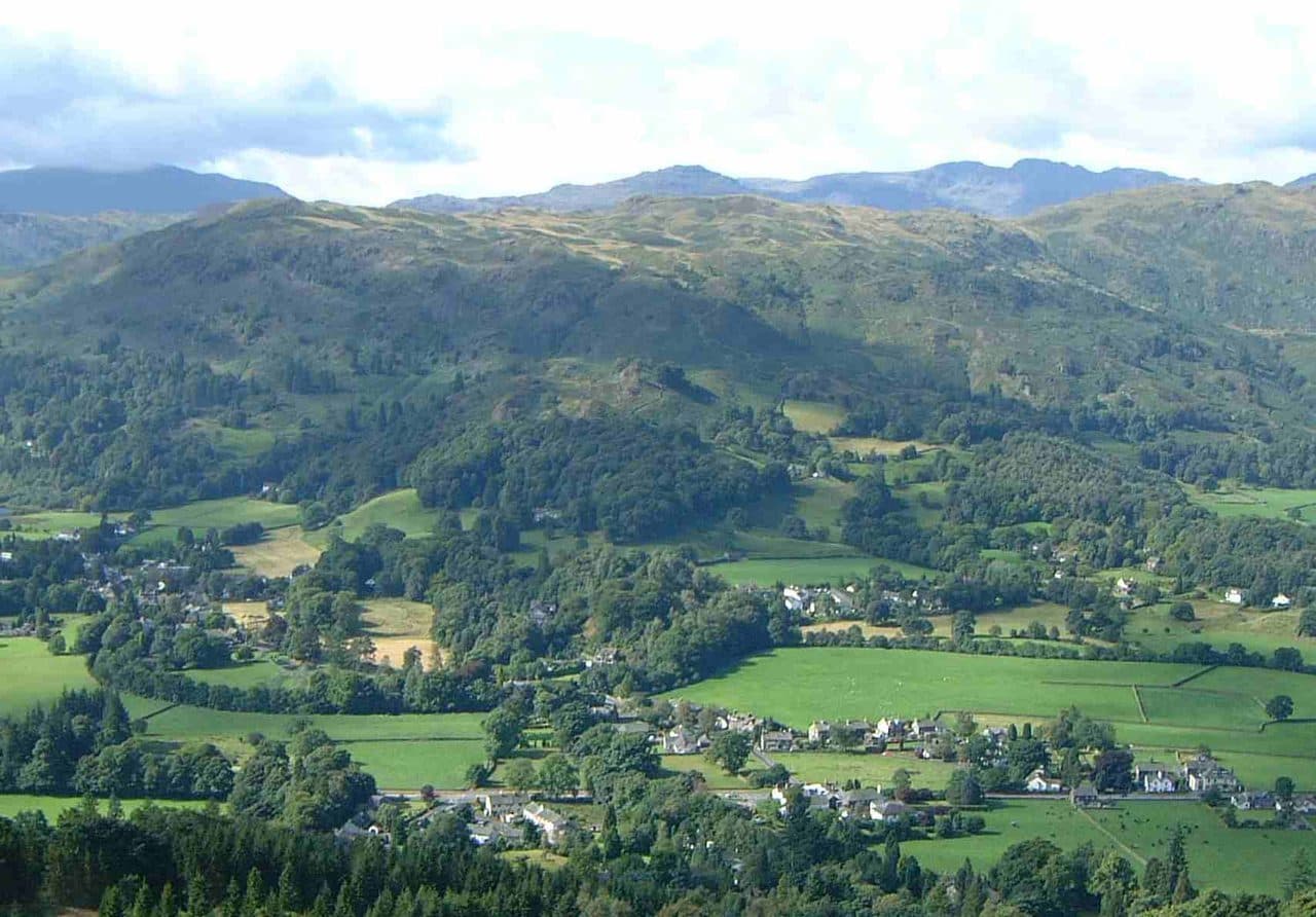
Photo: Mick Knapton via Wikimedia Commons
About Silver How
A rolling top above Grasmere and Langdale with wide views for modest effort. Paths weave through knolls and tarns, making it a great choice for an easy evening round. Link it with Loughrigg or the Langdale edges for a longer day.
From the cairn you look straight down on Grasmere village and its lake, with the Fairfield horseshoe filling the skyline behind. Turn round and the Langdale Pikes are close and side-on, and the Coniston fells show to the south.
Grasmere is the usual start. There is pay and display parking on Red Bank Road and at Stock Lane, and the 555 bus between Kendal and Keswick stops in the village. Take the narrow lane beside the Miller Howe Café up past Allan Bank, where Wordsworth lived for a time and which the National Trust now owns. You then climb through stands of juniper, ford Wray Gill (wet after rain), cross a small plateau and make a steep final push to the top. A good way back is the engineered steps down Scree Gully. The round is about 5 km with a little over 300 m of climbing.
Chapel Stile in Great Langdale is the shortest approach, steep but quick, with the Pikes in front of you once you gain height. Elterwater and High Close near Red Bank are other starting points, and the paths criss-cross so much that you can make up a different circuit each time.
It is grass and rock underfoot, with some boggy patches. The Grasmere side is wooded low down and craggy near the top. There is no real scrambling, but the ground around the summit is a jumble of rounded knolls, and in mist it's harder to find your way than the modest height suggests.
Silver How sits on a long ridge. Westward it runs over Lang How, Swinescar Pike and the Castle Hows to Blea Rigg. Eastward it drops through the woods at Red Bank to Loughrigg Fell. Either makes an easy extension.
In winter
The steep stepped path down Scree Gully to Grasmere and the rocky final pull to the cairn ice up quickly. In snow the knolly ground west of the summit towards Blea Rigg has so many small tops and crossing paths that it is easy to drop into the wrong valley.
- Great Views
- Popular
- Family Walk
- Dog Friendly
Sources: Wikipedia: Silver How, Walk Lakes: Silver How. Updated .
Summit
- OS grid ref
- NY 324 066
- Latitude
- 54.45068° N
- Longitude
- 3.04287° W
- Area
- Central Fells
Walking up Silver How
The nearest car park on foot is Shoppers & Cafe Car Park, 1.8 km (1.1 miles) from the summit along mapped paths. Directions to the car park
Route from Shoppers & Cafe Car Park
- Distance
- 1.8 km
- 1.1 miles, one way
- Ascent
- 310 m
- Total climb to the summit
- Time up
- 50 min
- Allow 1 to 2 hours
Times use Naismith’s rule, 5 km/h on the flat plus extra time for the climb, with Langmuir’s corrections. It’s a rule of thumb for the way up only, so add stops, weather and the walk back down.
The route follows paths mapped by OpenStreetMap contributors and isn’t a guided line. This car park was picked automatically and hasn’t been checked by hand yet, so compare it with a map. Check the mountain forecast before you go and carry a map and compass.
Silver How questions
Is Silver How a Wainwright?
How high is Silver How?
Where do you park for Silver How?
How long does it take to climb Silver How?
How hard is Silver How?
Which Wainwrights are near Silver How?
What is the grid reference for the summit of Silver How?
Often walked with Silver How
Fells people usually take in on the same day.
Silver How in our guides
Wainwrights near Silver How
Straight-line distance and direction from the summit.
 Blea Rigg556 m2.6 km NW
 Loughrigg Fell335 m2.7 km SE
 Helm Crag405 m2.7 km N
 Lingmoor Fell470 m3.0 km SW
 Nab Scar450 m3.1 km E
 Gibson Knott420 m3.3 km N
More in the Central Fells
- High Raise [Langdale]762 m
- Harrison Stickle736 m
- Sergeant Man736 m
- Ullscarf726 m
- Thunacar Knott723 m
- Pike o'Stickle708 m
- Pavey Ark700 m
- Loft Crag682 m
- High Seat608 m
- Bleaberry Fell590 m
- Sergeant's Crag571 m
- Blea Rigg556 m
- Steel Fell553 m
- Tarn Crag [Easedale]551 m
- Calf Crag537 m
- Eagle Crag525 m
- High Tove515 m
- Armboth Fell475 m
- Raven Crag461 m
- Great Crag449 m
- Gibson Knott420 m
- Grange Fell (Brund Fell)417 m
- Helm Crag405 m
- Walla Crag379 m
- High Rigg357 m
- Loughrigg Fell335 m
Bag Silver How with Upfell
Reach the summit and capture Silver How, even with no signal. It goes on your round of the 214 with its own patch.
Coming soon to theApp Store