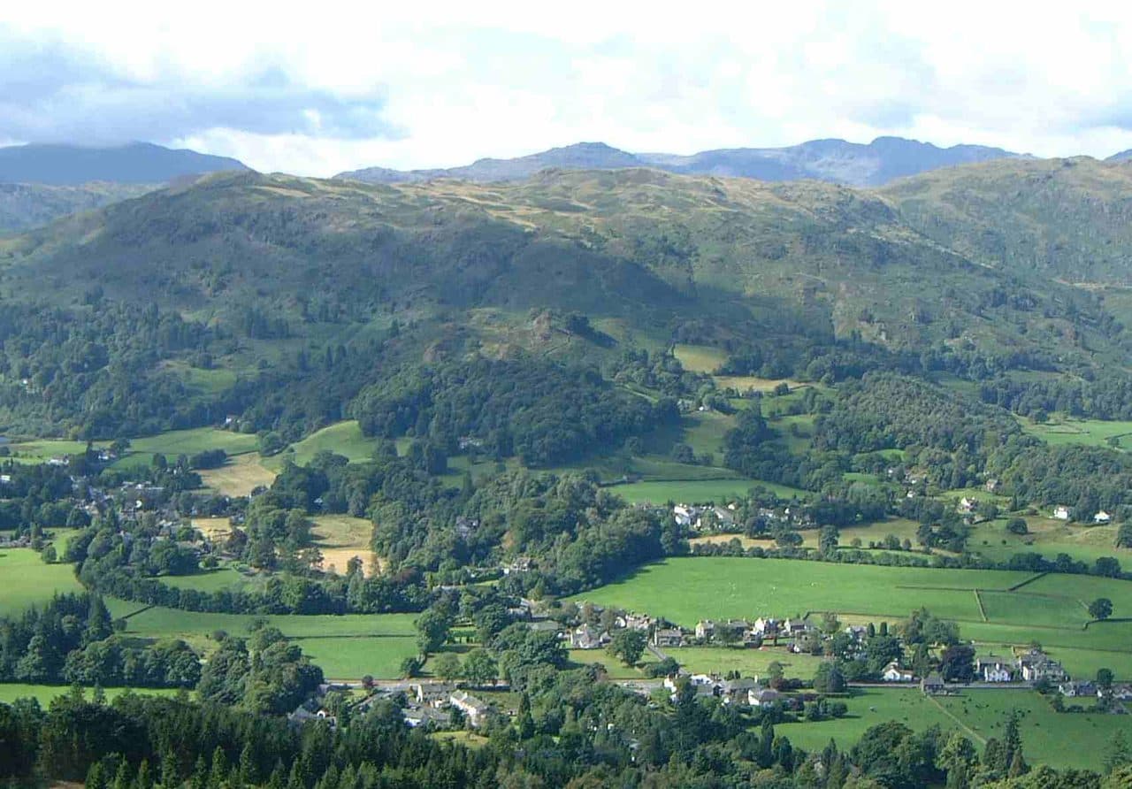
Sixteen Wainwrights are within walking distance of Grasmere village. West of the village are Helm Crag, Gibson Knott, Calf Crag, Steel Fell, Silver How, Tarn Crag, Blea Rigg, Sergeant Man and High Raise, all in the Central Fells, plus Loughrigg Fell to the south. East of the A591 are Stone Arthur, Nab Scar, Heron Pike, Great Rigg, Fairfield and Seat Sandal in the Eastern Fells.
Parking and buses
Grasmere has three main pay and display car parks. Stock Lane is by the village entrance, near Dove Cottage and St Oswald's church. Red Bank Road has 77 spaces. Broadgate Meadow, on the north edge of the village, has 81 and is the closest to the Helm Crag and Easedale paths. The WalkLakes round of Helm Crag and Steel Fell notes that there are pay and display car parks throughout the village. For Seat Sandal there are laybys on the A591 near Mill Bridge.
The Stagecoach summer 2026 timetable (23 March to 1 November) lists two buses at Grasmere Centre:
- 555 south to Rydal, Ambleside, Windermere and Kendal, and north over Dunmail Raise to Thirlmere and Keswick, about every 30 minutes
- 599 open-top bus to Rydal, Ambleside, Windermere and Bowness, every 20 minutes in the day
The bus is handy for linear walks. Walk from Grasmere over Great Rigg and Fairfield and down the Low Pike ridge into Ambleside, or cross from Grasmere to Great Langdale and catch the 516 from Dungeon Ghyll.
Short walks from the village
For a short day, start with Silver How or Helm Crag. WalkLakes gives Silver How as 5 km with 325 m of ascent, about an hour and a half of walking, and Helm Crag as 6.4 km and 341 m. The rocky crest of Helm Crag is the Lion and the Lamb seen from the village, but the true summit is the Howitzer at the far end, and that needs a scramble. Loughrigg Fell is quickest from White Moss, a mile down the A591 towards Rydal: 4.9 km and 273 m by Loughrigg Terrace. Add time for stops, because WalkLakes times are for walking only.
Short walks from Grasmere
| Rank | Fell | Height | Area | Difficulty |
|---|---|---|---|---|
| 202 | Silver HowCentral Fells | 395 m | Central Fells | Moderate |
| 201 | Helm CragCentral Fells | 405 m | Central Fells | Moderate |
| 211 | Loughrigg FellCentral Fells | 335 m | Central Fells | Moderate |
Full days from the village
Stone Arthur is steep from the start, and the ridge above it goes on to Great Rigg. The WalkLakes round over Stone Arthur, Great Rigg, Heron Pike and Nab Scar is 12.5 km with 800 m of ascent, a minimum of 3 hours 50 minutes. Fairfield is a short way north of Great Rigg if you want it. Seat Sandal from Mill Bridge, up Tongue Gill to Grisedale Hause, is 7 km and 630 m. Up Easedale, the WalkLakes loop by Easedale Tarn, Codale Tarn and Tarn Crag is 13 km and 510 m, with a little scrambling. Sergeant Man and High Raise are a further climb above Codale Tarn, and Blea Rigg is the long ridge south of Easedale Tarn.
Full days from Grasmere
| Rank | Fell | Height | Area | Difficulty |
|---|---|---|---|---|
| 174 | Stone ArthurEastern Fells | 504 m | Eastern Fells | Easy |
| 198 | Gibson KnottCentral Fells | 420 m | Central Fells | Easy |
| =154 | Calf CragCentral Fells | 537 m | Central Fells | Moderate |
| 147 | Steel FellCentral Fells | 553 m | Central Fells | Easy |
| =149 | Tarn Crag [Easedale]Central Fells | 551 m | Central Fells | Moderate |
| =145 | Blea RiggCentral Fells | 556 m | Central Fells | Moderate |
| =69 | Sergeant ManCentral Fells | 736 m | Central Fells | Moderate |
| =57 | High Raise [Langdale]Central Fells | 762 m | Central Fells | Moderate |
| 190 | Nab ScarEastern Fells | 450 m | Eastern Fells | Easy |
| 127 | Heron PikeEastern Fells | 612 m | Eastern Fells | Moderate |
| 54 | Great RiggEastern Fells | 766 m | Eastern Fells | Easy |
| =67 | Seat SandalEastern Fells | 737 m | Eastern Fells | Moderate |
| 13 | FairfieldEastern Fells | 873 m | Eastern Fells | Moderate |
Classic rounds from Grasmere
The Greenburn round
Helm Crag, Gibson Knott, Calf Crag and Steel Fell make a horseshoe round the Greenburn valley. The WalkLakes version is 14 km with 710 m of ascent and a minimum of about four hours. After Steel Fell the ridge stays above 350 m for 5 km until Bracken Hause below Helm Crag. It is broad and boggy, with a path that comes and goes, so WalkLakes says you will need accurate map and compass work in mist.
Stone Arthur, Great Rigg and Nab Scar
Climb Stone Arthur behind the village, carry on to Great Rigg, and come back south over Heron Pike and Nab Scar. Drop to Rydal Mount and walk home along the old coffin route, or catch the 555 or 599 from Rydal. Add Fairfield from Great Rigg and you have five Wainwrights in the day.
Easedale Tarn and Tarn Crag
Follow Easedale Beck up past the waterfalls to Easedale Tarn, climb on to Codale Tarn and Tarn Crag, then come down Tarn Crag's east ridge and out through Far Easedale. WalkLakes says to go this way round, because descending beside the falls below Codale Tarn means slippery rock above steep ground.
On all of these, carry a map and compass and check the Mountain Weather Information Service (MWIS) forecast before you set out. Ambleside is a bus ride away with its own list: see Wainwrights from Ambleside. If you are new to the fells, Wainwrights for beginners has more gentle starts.