Central Fells · Book 3
Steel Fell
Steel Fell is a Wainwright, one of the 214 Lake District fells in Alfred Wainwright’s Pictorial Guides. At 553 m (1,814 ft) it is the 147th highest of the 214 and the 13th highest in the Central Fells.
- Height
- 553 m
- 1,814 ft
- Rank
- 147
- of 214
- In area
- 13
- of 27
- Difficulty
- Easy
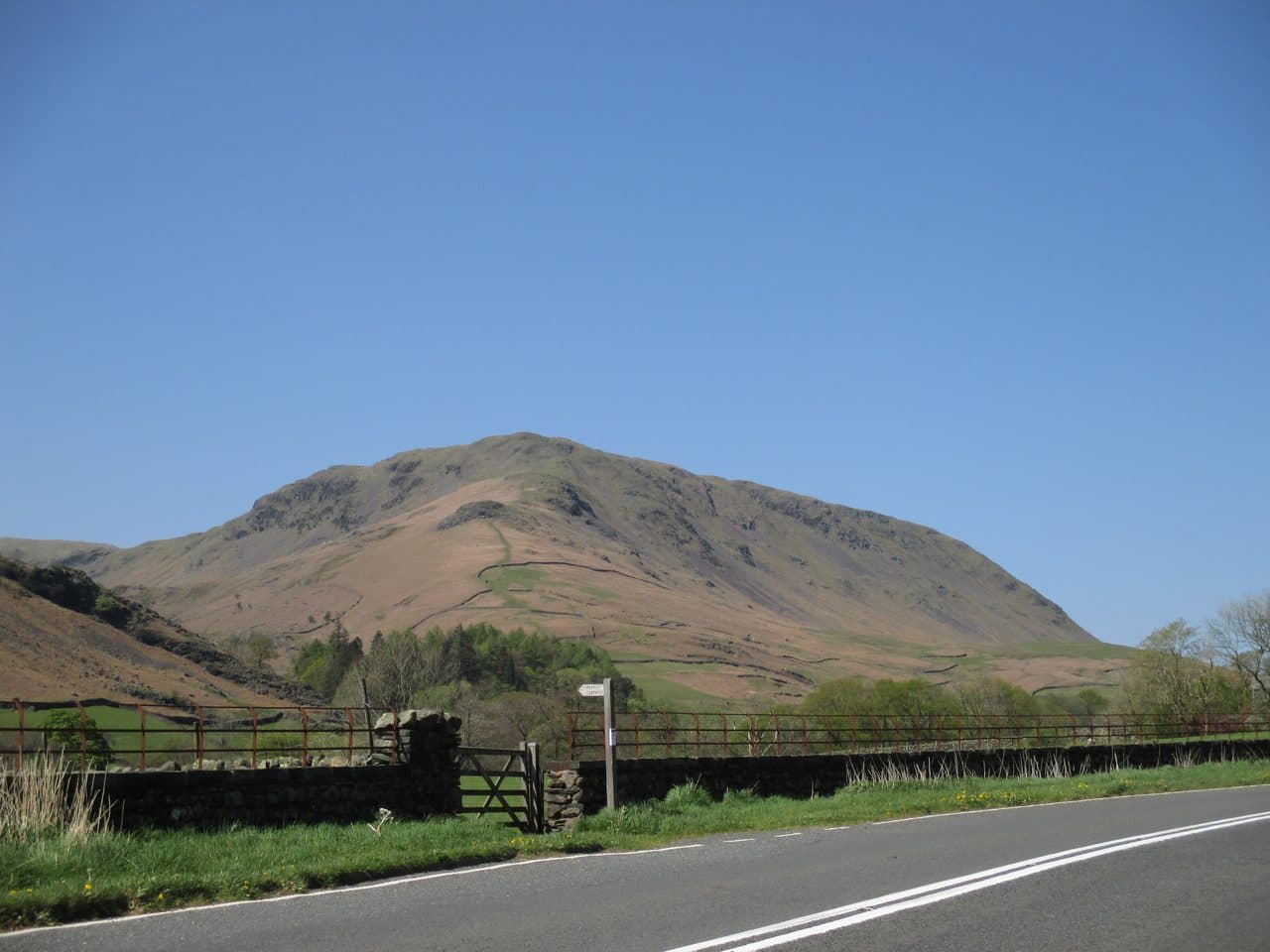
Photo: Antiquary via Wikimedia Commons
About Steel Fell
A triangular fell at the head of the Grasmere valley, between Thirlmere and Dunmail Raise. Grassy ridges lead to a plateau dotted with small tarns, with views north to Blencathra and south west to the Coniston Fells. Often the first top of the Greenburn round.
The main north to south watershed of the Lake District runs over Steel Fell. Its southern slopes drain to Morecambe Bay, and the north side drains through Thirlmere to the River Derwent.
The fell is a rough triangle with three ridges. The most popular way up is the south east ridge from Gill Foot, where the lane out of Grasmere crosses Green Burn, and Grasmere's pay and display car parks are the place to leave a car. From the head of Thirlmere, the United Utilities car park at Steel End puts you at the foot of the north ridge, a steep grassy trudge with Thirlmere opening out behind you. There are also direct lines up the eastern face from the top of Dunmail Raise.
The ridges are grass, steep in places, with no rock to deal with. The summit plateau, about half a mile across, is dotted with small tarns and wet hollows, and the ground west towards Calf Crag is very boggy in any season.
The summit, named Dead Pike, has a large cairn of reddish stone with bits of old fence post stuck in it. North, over Thirlmere, you see Blencathra and Skiddaw. East is the Helvellyn range with Dollywaggon Pike and Seat Sandal, and to the south west a line of mountains runs as far as the Coniston Fells. Across the Wyth Burn valley stand Ullscarf and Nab Crags.
Steel Fell is usually the first top of the Greenburn Horseshoe from Grasmere, which goes on over Calf Crag, Gibson Knott and Helm Crag and back into the village, about 14 km in all.
In winter
The north ridge from Steel End is a steep grass slope that is heavy going in snow, and the plateau and the crossing to Calf Crag are full of tarns and bog that are easiest when frozen solid. In mist, the knolls between here and Calf Crag make the line hard to hold.
- Great Views
- Family Walk
- Kid Friendly
- Dog Friendly
- Summit Tarn
Sources: Wikipedia: Steel Fell, Wainwright Walking: Steel Fell, Walk Lakes: Steel Fell, Calf Crag, Gibson Knott and Helm Crag. Updated .
Summit
- OS grid ref
- NY 319 111
- Latitude
- 54.49114° N
- Longitude
- 3.05216° W
- Area
- Central Fells
Walking up Steel Fell
The nearest car park on foot is Steel End Car Park, 2.2 km (1.4 miles) from the summit along mapped paths. Directions to the car park
Route from Steel End Car Park
- Distance
- 2.2 km
- 1.4 miles, one way
- Ascent
- 359 m
- Total climb to the summit
- Time up
- 1 h 1 min
- Allow 1 to 2 hours
Times use Naismith’s rule, 5 km/h on the flat plus extra time for the climb, with Langmuir’s corrections. It’s a rule of thumb for the way up only, so add stops, weather and the walk back down.
The route follows paths mapped by OpenStreetMap contributors and isn’t a guided line. Check the mountain forecast before you go and carry a map and compass.
Steel Fell questions
Is Steel Fell a Wainwright?
How high is Steel Fell?
Where do you park for Steel Fell?
How long does it take to climb Steel Fell?
How hard is Steel Fell?
Which Wainwrights are near Steel Fell?
What is the grid reference for the summit of Steel Fell?
Often walked with Steel Fell
Fells people usually take in on the same day.
Steel Fell in our guides
Wainwrights near Steel Fell
Straight-line distance and direction from the summit.
 Gibson Knott420 m1.2 km S
 Calf Crag537 m1.9 km SW
 Helm Crag405 m1.9 km S
 Tarn Crag [Easedale]551 m2.4 km SW
 Seat Sandal737 m2.5 km E
 Ullscarf726 m3.0 km W
More in the Central Fells
- High Raise [Langdale]762 m
- Harrison Stickle736 m
- Sergeant Man736 m
- Ullscarf726 m
- Thunacar Knott723 m
- Pike o'Stickle708 m
- Pavey Ark700 m
- Loft Crag682 m
- High Seat608 m
- Bleaberry Fell590 m
- Sergeant's Crag571 m
- Blea Rigg556 m
- Tarn Crag [Easedale]551 m
- Calf Crag537 m
- Eagle Crag525 m
- High Tove515 m
- Armboth Fell475 m
- Raven Crag461 m
- Great Crag449 m
- Gibson Knott420 m
- Grange Fell (Brund Fell)417 m
- Helm Crag405 m
- Silver How395 m
- Walla Crag379 m
- High Rigg357 m
- Loughrigg Fell335 m
Bag Steel Fell with Upfell
Reach the summit and capture Steel Fell, even with no signal. It goes on your round of the 214 with its own patch.
Coming soon to theApp Store