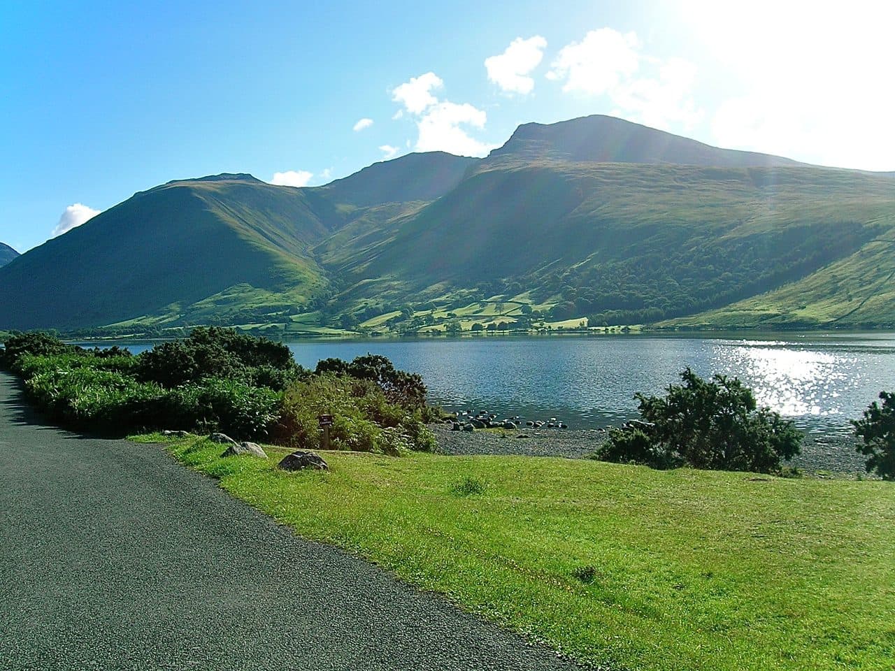
Some Wainwrights are fine in any weather. Others are wonderful on a clear, calm day and a real problem in wind, rain or cloud. The fells here fall into three groups: those with edges and rakes where you use your hands, high rough tops where it is easy to go wrong when you can't see, and summits with crags right beside the path. None of them is off limits. Save them for a good forecast, and have a low fell ready for the days when the tops are out.
These fells make up a collection of their own in the Upfell app, so you can see at a glance which of your remaining Wainwrights need a clear day.
Fells to save for a clear, calm day
| Rank | Fell | Height | Area | Difficulty |
|---|---|---|---|---|
| 1 | Scafell PikeSouthern Fells | 978 m | Southern Fells | Difficult |
| 2 | ScafellSouthern Fells | 964 m | Southern Fells | Difficult |
| 3 | HelvellynEastern Fells | 950 m | Eastern Fells | Difficult |
| 6 | BowfellSouthern Fells | 903 m | Southern Fells | Difficult |
| 7 | Great GableWestern Fells | 899 m | Western Fells | Difficult |
| 8 | PillarWestern Fells | 892 m | Western Fells | Difficult |
| 9 | Nethermost PikeEastern Fells | 891 m | Eastern Fells | Moderate |
| 10 | CatstycamEastern Fells | 890 m | Eastern Fells | Moderate |
| 11 | Esk PikeSouthern Fells | 885 m | Southern Fells | Difficult |
| 14 | BlencathraNorthern Fells | 868 m | Northern Fells | Difficult |
| =17 | Crinkle Crags (Long Top)Southern Fells | 859 m | Southern Fells | Difficult |
| 20 | GrasmoorNorth Western Fells | 852 m | North Western Fells | Difficult |
| =22 | Scoat FellWestern Fells | 841 m | Western Fells | Difficult |
| 26 | Red Pike [Wasdale]Western Fells | 826 m | Western Fells | Difficult |
| 28 | SteepleWestern Fells | 819 m | Western Fells | Difficult |
| 30 | High StileWestern Fells | 806 m | Western Fells | Difficult |
| =31 | High Raise [Martindale]Far Eastern Fells | 802 m | Far Eastern Fells | Moderate |
| 36 | HaycockWestern Fells | 797 m | Western Fells | Difficult |
| 40 | Grisedale PikeNorth Western Fells | 791 m | North Western Fells | Difficult |
| =42 | Allen CragsSouthern Fells | 785 m | Southern Fells | Difficult |
| 45 | GlaramaraSouthern Fells | 783 m | Southern Fells | Difficult |
| 60 | Ill BellFar Eastern Fells | 757 m | Far Eastern Fells | Moderate |
| 62 | Red Pike [Buttermere]Western Fells | 755 m | Western Fells | Difficult |
| 65 | High CragWestern Fells | 744 m | Western Fells | Difficult |
| =69 | Harrison StickleCentral Fells | 736 m | Central Fells | Difficult |
| 86 | Pike o'BliscoSouthern Fells | 705 m | Southern Fells | Difficult |
| 89 | Pavey ArkCentral Fells | 700 m | Central Fells | Moderate |
| 116 | Fleetwith PikeWestern Fells | 649 m | Western Fells | Difficult |
| 123 | YewbarrowWestern Fells | 627 m | Western Fells | Difficult |
| 143 | Angletarn PikesFar Eastern Fells | 567 m | Far Eastern Fells | Moderate |
| 160 | Eagle CragCentral Fells | 525 m | Central Fells | Difficult |
| 168 | Mellbreak (south top)Western Fells | 512 m | Western Fells | Moderate |
| =170 | Beda Fell (Beda Head)Far Eastern Fells | 509 m | Far Eastern Fells | Moderate |
| 176 | Green CragSouthern Fells | 489 m | Southern Fells | Moderate |
| 201 | Helm CragCentral Fells | 405 m | Central Fells | Moderate |
Where the rescue teams are busiest
Mountain Rescue England and Wales and Ordnance Survey published a map of 2025 callouts that showed the largest clusters around Helvellyn and Scafell Pike. A spokesperson for the Lake District Search and Mountain Rescue Association (LDSAMRA) told the Whitehaven News that on Scafell Pike many people "just can't find their way back down again", while Helvellyn "probably has more actual accidents with people falling". Those are the two kinds of trouble this page is about: getting lost in cloud, and falling from steep ground.
Weather on the tops is not the weather in the valley. Wasdale Mountain Rescue warns that strong winds, severe windchill and even snow are possible on Scafell Pike all year, and that the summit is likely to be 5 to 10 degrees colder than the valley.
Edges and rakes
These are the routes where wind, wet rock or ice changes everything. LDSAMRA and AdventureSmart list most of them as local hotspots.
- Helvellyn by Striding Edge. An exposed ridge with no easy way off. Near the end you either climb down about 4 to 5 m or take a lower path to the left, and AdventureSmart warns that any accident at that point could prove fatal. In winter it becomes a winter climbing route that needs an ice axe and crampons.
- Catstycam and Helvellyn by Swirral Edge. Slightly shorter than Striding Edge, with no bad step, but just as exposed. Cornices can build where it meets the summit plateau.
- Blencathra by Sharp Edge. Few problems for experienced walkers in the dry, but AdventureSmart says it becomes slippery and dangerous in wet, windy or winter conditions and can stay that way for several days after rain.
- Pavey Ark by Jack's Rake. Wet for most of the year, with crumbly rock and a queue on busy days. AdventureSmart advises a helmet and a ten to fifteen minute gap behind the group in front, and warns walkers off the grassy ledges to the left.
- Crinkle Crags. The Bad Step is easy to avoid by the bypass on the left, but the summit ridge is bare rock with a path marked only by cairns. In mist people have headed off towards Rest Ghyll and the steep ground above it.
- Yewbarrow. Stirrup Crag and the gully below Great Door are Grade 1 scrambles, and WalkLakes recommends its side path round the crags in poor weather.
The Wainwright scrambles guide grades each route and gives the walkers' way round.
High tops that are hard in cloud
On these fells the danger is navigation. The ground is rough, the paths fade, and big drops sit close to the obvious way off.
- Scafell Pike. There are three routes off the summit, and Wasdale Mountain Rescue says that in bad weather you will need a map and compass and the ability to use them to find your way down. If you reach Mickledore, the col with the stretcher box, face the cliff: Wasdale is down to your right and Eskdale down to your left. Avoid Piers Gill, the deep ravine beside the Corridor Route. Don't try to walk down its stream bed, and don't expect phone signal around it.
- Great Gable. In mist the summit is a sea of stones between Gable Crag and the Napes cliffs. Take a bearing before you leave the top.
- Esk Pike and Allen Crags. Esk Hause and Ore Gap are high, broad cols where several paths meet, and the haematite in the ground at Ore Gap can upset a compass.
- Bowfell and Glaramara. Bowfell's top is a pile of boulders with gaps that snow hides. Glaramara's ridge south to Allen Crags is knolly and easy to lose in snow or mist.
- Grasmoor. A huge rounded plateau where the summit shelter only appears when you are a few metres from it.
- Scoat Fell, Haycock and Pillar. Broad stony tops a long way from any road. In cloud, the Ennerdale wall along the ridge is your handrail.
Crags beside the path
Here the path is clear enough, but the edge is close. In cloud or a strong wind, stay well back.
- Red Pike (Wasdale). The summit cairn stands right on the edge of the Mosedale crags.
- Red Pike (Buttermere), High Stile and High Crag. Red Pike is sheer on three sides, and along the ridge the path keeps close to the top of the crags above Birkness Comb. Follow the old fence posts.
- Grisedale Pike. The whole east ridge takes the full force of a westerly, and the summit drops steeply towards Hobcarton Crag.
- Nethermost Pike. The highest point sits close to the drop into Nethermost Cove.
- Harrison Stickle and Pike o' Blisco. Harrison Stickle's south and east faces are sheer crag, and Pike o' Blisco's top falls away steeply on every side. Come off the way you know rather than look for a shortcut.
- Eagle Crag. Never come down the front, because the crags below can't be seen from above.
- Mellbreak and Fleetwith Pike. Loose scree and rocky steps on the usual lines. For Fleetwith, the approach from Honister over Black Star is gentler than the edge.
Where to go instead
On a day of low cloud or high wind, drop your plans for the tops and pick a low fell with a clear path. All of these start near a valley road, most are on a bus route, and each is under two and a half hours of walking by WalkLakes' minimum times. The winter Wainwrights guide has times for each.
Low fells for a poor forecast


If you want a bigger fell on a middling day, choose the gentler route. Walk up Helvellyn from Swirls, Blencathra by Scales Fell or Blease Fell, and Scafell Pike by the Wasdale path, which Wasdale Mountain Rescue recommends as the shortest. Skiddaw's tourist path from Gale Road is wide and easy to follow even in thick mist.
Before you go
- Check the Mountain Weather Information Service (MWIS) forecast for wind speed, cloud base and freezing level on the tops.
- In winter, read the fell top assessors' report. From about December to March a small National Park team climbs Helvellyn to check conditions, and their top tip is simple: if in doubt, turn back.
- Carry what Wasdale Mountain Rescue lists: warm clothing, waterproofs, good boots, food and drink, map, compass, torch, whistle, and a survival bag or bivi tent.
- Make sure someone in the group is actually navigating, and agree a time to turn back.
- If something goes wrong, dial 999 or 112, ask for the police, then mountain rescue, and stay where you are until the team contacts you, as Mountain Rescue England and Wales advises.
For quieter fells that are still safe in mixed weather, see the quiet Wainwrights. The most popular Wainwrights guide covers several of the fells on this page with quieter routes. The town guides for Glenridding and Patterdale, Wasdale and Borrowdale list the low walks from each base.