Northern Fells · Book 5
Latrigg
Latrigg is a Wainwright, one of the 214 Lake District fells in Alfred Wainwright’s Pictorial Guides. At 368 m (1,207 ft) it is the 206th highest of the 214 and the lowest in the Northern Fells.
- Height
- 368 m
- 1,207 ft
- Rank
- 206
- of 214
- In area
- 24
- of 24
- Difficulty
- Easy
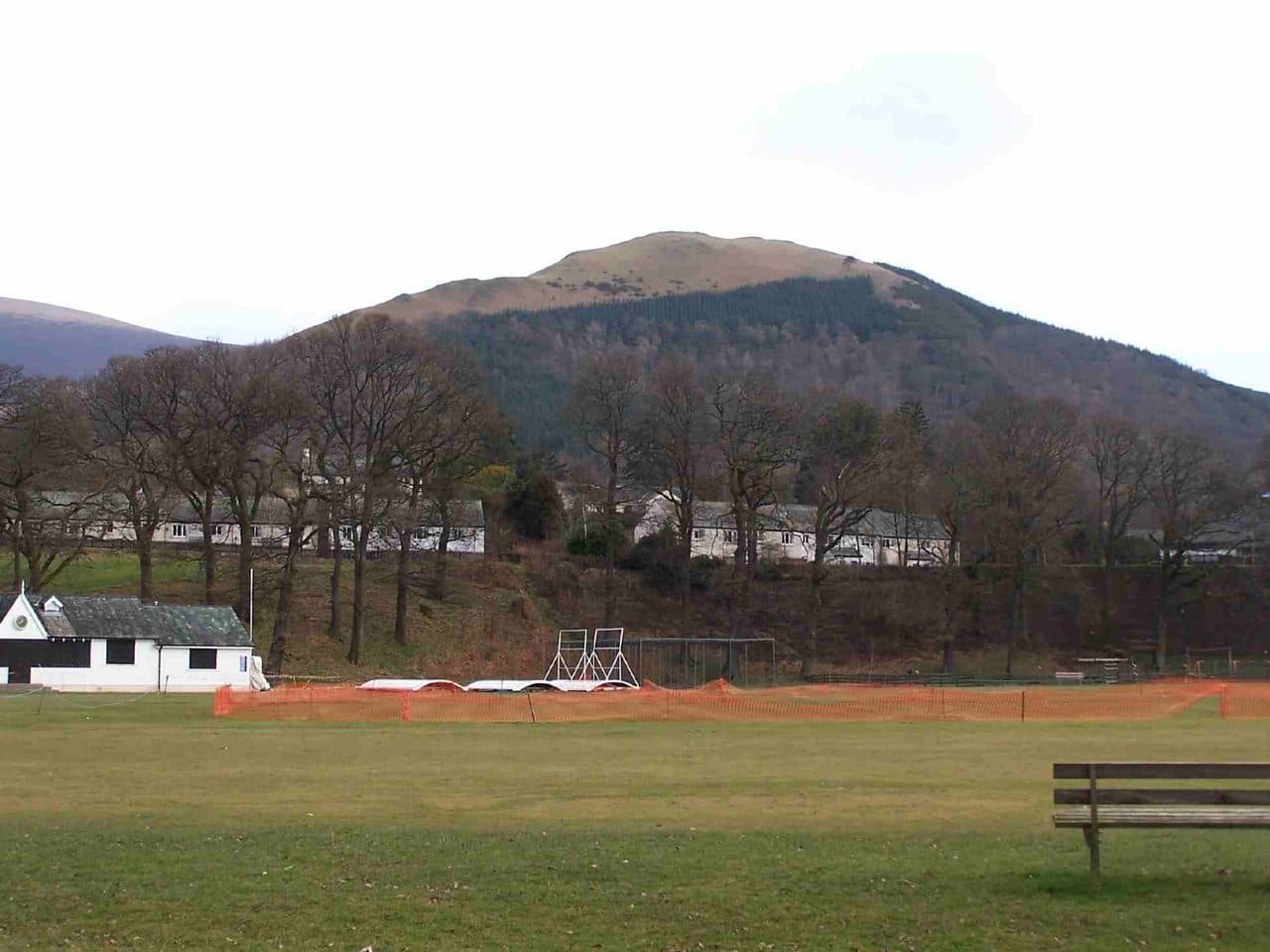
Photo: Mick Knapton via Wikimedia Commons
About Latrigg
Keswick's local hill and a favourite for sunrise jogs and family strolls. The grassy summit ridge serves up a classic panorama of Derwentwater and Borrowdale. Access paths are friendly, but it can be breezy on top.
You can walk up Latrigg from Keswick without touching the car. The usual line goes through Fitz Park, past the old railway station and up Spooney Green Lane, the bridleway signed for Skiddaw, which crosses the A66 on a bridge. Above the bypass the path zigzags up through a conifer plantation. The steepest pull lasts about half a kilometre, then the gradient eases onto open grass.
For a short outing, drive past Applethwaite towards Underscar and on to the free car park at the end of Gale Road (roughly 15 spaces, postcode CA12 4PQ). It is already at about 280m, so the summit is only a few minutes' stroll on grass, and a surfaced path for limited mobility runs out to the viewpoint. Gale Road is also the start of the main path up Skiddaw, which is why it fills early on fine weekends. A quieter approach comes in from Threlkeld, crossing Glenderaterra Beck and following the long east ridge.
Underfoot there is a stony bridleway, a plantation path that gets muddy after rain, and then sheep-cropped turf. There is no scrambling and no exposure anywhere.
The summit is a grassy ridge rather than a peak. The steep south face is what makes it: Keswick sits directly below, with Derwentwater running down to Borrowdale and the central fells stacked up behind. Bassenthwaite Lake is off to the west, and Skiddaw and Blencathra fill the view north and east. The bench is on the best viewpoint, a little short of the highest point.
Near the top is a wind-bent tree known as The Witch, which from the right angle looks like a figure riding a broomstick.
In winter
Latrigg is a good fallback when the higher tops are in cloud or snow, but the zigzags through the plantation on the Keswick side churn to mud and can ice over. The grass edge above the town is steep enough to be awkward when frozen, so keep to the path.
- Great Views
- Popular
- Kid Friendly
- Family Walk
- Dog Friendly
Sources: Wikipedia: Latrigg, Keswick Tourism Association: Latrigg walking route, Hiking Photographer: Latrigg walk and where to park. Updated .
Summit
- OS grid ref
- NY 279 246
- Latitude
- 54.61228° N
- Longitude
- 3.11754° W
- Area
- Northern Fells
Walking up Latrigg
The nearest car park on foot is Crosthwaite Road Car Park, 2.3 km (1.4 miles) from the summit along mapped paths. Directions to the car park
Route from Crosthwaite Road Car Park
- Distance
- 2.3 km
- 1.4 miles, one way
- Ascent
- 287 m
- Total climb to the summit
- Time up
- 54 min
- Allow 1 to 2 hours
Times use Naismith’s rule, 5 km/h on the flat plus extra time for the climb, with Langmuir’s corrections. It’s a rule of thumb for the way up only, so add stops, weather and the walk back down.
The route follows paths mapped by OpenStreetMap contributors and isn’t a guided line. This car park was picked automatically and hasn’t been checked by hand yet, so compare it with a map. Check the mountain forecast before you go and carry a map and compass.
Latrigg questions
Is Latrigg a Wainwright?
How high is Latrigg?
Where do you park for Latrigg?
How long does it take to climb Latrigg?
How hard is Latrigg?
Which Wainwrights are near Latrigg?
What is the grid reference for the summit of Latrigg?
Often walked with Latrigg
Fells people usually take in on the same day.
Latrigg in our guides
- Doing the Wainwrights together: couples, clubs and dogs
- The easiest Wainwrights: where to start
- Wainwrights for beginners: a first-timer's guide
- Wainwrights for kids: easy fells for children
- Wainwrights from Keswick
- Wainwrights to avoid in bad weather, and where to go instead
- Wainwrights with the best views
- Winter Wainwrights: fells you can still reach when the passes shut
Wainwrights near Latrigg
Straight-line distance and direction from the summit.
 Lonscale Fell715 m2.5 km N
 Skiddaw Little Man865 m3.3 km NW
 Walla Crag379 m3.4 km S
 High Rigg357 m4.0 km SE
 Carl Side746 m4.2 km NW
 Dodd502 m4.4 km NW
More in the Northern Fells
- Skiddaw931 m
- Blencathra868 m
- Skiddaw Little Man865 m
- Carl Side746 m
- Long Side734 m
- Lonscale Fell715 m
- Knott710 m
- Bowscale Fell702 m
- Great Calva690 m
- Ullock Pike690 m
- Bannerdale Crags683 m
- Bakestall673 m
- Carrock Fell663 m
- High Pike [Caldbeck]658 m
- Great Sca Fell651 m
- Mungrisdale Common633 m
- Brae Fell586 m
- Meal Fell550 m
- Great Cockup526 m
- Souther Fell522 m
- Dodd502 m
- Longlands Fell483 m
- Binsey447 m
Bag Latrigg with Upfell
Reach the summit and capture Latrigg, even with no signal. It goes on your round of the 214 with its own patch.
Coming soon to theApp Store