Northern Fells · Book 5
Longlands Fell
Longlands Fell is a Wainwright, one of the 214 Lake District fells in Alfred Wainwright’s Pictorial Guides. At 483 m (1,585 ft) it is the joint 179th highest of the 214 and the 22nd highest in the Northern Fells.
- Height
- 483 m
- 1,585 ft
- Rank
- =179
- of 214
- In area
- 22
- of 24
- Difficulty
- Moderate
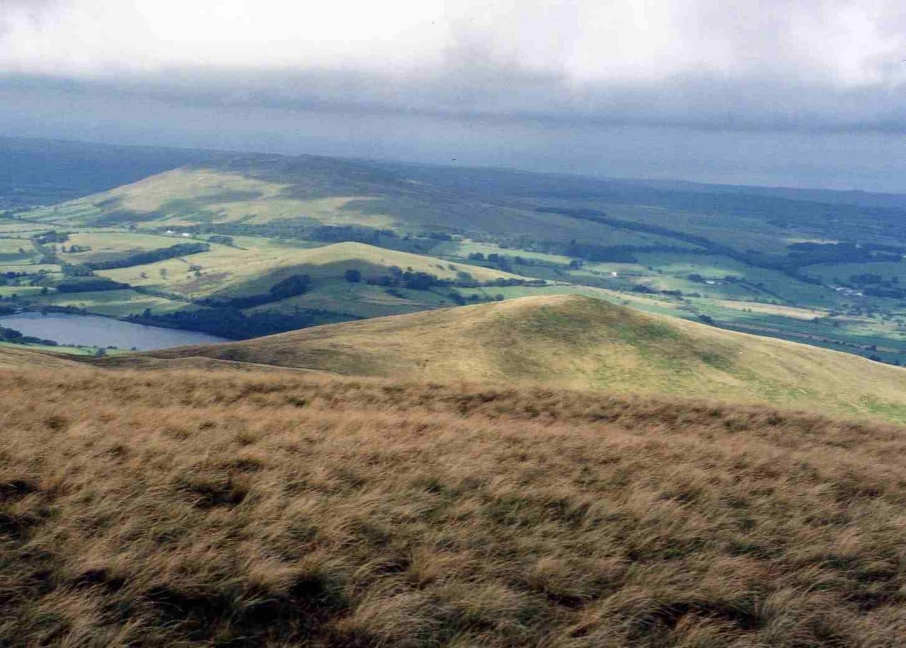
Photo: Mick Knapton via Wikimedia Commons
About Longlands Fell
A gentle northern gateway to the Uldale Fells. Broad, grassy slopes and easy paths give a relaxed outing with sweeping Blencathra and Skiddaw views. Often used as a rolling circuit with Meal Fell and Great Cockup.
Together with Binsey, Longlands Fell is one of the two most northerly fells in the Lake District. Its smooth grass slopes fall gently to the lowlands, and it is the natural first top on a round of the Uldale Fells.
The hamlet of Longlands, a few houses on the minor road north of Skiddaw, is the start. Space there is tight, with informal room for about four cars by the gate signed for Green Head and the Cumbria Way. Overwater, to the west, has easier parking if you do not mind some road walking. The track through the gate runs along the foot of the fell and is part of the Cumbria Way's low level route. Leave it to cross a beck and climb steeply through bracken to the summit cairn.
From the top most people go on. Walk Lakes crosses a boggy dip to Lowthwaite Fell, then goes through tussocks to Brae Fell and returns down Charleton Gill, 7 km with 450 metres of climbing. A 2.5 km ridge leads the other way to Great Sca Fell.
It is grass all the way, soft in places, with no rock at all. Paths get faint beyond the summit, so the map matters more than the gradient.
North of the summit cairn the view reaches the Solway Firth and the hills of Galloway. To the south you see Skiddaw and the fells around Whinlatter.
Someone tried to mine copper here in the second half of the 1800s, but the mine never paid and closed. One of its old levels now supplies water to Uldale. On Aughtertree Fell, close by, there are traces of settlement going back about 3,000 years.
In winter
The slopes are short and grassy with no crags, but the boggy dip towards Lowthwaite Fell and the faint paths beyond are easy to lose in snow or cloud. Walk Lakes does not recommend going on to Brae Fell in poor visibility.
- Great Views
- Quiet & Remote
- Dog Friendly
Sources: Wikipedia: Longlands Fell, Walk Lakes: Longlands, Lowthwaite and Brae Fells. Updated .
Summit
- OS grid ref
- NY 275 354
- Latitude
- 54.70839° N
- Longitude
- 3.12529° W
- Area
- Northern Fells
Walking up Longlands Fell
The nearest car park on foot is Sun Inn Parking, 6.8 km (4.2 miles) from the summit along mapped paths. Directions to the car park
Route from Sun Inn Parking
- Distance
- 6.8 km
- 4.2 miles, one way
- Ascent
- 471 m
- Total climb to the summit
- Time up
- 2 h 5 min
- Allow 1 to 3 hours
Times use Naismith’s rule, 5 km/h on the flat plus extra time for the climb, with Langmuir’s corrections. It’s a rule of thumb for the way up only, so add stops, weather and the walk back down.
The route follows paths mapped by OpenStreetMap contributors and isn’t a guided line. Check the mountain forecast before you go and carry a map and compass.
Longlands Fell questions
Is Longlands Fell a Wainwright?
How high is Longlands Fell?
Where do you park for Longlands Fell?
How long does it take to climb Longlands Fell?
How hard is Longlands Fell?
Which Wainwrights are near Longlands Fell?
What is the grid reference for the summit of Longlands Fell?
Often walked with Longlands Fell
Fells people usually take in on the same day.
Longlands Fell in our guides
Wainwrights near Longlands Fell
Straight-line distance and direction from the summit.
 Brae Fell586 m1.3 km E
 Meal Fell550 m1.8 km S
 Great Cockup526 m2.1 km S
 Great Sca Fell651 m2.1 km SE
 Knott710 m3.1 km SE
 High Pike [Caldbeck]658 m4.3 km E
More in the Northern Fells
- Skiddaw931 m
- Blencathra868 m
- Skiddaw Little Man865 m
- Carl Side746 m
- Long Side734 m
- Lonscale Fell715 m
- Knott710 m
- Bowscale Fell702 m
- Great Calva690 m
- Ullock Pike690 m
- Bannerdale Crags683 m
- Bakestall673 m
- Carrock Fell663 m
- High Pike [Caldbeck]658 m
- Great Sca Fell651 m
- Mungrisdale Common633 m
- Brae Fell586 m
- Meal Fell550 m
- Great Cockup526 m
- Souther Fell522 m
- Dodd502 m
- Binsey447 m
- Latrigg368 m
Bag Longlands Fell with Upfell
Reach the summit and capture Longlands Fell, even with no signal. It goes on your round of the 214 with its own patch.
Coming soon to theApp Store