Far Eastern Fells · Book 2
Sour Howes
Sour Howes is a Wainwright, one of the 214 Lake District fells in Alfred Wainwright’s Pictorial Guides. At 483 m (1,585 ft) it is the joint 179th highest of the 214 and the 33rd highest in the Far Eastern Fells.
- Height
- 483 m
- 1,585 ft
- Rank
- =179
- of 214
- In area
- 33
- of 36
- Difficulty
- Easy
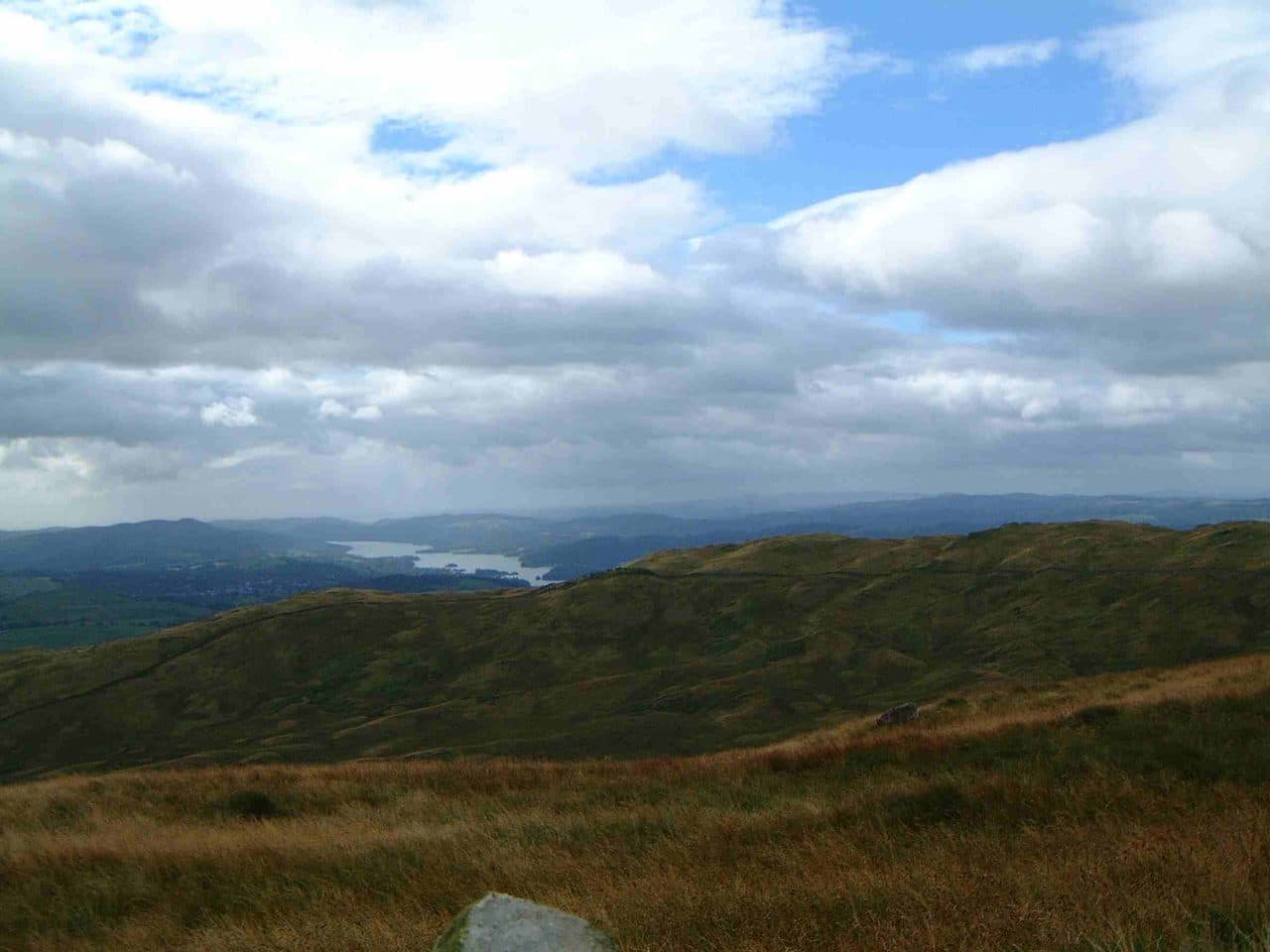
Photo: Mick Knapton via Wikimedia Commons
About Sour Howes
Low, lumpy and lovely above Troutbeck. Undulating turf leads to a crest with fine panoramas over Windermere and the Far Eastern skyline. Pairs naturally with Sallows and Wansfell for a fluid half-day ridge walk.
The western flank of Sour Howes drops steeply to the Troutbeck valley, and Troutbeck village is the place to start. Leave the village on the Garburn Road, the stony track that climbs towards Garburn Pass. Turn off it by Backstone Barrow and climb to the top. Or follow the track to the top of the pass, then turn south along the dry stone wall that links Sallows to Sour Howes. A round over both tops and back down the Garburn Road is about 9 km. From Kentmere there is a longer circuit that starts at Ullthwaite Bridge and comes up by Capple Howe, the fell's lower south eastern top.
Most of the fell is grass, with heather on the eastern slopes, which fall gently to Kentmere. Some of the ground along the wall is tussocky and boggy. There is no scrambling anywhere.
The summit is a cluster of knolls, and a pile of stones marks the highest one. The view is better than the height suggests. The high fells line up to the west, Windermere lies to the south, and on a clear day you can see out to Morecambe Bay.
Lower down the western slope is the old Applethwaite quarry, now disused and wooded over, and the Dubbs Road bridleway crosses that side of the fell. On the heather to the east are lines of grouse butts.
In winter
The route is low and grassy with no exposure, but the wall line between Sour Howes and Sallows gets boggy and tussocky, and the Garburn Road holds ice in its stony ruts. A good choice when the higher Kentmere fells are in cloud.
- Ridge Walk
- Great Views
- Dog Friendly
Sources: Wikipedia: Sour Howes, go4awalk: Walks up Sour Howes. Updated .
Summit
- OS grid ref
- NY 428 031
- Latitude
- 54.42099° N
- Longitude
- 2.88254° W
Walking up Sour Howes
The nearest car park on foot is Sixth Form Car Park, 4.7 km (2.9 miles) from the summit along mapped paths. Directions to the car park
Route from Sixth Form Car Park
- Distance
- 4.7 km
- 2.9 miles, one way
- Ascent
- 389 m
- Total climb to the summit
- Time up
- 1 h 33 min
- Allow 1 to 2 hours
Times use Naismith’s rule, 5 km/h on the flat plus extra time for the climb, with Langmuir’s corrections. It’s a rule of thumb for the way up only, so add stops, weather and the walk back down.
The route follows paths mapped by OpenStreetMap contributors and isn’t a guided line. Check the mountain forecast before you go and carry a map and compass.
Sour Howes questions
Is Sour Howes a Wainwright?
How high is Sour Howes?
Where do you park for Sour Howes?
How long does it take to climb Sour Howes?
How hard is Sour Howes?
Which Wainwrights are near Sour Howes?
What is the grid reference for the summit of Sour Howes?
Often walked with Sour Howes
Fells people usually take in on the same day.
Sour Howes in our guides
Wainwrights near Sour Howes
Straight-line distance and direction from the summit.
 Sallows516 m1.1 km NE
 Wansfell (Baystones)487 m3.2 km NW
 Troutbeck Tongue364 m3.2 km N
 Yoke706 m3.7 km N
 Ill Bell757 m4.6 km N
 Shipman Knotts587 m5.4 km NE
More in the Far Eastern Fells
- High Street828 m
- High Raise [Martindale]802 m
- Rampsgill Head792 m
- Thornthwaite Crag784 m
- Kidsty Pike780 m
- Harter Fell [Mardale]779 m
- Caudale Moor (Stony Cove Pike)763 m
- Mardale Ill Bell760 m
- Ill Bell757 m
- The Knott739 m
- Kentmere Pike730 m
- Froswick720 m
- Branstree713 m
- Yoke706 m
- Gray Crag699 m
- Rest Dodd696 m
- Wether Hill673 m
- Loadpot Hill671 m
- Tarn Crag [Longsleddale]664 m
- Place Fell657 m
- Selside Pike655 m
- Grey Crag638 m
- Hartsop Dodd618 m
- Shipman Knotts587 m
- The Nab576 m
- Angletarn Pikes567 m
- Brock Crags561 m
- Arthur's Pike533 m
- Bonscale Pike524 m
- Sallows516 m
- Beda Fell (Beda Head)509 m
- Wansfell (Baystones)487 m
- Steel Knotts (Pikeawassa)432 m
- Hallin Fell388 m
- Troutbeck Tongue364 m
Bag Sour Howes with Upfell
Reach the summit and capture Sour Howes, even with no signal. It goes on your round of the 214 with its own patch.
Coming soon to theApp Store