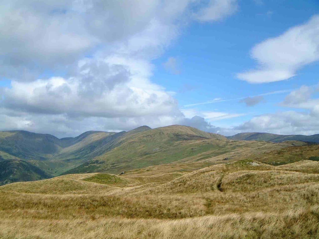
The Kentmere Horseshoe is the round of high fells around Kentmere Reservoir, and it bags eight Wainwrights: Yoke, Ill Bell, Froswick, Thornthwaite Crag, Mardale Ill Bell, Harter Fell, Kentmere Pike and Shipman Knotts. A short detour adds High Street, at 828 m the highest of the Far Eastern Fells, for nine.
The WalkLakes route goes clockwise from Kentmere village and measures 20.7 km with 1,085 m of ascent. Its minimum walking time is 5 hours 57 minutes, and that is moving time only. Wikipedia gives Wainwright's Kentmere Round as 12 miles (19 km). It is a longer day than the Fairfield Horseshoe, on rougher and quieter ground, with some indistinct paths where WalkLakes expects map and compass skills.
The Kentmere Horseshoe, clockwise, with High Street
| Rank | Fell | Height | Area | Difficulty |
|---|---|---|---|---|
| 85 | YokeFar Eastern Fells | 706 m | Far Eastern Fells | Moderate |
| 60 | Ill BellFar Eastern Fells | 757 m | Far Eastern Fells | Moderate |
| 77 | FroswickFar Eastern Fells | 720 m | Far Eastern Fells | Moderate |
| 44 | Thornthwaite CragFar Eastern Fells | 784 m | Far Eastern Fells | Moderate |
| 25 | High StreetFar Eastern Fells | 828 m | Far Eastern Fells | Moderate |
| 59 | Mardale Ill BellFar Eastern Fells | 760 m | Far Eastern Fells | Moderate |
| 47 | Harter Fell [Mardale]Far Eastern Fells | 779 m | Far Eastern Fells | Moderate |
| 72 | Kentmere PikeFar Eastern Fells | 730 m | Far Eastern Fells | Easy |
| 133 | Shipman KnottsFar Eastern Fells | 587 m | Far Eastern Fells | Easy |
Where to start and park
Kentmere is a hamlet about four miles north of Staveley, and the only road in comes up the valley from Staveley. Parking is the problem. WalkLakes says there is room for fewer than half a dozen cars beside the village hall (NY 455 041), opposite St Cuthbert's church, with an honesty box. A farmer sometimes opens a field for parking, but you can't count on it. Mud and Routes, which starts from the same place, says it is often full by 8 am.
If Kentmere is full, Troutbeck (NY 412 026) is the other way onto the ridge. The Garburn Road climbs from the village to the top of the Garburn Pass, where you join the horseshoe below Yoke. That gets you the western side but leaves you a long way from Shipman Knotts, so it suits a split round better than the full one.
Clockwise or anticlockwise
Clockwise is the usual direction. Mud and Routes calls its own anticlockwise route the opposite of the more common way, and WalkLakes goes clockwise.
Clockwise, you walk up the lane to The Nook and take the rough track over the Garburn Pass. At the top you turn north along the wall to Yoke, then follow the ridge over Ill Bell and Froswick to the big stone beacon on Thornthwaite Crag, the obvious lunch stop. From there you cross to Mardale Ill Bell, drop to Nan Bield Pass and climb Harter Fell, then come south over Kentmere Pike and Shipman Knotts. You finish on the descent by Wray Crag, which is rocky and slippery when wet.
Anticlockwise starts up the track towards Longsleddale and the wall north to Shipman Knotts, and it finishes down the Garburn Pass track. Every summit is on or beside the ridge either way, so for bagging it comes down to which end you would rather walk down.
Adding High Street
WalkLakes leaves High Street out, and its route goes from Thornthwaite Crag straight to Mardale Ill Bell. High Street's summit, with its trig pillar beside the wall, is just north of that line. The Roman road climbs onto the plateau on Thornthwaite Crag's south ridge and swings east around its summit towards High Street. If you are bagging, go over the top. You are unlikely to come this way again just for High Street, and coming back for it from Mardale Head means another full day.
The Mud and Routes version includes High Street. It measures 22.31 km with 1,449 m of ascent and suggests 6 to 8 hours. That is a different measurement from WalkLakes', so don't read the gap as the exact cost of the detour.
The tricky bits
- The Garburn Pass. WalkLakes calls it a very rough track. Cattle graze the pass and the slopes of Yoke all year, so watch for them near Stile End, especially with a dog.
- Rainsborrow Crag. East of Yoke the fell ends in a 300 m drop to the valley floor. Snow can hide the edge.
- Ill Bell to Froswick. WalkLakes flags rocky, awkward ground on Ill Bell's upper slopes and a steep descent through boulders towards Froswick. The Kentmere side of both fells is scree, so stay on the ridge path.
- Nan Bield to Harter Fell. The climb is only about 140 m, but WalkLakes notes it feels harder than it is, because your legs have done a lot by then.
- Kentmere Pike to Shipman Knotts. WalkLakes describes complicated ground of bumps and outcrops that needs careful navigation. The wall along the crest is your handrail in mist, though it zigzags off the ridge in places near Shipman Knotts.
- The length. At over 20 km, this is a lot to cover on a short winter day, and Shipman Knotts often comes late.
Escape routes
- Nan Bield Pass is the main way down mid-round. It was the old trade route between Kentmere and Mardale, and its path drops into the head of the Kentmere valley and back to the village.
- The Garburn Pass is the way off at the start, back down the track to Kentmere, or west to Troutbeck.
- Avoid going straight down the Kentmere flanks of Ill Bell and Froswick. They are scree fans above the reservoir.
Shorter ways to bag the same fells
- The Ill Bell ridge from Troutbeck. Walk up the Garburn Road, take in Sour Howes and Sallows, then cross Yoke, Ill Bell and Froswick and come home by Hagg Gill. That bags five Wainwrights, two of them off the horseshoe.
- Thornthwaite Crag from Hartsop. The WalkLakes Pasture Beck round climbs to Threshthwaite Mouth and the beacon and comes back over Gray Crag. About 10.4 km and 836 m if you include Hartsop Dodd and Stony Cove Pike.
- High Street and Mardale Ill Bell from Mardale Head. Go up Rough Crag and Long Stile to High Street, cross to Mardale Ill Bell, and come down by Nan Bield and Small Water. Harter Fell sits just above Nan Bield if you want a third.
- Kentmere Pike and Shipman Knotts from Longsleddale. Start at Sadgill (NY 483 057) and take the Gatescarth track, or come up from Kentmere by the Longsleddale track and the wall north.
Far Eastern Wainwrights just off the horseshoe



Getting there without a car
There is no bus to Kentmere. The Kentmere Rambler has stopped running, according to WalkLakes, and Mud and Routes says a car will be needed. The nearest public transport is at Staveley:
- The 555 stops at Staveley Abbey Square on its way between Kendal, Windermere, Ambleside and Keswick, about every 30 minutes in the day, in the Stagecoach summer 2026 timetable.
- Staveley station is on the Windermere branch line, with a generally hourly Northern service between Windermere and Oxenholme.
From Staveley it is about four miles up the valley road to Kentmere, and the same back, on top of a 20 km round. A more practical car-free plan is to split the horseshoe and do the western half from Troutbeck. See Wainwrights by bus for rounds that start at a bus stop.
How it fits a Wainwright round
Eight or nine Wainwrights in a day is a big haul, and it clears most of the high ground between Troutbeck and Haweswater. What it leaves are the fells on the edges: Sallows and Sour Howes above Troutbeck, Kidsty Pike and the High Street fells to the north, and the Shap end of the area around Branstree and Selside Pike. The awkward Longsleddale pair, Grey Crag and Tarn Crag, are in our guide to the hardest Wainwrights to bag.
Windermere is the nearest large base, and the Windermere guide covers the fells you can reach from there. For more rounds that string several summits together, see Wainwright ridge walks. Check the Mountain Weather Information Service (MWIS) forecast before you go, and carry a map and compass. Upfell is a free iPhone app that keeps your list of bagged fells for you.