North Western Fells · Book 6
Graystones
Graystones is a Wainwright, one of the 214 Lake District fells in Alfred Wainwright’s Pictorial Guides. At 452 m (1,483 ft) it is the 188th highest of the 214 and the 24th highest in the North Western Fells.
- Height
- 452 m
- 1,483 ft
- Rank
- 188
- of 214
- In area
- 24
- of 29
- Difficulty
- Moderate
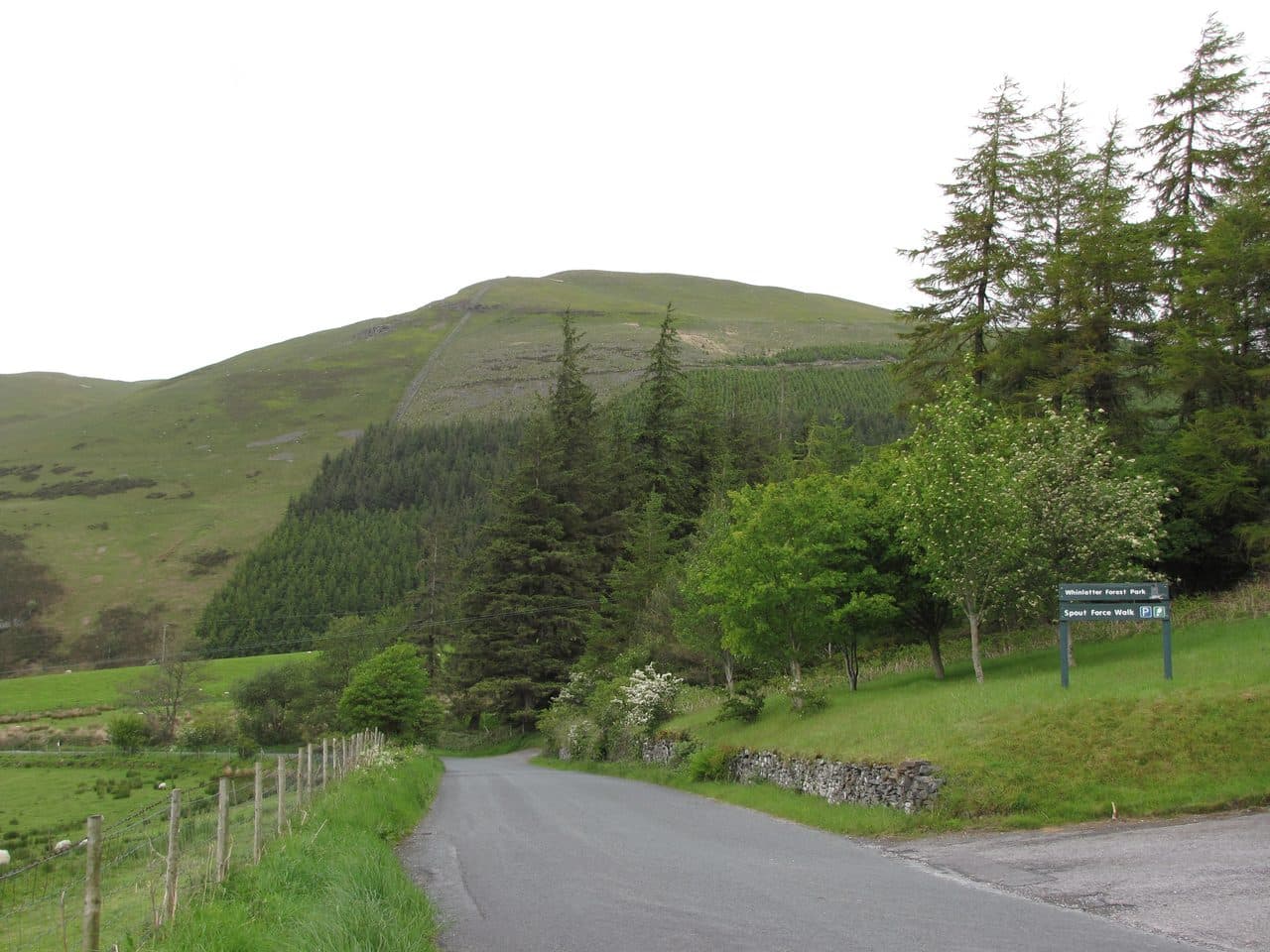
Photo: Mick Knapton via Wikimedia Commons
About Graystones
A two‑topped North Western outlier over the Embleton valley. Approaches vary from quick and steep to longer heathery ribs, all giving fine views to Lord’s Seat and the Lorton fells. Often linked with Broom Fell and Whinlatter.
The ridge that runs from the Vale of Lorton over Broom Fell and Lord's Seat to Barf begins at Graystones. It has two summits, and people disagree about their names. Wainwright used Graystones for the whole fell and said the hill was properly called Kirk Fell. Some guidebooks, and the OS 1:25,000 map, put Graystones on the eastern top and Kirk Fell on the western one. On the ground the Wainwright top and the Birkett top are separate lumps across a small col, and many baggers visit both.
The shortest way up starts at the Forestry Commission's Scawgill car park on the western side of the Whinlatter Pass road. Drop into the ravine, cross the footbridge, and take a narrow path steeply up through gorse and then grass beside a wall and fence. There is one rocky step, which you can climb or walk round. Above it a broken wall leads to the top. From the north-west you can come up from Armaside over Harrot and the Kirk Fell top, or from the north by Tom Rudd Beck from Embleton. Most walkers carry on over Widow Hause to Broom Fell.
The summit is grass, and its high point is a small upthrust of rock near the end of the wall from Widow Hause. The slopes are too gentle for much of a view. The Loweswater fells and the tops around Coledale Hause are in sight, with glimpses of Skiddaw and Helvellyn and a long line of the Scottish coast.
Conifers of the Darling How plantation cover the south-east flank. Hidden in them is Spout Force, a waterfall on Aiken Beck a few minutes from the car park. It is at its best in winter after rain, when the undergrowth has died back.
In winter
The short climb from Scawgill is steep grass with a rocky step near the top that is slippery when frozen, and a path skirts it to the left. The broad top has little to steer by in mist, so follow the broken wall and fences.
- Great Views
- Family Walk
- Dog Friendly
Sources: Wikipedia: Graystones, Walk Lakes: Graystones, Broom Fell, and Lord's Seat. Updated .
Summit
- OS grid ref
- NY 176 266
- Latitude
- 54.62797° N
- Longitude
- 3.27762° W
Walking up Graystones
The nearest car park on foot is Spout Force Waterfall, 1.1 km (0.7 miles) from the summit along mapped paths. Directions to the car park
Route from Spout Force Waterfall
- Distance
- 1.1 km
- 0.7 miles, one way
- Ascent
- 277 m
- Total climb to the summit
- Time up
- 39 min
- Allow 1 to 2 hours
Times use Naismith’s rule, 5 km/h on the flat plus extra time for the climb, with Langmuir’s corrections. It’s a rule of thumb for the way up only, so add stops, weather and the walk back down.
The route follows paths mapped by OpenStreetMap contributors and isn’t a guided line. Check the mountain forecast before you go and carry a map and compass.
Graystones questions
Is Graystones a Wainwright?
How high is Graystones?
Where do you park for Graystones?
How long does it take to climb Graystones?
How hard is Graystones?
Which Wainwrights are near Graystones?
What is the grid reference for the summit of Graystones?
Often walked with Graystones
Fells people usually take in on the same day.
Wainwrights near Graystones
Straight-line distance and direction from the summit.
 Broom Fell511 m1.9 km E
 Ling Fell373 m2.0 km N
 Whinlatter (Brown How)517 m2.1 km SE
 Lord's Seat552 m2.8 km E
 Sale Fell359 m3.5 km NE
 Barf469 m3.8 km E
More in the North Western Fells
- Grasmoor852 m
- Eel Crag (Crag Hill)839 m
- Grisedale Pike791 m
- Wandope774 m
- Sail773 m
- Hopegill Head770 m
- Dale Head753 m
- Robinson737 m
- Hindscarth727 m
- Whiteside (west top)707 m
- Scar Crags672 m
- Whiteless Pike660 m
- High Spy653 m
- Causey Pike637 m
- Ard Crags581 m
- Maiden Moor575 m
- Outerside568 m
- Knott Rigg556 m
- Lord's Seat552 m
- Whinlatter (Brown How)517 m
- Broom Fell511 m
- Barf469 m
- Barrow455 m
- Catbells451 m
- Ling Fell373 m
- Sale Fell359 m
- Rannerdale Knotts355 m
- Castle Crag290 m
Bag Graystones with Upfell
Reach the summit and capture Graystones, even with no signal. It goes on your round of the 214 with its own patch.
Coming soon to theApp Store