North Western Fells · Book 6
Robinson
Robinson is a Wainwright, one of the 214 Lake District fells in Alfred Wainwright’s Pictorial Guides. At 737 m (2,418 ft) it is the joint 67th highest of the 214 and the 8th highest in the North Western Fells.
- Height
- 737 m
- 2,418 ft
- Rank
- =67
- of 214
- In area
- 8
- of 29
- Difficulty
- Moderate
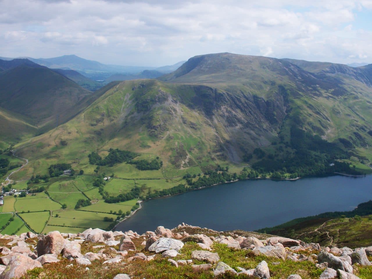
Photo: Bobble Hat via Wikimedia Commons
About Robinson
A bulky wedge closing the Newlands Valley with grassy tops and sudden craggy edges. The ridge from Hindscarth is a joy, with views tumbling to Derwentwater.
From Buttermere, Robinson looks like a bland, rounded hill. From Newlands it looks like another mountain entirely, with Robinson Crags dropping from the summit as if a chunk of the fell had been cut away. Wainwright's account of the name is that a Richard Robinson bought land around Buttermere centuries ago, including this hill, which became Robinson's Fell.
The best line is the north-east ridge from Little Town. Park at Chapel Bridge, where the farmer takes a small fee, walk past Newlands church to Low High Snab and climb steeply through bracken onto High Snab Bank. Higher up, three rock bands cross the ridge, followed by a fourth. In the dry, worn rock shows the way and none of them is exposed, but they need hands and get slippery after rain. Each has a way round, or you can skip them by walking up Little Dale. Walk Lakes' Scope horseshoe returns over Hindscarth and Scope End, 11.3km with 795m of ascent.
From Buttermere village a good path climbs to High Snockrigg, a fine viewpoint over the valley. It then crosses Buttermere Moss, a wide marshy hollow, before a stiff final climb. Newlands Hause saves the most height, going up to the right of Moss Force and over the Moss.
The summit is rounded grass with two low rock outcrops, and the western one carries the cairn. From below, a prominent cairn at the head of the north-east ridge looks like the top, but it is not. Only the Far Eastern Fells are missing from the view.
South of the top are the Hackney Holes. They are now thought to mark the head of the largest rock slope failure in the Lake District, where about 1.3 square kilometres of the Buttermere valley wall has bulged downhill.
In winter
The rock steps on High Snab Bank turn as slick as ice when wet or frozen, and Walk Lakes suggest going up Little Dale instead in those conditions. From Newlands Hause the path fades out on the wide bog of Buttermere Moss, so it needs care in mist.
- Ridge Walk
- Great Views
- Dog Friendly
Sources: Wikipedia: Robinson, Walk Lakes: Robinson and Hindscarth from Little Town, Walk Lakes: Robinson, Hindscarth and Dale Head. Updated .
Summit
- OS grid ref
- NY 201 168
- Latitude
- 54.54080° N
- Longitude
- 3.23526° W
Walking up Robinson
The nearest car park on foot is Gatesgarth Farm, 3.3 km (2.1 miles) from the summit along mapped paths. Directions to the car park
Route from Gatesgarth Farm
- Distance
- 3.3 km
- 2.1 miles, one way
- Ascent
- 636 m
- Total climb to the summit
- Time up
- 1 h 39 min
- Allow 1 to 3 hours
Times use Naismith’s rule, 5 km/h on the flat plus extra time for the climb, with Langmuir’s corrections. It’s a rule of thumb for the way up only, so add stops, weather and the walk back down.
The route follows paths mapped by OpenStreetMap contributors and isn’t a guided line. Check the mountain forecast before you go and carry a map and compass.
Robinson questions
Is Robinson a Wainwright?
How high is Robinson?
Where do you park for Robinson?
How long does it take to climb Robinson?
How hard is Robinson?
Which Wainwrights are near Robinson?
What is the grid reference for the summit of Robinson?
Often walked with Robinson
Fells people usually take in on the same day.
Robinson in our guides
Wainwrights near Robinson
Straight-line distance and direction from the summit.
 Hindscarth727 m1.4 km E
 Knott Rigg556 m2.0 km N
 Dale Head753 m2.6 km SE
 Fleetwith Pike649 m2.7 km S
 Ard Crags581 m2.9 km N
 Whiteless Pike660 m3.0 km NW
More in the North Western Fells
- Grasmoor852 m
- Eel Crag (Crag Hill)839 m
- Grisedale Pike791 m
- Wandope774 m
- Sail773 m
- Hopegill Head770 m
- Dale Head753 m
- Hindscarth727 m
- Whiteside (west top)707 m
- Scar Crags672 m
- Whiteless Pike660 m
- High Spy653 m
- Causey Pike637 m
- Ard Crags581 m
- Maiden Moor575 m
- Outerside568 m
- Knott Rigg556 m
- Lord's Seat552 m
- Whinlatter (Brown How)517 m
- Broom Fell511 m
- Barf469 m
- Barrow455 m
- Graystones452 m
- Catbells451 m
- Ling Fell373 m
- Sale Fell359 m
- Rannerdale Knotts355 m
- Castle Crag290 m
Bag Robinson with Upfell
Reach the summit and capture Robinson, even with no signal. It goes on your round of the 214 with its own patch.
Coming soon to theApp Store