North Western Fells · Book 6
High Spy
High Spy is a Wainwright, one of the 214 Lake District fells in Alfred Wainwright’s Pictorial Guides. At 653 m (2,142 ft) it is the 113th highest of the 214 and the 13th highest in the North Western Fells.
- Height
- 653 m
- 2,142 ft
- Rank
- 113
- of 214
- In area
- 13
- of 29
- Difficulty
- Moderate
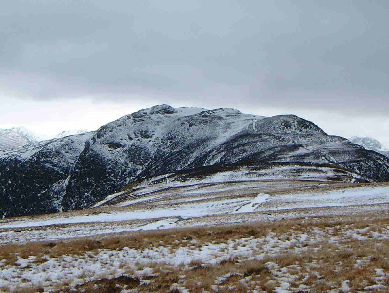
Photo: Mick Knapton via Wikimedia Commons
About High Spy
A broad North Western ridge with easy high-level walking and constant drama over Borrowdale. The summit plateau gives big views to Dale Head, Maiden Moor and the Skiddaw massif. Perfect for a flowing point-to-point day.
High Spy's summit cairn is a tall, carefully built tower of stone. Vandals have knocked it about more than once, and walkers keep putting it back. It stands on a long, nearly level top between Newlands and Borrowdale, 653m up. Crags guard both sides. On the Newlands flank, Eel Crags fall sheer and are popular with rock climbers for the quality of the rock.
Most people take it in on the Newlands Horseshoe, walking south from Catbells over Maiden Moor. Walk Lakes' half-horseshoe starts at the small parking area near Hawse End, follows the ridge to High Spy, then drops to Dalehead Tarn and comes back down the valley beside Newlands Beck and its waterfalls, 16km with 750m of ascent. The ridge path is broad and easy to follow, and the only hands-on moments are on Catbells.
Direct routes come up from both valleys. From Rosthwaite a path climbs through the disused Rigg Head Quarries to the col with Dale Head and goes up the south ridge past a small tarn. From Grange an old drove road gets through the barrier of Blea Crag. From Little Town an old mine road zigzags up to the same col as the Rosthwaite path. Grange is also the start of a scramble up the rocky rake of Nitting Haws, which is not a walking route.
The Little Town path passes the Castlenook lead mine at the foot of the fell. The Company of Mines Royal once owned it, and it worked from the 1860s until 1918, when cheaper imports closed it.
High Spy North Top, just under a kilometre north, has the better view of Derwentwater. The name may once have meant a lookout, though nobody is sure.
In winter
The top is almost level for about 2.5km, and on the Newlands side Eel Crags drop sheer, so in snow or mist keep to the main path well back from the western edge. The cairned descent south to the col with Dale Head crosses rough, rock-strewn ground that is slow going when icy.
- Ridge Walk
- Great Views
- Family Walk
- Dog Friendly
- Summit Tarn
Sources: Wikipedia: High Spy, Walk Lakes: Catbells, Maiden Moor, High Spy. Updated .
Summit
- OS grid ref
- NY 234 162
- Latitude
- 54.53554° N
- Longitude
- 3.18512° W
Walking up High Spy
The nearest car park on foot is Seatoller NT car park, 3.8 km (2.3 miles) from the summit along mapped paths. Directions to the car park
Route from Seatoller NT car park
- Distance
- 3.8 km
- 2.3 miles, one way
- Ascent
- 581 m
- Total climb to the summit
- Time up
- 1 h 38 min
- Allow 1 to 3 hours
Times use Naismith’s rule, 5 km/h on the flat plus extra time for the climb, with Langmuir’s corrections. It’s a rule of thumb for the way up only, so add stops, weather and the walk back down.
The route follows paths mapped by OpenStreetMap contributors and isn’t a guided line. This car park was picked automatically and hasn’t been checked by hand yet, so compare it with a map. Check the mountain forecast before you go and carry a map and compass.
High Spy questions
Is High Spy a Wainwright?
How high is High Spy?
Where do you park for High Spy?
How long does it take to climb High Spy?
How hard is High Spy?
Which Wainwrights are near High Spy?
What is the grid reference for the summit of High Spy?
Often walked with High Spy
Fells people usually take in on the same day.

High Spy in our guides
Wainwrights near High Spy
Straight-line distance and direction from the summit.
 Dale Head753 m1.4 km SW
 Castle Crag290 m1.5 km E
 Hindscarth727 m1.9 km W
 Maiden Moor575 m2.0 km N
 Grange Fell (Brund Fell)417 m3.0 km E
 Robinson737 m3.3 km W
More in the North Western Fells
- Grasmoor852 m
- Eel Crag (Crag Hill)839 m
- Grisedale Pike791 m
- Wandope774 m
- Sail773 m
- Hopegill Head770 m
- Dale Head753 m
- Robinson737 m
- Hindscarth727 m
- Whiteside (west top)707 m
- Scar Crags672 m
- Whiteless Pike660 m
- Causey Pike637 m
- Ard Crags581 m
- Maiden Moor575 m
- Outerside568 m
- Knott Rigg556 m
- Lord's Seat552 m
- Whinlatter (Brown How)517 m
- Broom Fell511 m
- Barf469 m
- Barrow455 m
- Graystones452 m
- Catbells451 m
- Ling Fell373 m
- Sale Fell359 m
- Rannerdale Knotts355 m
- Castle Crag290 m
Bag High Spy with Upfell
Reach the summit and capture High Spy, even with no signal. It goes on your round of the 214 with its own patch.
Coming soon to theApp Store