North Western Fells · Book 6
Scar Crags
Scar Crags is a Wainwright, one of the 214 Lake District fells in Alfred Wainwright’s Pictorial Guides. At 672 m (2,205 ft) it is the 102nd highest of the 214 and the 11th highest in the North Western Fells.
- Height
- 672 m
- 2,205 ft
- Rank
- 102
- of 214
- In area
- 11
- of 29
- Difficulty
- Moderate
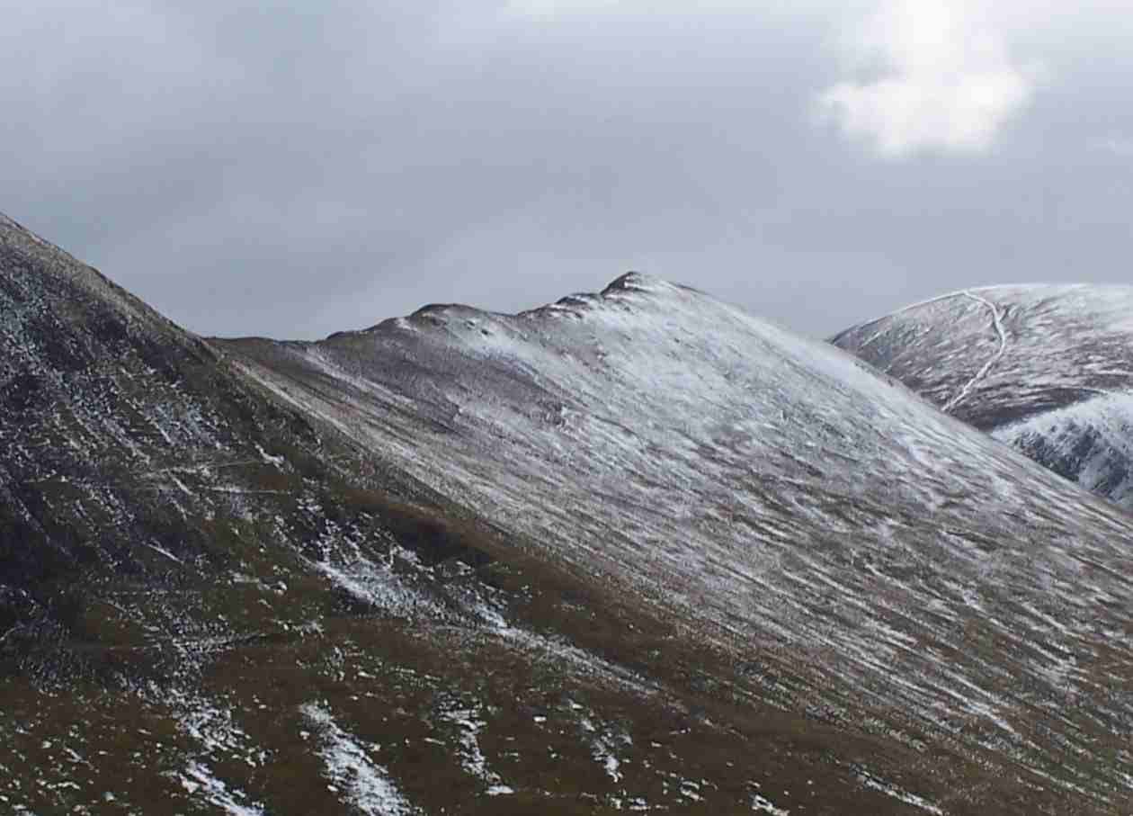
Photo: Mick Knapton via Wikimedia Commons
About Scar Crags
A craggy-sided height on the Coledale skyline between Causey Pike and Sail. The top is grassy, but the south face drops steeply to Rigg Beck. A natural link on the ridge from Causey Pike to Crag Hill.
West of Causey Pike, the long ridge to Crag Hill rises next over Scar Crags. From the north it looks harmless, with grassy slopes falling to Stonycroft Gill. The south side is steep crag all the way down to Rigg Beck.
Few people climb it on its own. The one practical direct route is the old mine track up Stonycroft Gill to Sail Pass, the col with Sail, followed by a short climb east to the top. It starts from a large informal parking area on the Newlands road just above Uzzicar Farm. Most walkers arrive along the ridge instead, west from the knobbles of Causey Pike or east from Sail. Walk Lakes' loop from the same parking goes up Rowling End and Causey Pike, over Scar Crags and back down the mine track, 8.3km with 609m of ascent. The fell also lies on the Coledale Round from Braithwaite or Stair, around 17.5km with over 1,300m of ascent.
The ridge path is clear and mostly grass, and there is no scrambling on this fell. From Sail Pass a terrace path runs across the northern face above Long Comb, a good way down towards Stair or on to Outerside.
The top is grassy, often muddy, with a small cairn. It looks straight down into Rigg Beck.
Below Long Crag on the northern slopes are the remains of the only cobalt mine in the Lake District. The Keswick Mining Company opened it in 1846 and spent 7,000 pounds on it, building a road and an inclined tramway down to Stoneycroft. Four adits went in, the longest about 60m. The ore would not give up cobalt in the quantities expected, and the mine closed.
In winter
The top is grassy and often wet, and the south side falls in steep crags to Rigg Beck, so stay on the path in snow or mist. The old mine track up Stonycroft Gill to Sail Pass is the gentlest way on and off when the rock steps on Causey Pike are icy.
- Dog Friendly
Sources: Wikipedia: Scar Crags, Walk Lakes: Causey Pike and Scar Crags. Updated .
Summit
- OS grid ref
- NY 207 205
- Latitude
- 54.57436° N
- Longitude
- 3.22747° W
Walking up Scar Crags
The nearest car park on foot is Stoneycroft Ghyll, 3.8 km (2.4 miles) from the summit along mapped paths. Directions to the car park
Route from Stoneycroft Ghyll
- Distance
- 3.8 km
- 2.4 miles, one way
- Ascent
- 562 m
- Total climb to the summit
- Time up
- 1 h 38 min
- Allow 1 to 3 hours
Times use Naismith’s rule, 5 km/h on the flat plus extra time for the climb, with Langmuir’s corrections. It’s a rule of thumb for the way up only, so add stops, weather and the walk back down.
The route follows paths mapped by OpenStreetMap contributors and isn’t a guided line. This car park was picked automatically and hasn’t been checked by hand yet, so compare it with a map. Check the mountain forecast before you go and carry a map and compass.
Scar Crags questions
Is Scar Crags a Wainwright?
How high is Scar Crags?
Where do you park for Scar Crags?
How long does it take to climb Scar Crags?
How hard is Scar Crags?
Which Wainwrights are near Scar Crags?
What is the grid reference for the summit of Scar Crags?
Often walked with Scar Crags
Fells people usually take in on the same day.
Scar Crags in our guides
Wainwrights near Scar Crags
Straight-line distance and direction from the summit.
 Ard Crags581 m0.8 km S
 Outerside568 m0.9 km N
 Sail773 m1.0 km W
 Causey Pike637 m1.2 km E
 Eel Crag (Crag Hill)839 m1.5 km W
 Knott Rigg556 m2.0 km SW
More in the North Western Fells
- Grasmoor852 m
- Eel Crag (Crag Hill)839 m
- Grisedale Pike791 m
- Wandope774 m
- Sail773 m
- Hopegill Head770 m
- Dale Head753 m
- Robinson737 m
- Hindscarth727 m
- Whiteside (west top)707 m
- Whiteless Pike660 m
- High Spy653 m
- Causey Pike637 m
- Ard Crags581 m
- Maiden Moor575 m
- Outerside568 m
- Knott Rigg556 m
- Lord's Seat552 m
- Whinlatter (Brown How)517 m
- Broom Fell511 m
- Barf469 m
- Barrow455 m
- Graystones452 m
- Catbells451 m
- Ling Fell373 m
- Sale Fell359 m
- Rannerdale Knotts355 m
- Castle Crag290 m
Bag Scar Crags with Upfell
Reach the summit and capture Scar Crags, even with no signal. It goes on your round of the 214 with its own patch.
Coming soon to theApp Store