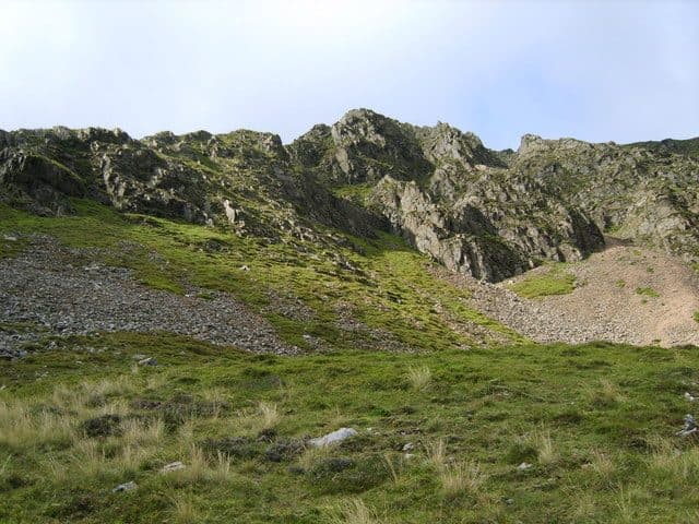
Braithwaite sits at the foot of Whinlatter Pass, just west of Keswick, where Coledale opens out. Eight Wainwrights start on foot from the village, all in the North Western Fells: Barrow, Outerside, Grisedale Pike, Hopegill Head, Crag Hill, Sail, Scar Crags and Causey Pike. The first six make up the Coledale Horseshoe and its shorter variant. A short bus ride adds Whinlatter, Lord's Seat and Barf.
The village has three pubs, the Coledale Inn, the Royal Oak and the Middle Ruddings Hotel, a shop by the bridge and a campsite.
Wainwrights starting near Braithwaite
| Rank | Fell | Height | Area | Difficulty |
|---|---|---|---|---|
| 24 | Eel Crag (Crag Hill)North Western Fells | 839 m | North Western Fells | Moderate |
| 40 | Grisedale PikeNorth Western Fells | 791 m | North Western Fells | Difficult |
| =51 | SailNorth Western Fells | 773 m | North Western Fells | Moderate |
| 102 | Scar CragsNorth Western Fells | 672 m | North Western Fells | Moderate |
| =119 | Causey PikeNorth Western Fells | 637 m | North Western Fells | Moderate |
| 142 | OutersideNorth Western Fells | 568 m | North Western Fells | Moderate |
| 165 | Whinlatter (Brown How)North Western Fells | 517 m | North Western Fells | Moderate |
| 187 | BarrowNorth Western Fells | 455 m | North Western Fells | Easy |
Parking and buses
The WalkLakes Grisedale Pike route starts from a small parking area near the bottom of the Whinlatter road, opposite the Hope Memorial Camp. It isn't signposted as a car park and it fills fast. Otherwise there are spaces on the street around the village, and the WalkLakes Coledale Horseshoe notes that the village school opens for parking in the summer holidays. For Causey Pike and Scar Crags, there is a large informal parking area on the Newlands road above Uzzicar Farm, and more space by the bridge over Stoneycroft Gill.
The Stagecoach summer 2026 timetable (23 March to 1 November) lists:
- X5 between Workington, Cockermouth and Keswick, stopping at Braithwaite Police Station about hourly, Sundays included, and on to Threlkeld and Penrith after Keswick
- 77 from Keswick to Braithwaite, then up to the Whinlatter Visitor Centre, Lorton and Buttermere
- 77A the other way round, reaching Braithwaite from Buttermere and Whinlatter on the way back to Keswick
The X5 also stops at the Swan Hotel in Thornthwaite, near the Powter How car park for Barf. The Honister Rambler lets you walk over the tops and ride back, or take the bus to Whinlatter and walk down.
Short walks from the village
Barrow is the quick one. Walk 100 m along the Newlands road from the bridge by the village shop and take the bridleway up past Braithwaite Lodge onto its north-east ridge. The top is 455 m, and because it stands clear of its neighbours the view goes all the way round. From there it is a short step on over Stile End to Outerside, a heather cone that sees far fewer walkers than the fells around it. Causey Pike is a little under two kilometres from the village. The direct line up Rowling End finishes with a short scramble over polished rock. The WalkLakes loop from Stoneycroft over Causey Pike and Scar Crags, down the old mine track, is 8.3 km with 609 m of ascent.
Short walks from Braithwaite
| Rank | Fell | Height | Area | Difficulty |
|---|---|---|---|---|
| 187 | BarrowNorth Western Fells | 455 m | North Western Fells | Easy |
| 142 | OutersideNorth Western Fells | 568 m | North Western Fells | Moderate |
| =119 | Causey PikeNorth Western Fells | 637 m | North Western Fells | Moderate |
| 102 | Scar CragsNorth Western Fells | 672 m | North Western Fells | Moderate |
Full days from the village
Grisedale Pike rises straight out of Braithwaite. Its east ridge climbs steeply to Kinn and then runs over Sleet How, and the last pull is loose stones and rock steps. The WalkLakes round that carries on to Hopegill Head and back down Coledale past Force Crag Mine is 13 km with 875 m of ascent, a minimum of 4 hours 3 minutes. Crag Hill and Sail are the high ground at the head of Coledale. The shorter Coledale round goes over Barrow, Stile End and Outerside to Sail and Crag Hill: 14.9 km with 1,001 m of ascent. WalkLakes times are walking only, so add your stops.
Full days from Braithwaite
| Rank | Fell | Height | Area | Difficulty |
|---|---|---|---|---|
| 40 | Grisedale PikeNorth Western Fells | 791 m | North Western Fells | Difficult |
| 53 | Hopegill HeadNorth Western Fells | 770 m | North Western Fells | Moderate |
| 24 | Eel Crag (Crag Hill)North Western Fells | 839 m | North Western Fells | Moderate |
| =51 | SailNorth Western Fells | 773 m | North Western Fells | Moderate |
A short bus ride away
The 77 climbs to the Whinlatter Visitor Centre near the top of the pass. From there, the Wainwright top of Whinlatter, Brown How, is about 6.5 km there and back with 280 m of ascent, and Lord's Seat is about 3 km on waymarked forest trails with only about 220 m of climbing. Take the X5 to Thornthwaite for Barf. Use the path beside Beckstones Gill, not the direct line past the Bishop, a loose scramble that signs at the foot warn walkers off. The WalkLakes loop over Barf and Lord's Seat from Powter How is 8 km with 600 m of ascent.
By bus from Braithwaite
| Rank | Fell | Height | Area | Difficulty |
|---|---|---|---|---|
| 165 | Whinlatter (Brown How)North Western Fells | 517 m | North Western Fells | Moderate |
| 148 | Lord's SeatNorth Western Fells | 552 m | North Western Fells | Moderate |
| 185 | BarfNorth Western Fells | 469 m | North Western Fells | Moderate |
Classic rounds from Braithwaite
The Coledale Horseshoe
Climb Grisedale Pike, follow the edge of Hobcarton Crag to Hopegill Head, cross Sand Hill and Coledale Hause to Crag Hill, then come back over Sail and Outerside. The WalkLakes version is 15 km with 1,178 m of ascent and a minimum of 4 hours 58 minutes. Our Coledale Horseshoe guide covers it step by step.
The shorter Coledale round
Start over Barrow and Outerside, climb Sail by the terrace path across Scar Crags, and cross The Scar, a narrow rocky crest with a couple of easy steps, to Crag Hill. Come down to Coledale Hause and walk home along the old mine road.
Causey Pike and the ridge
From Stoneycroft, go up Rowling End to Causey Pike, follow the ridge west over Scar Crags to Sail, and drop back down the Stonycroft Gill mine track. Add Crag Hill from Sail for a longer day.
On all of these, carry a map and compass and check the Mountain Weather Information Service (MWIS) forecast first. Keswick is a few minutes away on the X5, with its own list in Wainwrights from Keswick, and the Honister Rambler goes on to Buttermere. For more ridge days like these, see Wainwright ridge walks, and for fells you can reach without a car, Wainwrights by bus.